Main menu
You are here
Hammer Lakes Trail and Ape Lake Route
Hammer Lakes Trail: ~6.3km and 780m of elevation gain
Find this trail after driving past Odegaard Falls on your way to the Purgatory Lookout on the Nusatsum West FSR (approximately 29km up). Park near a bridge with a clear sign by Recreation Sites and Trails at the trail head.
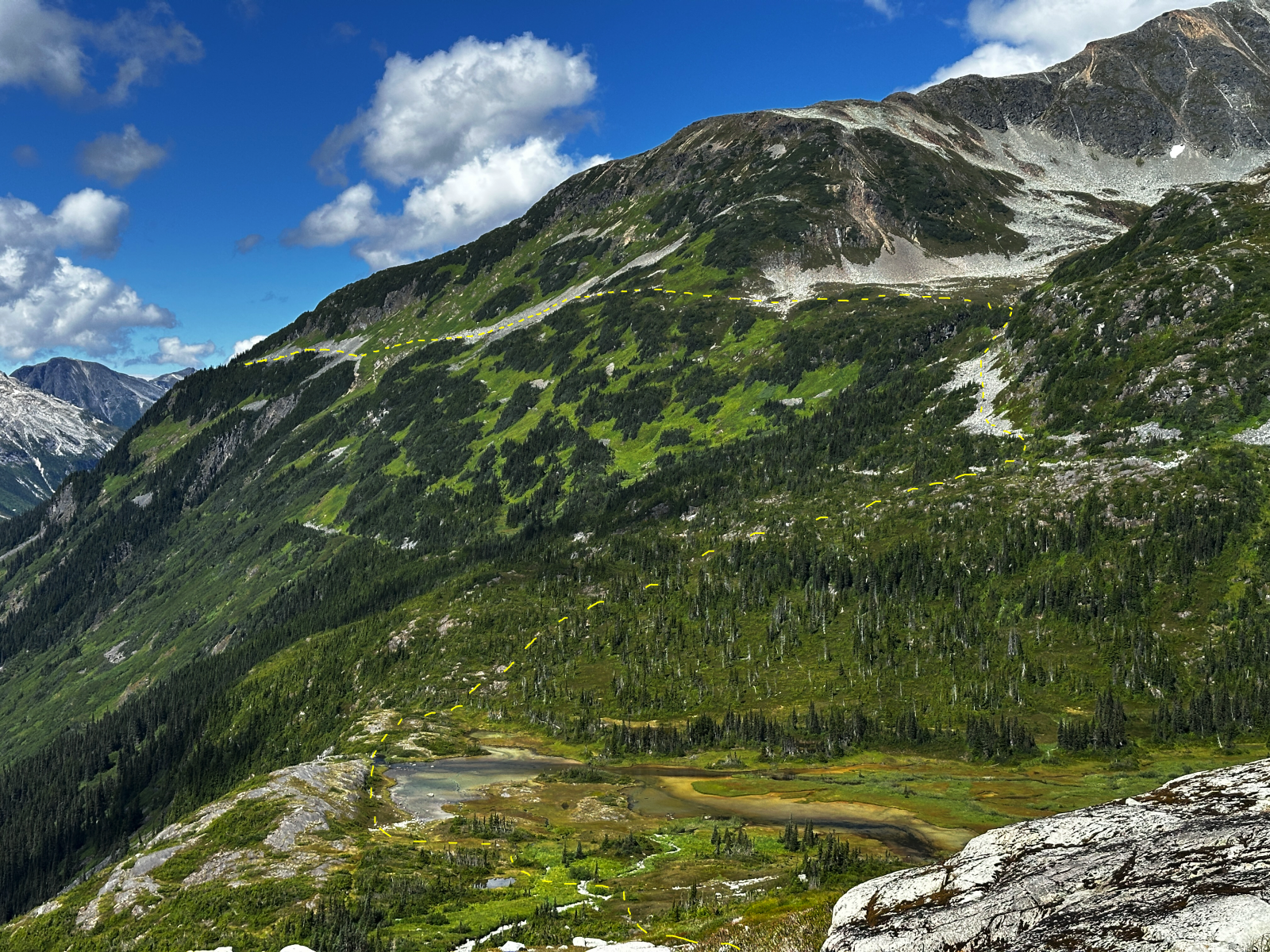
The trail begins in mature subalpine forest of Engelmann Spruce, Mountain Hemlock and Subalpine Fir where blueberries and huckleberries are plentiful in season. Continue through the forest with a few minor creek crossings along the way until the trail opens into the first meadow. Here you'll be treated to your first view of Iroquois Ridge and it's incredible glaciers. From here the trail can be quite wet and muddy at certain times of the year or during/after prolonged wet weather. There are a large sections of boardwalk across the sub-alpine meadows but they are in various states of disrepair and can be slippery when wet. Continue through small patches of forests and long meadows until you look down on Hammer Lake. If you want to visit the lakes you'll want to leave the trail as the trail doesn't lead directly to the lake shore.
From Hammer Lakes the trail climbs through the forest until you open into the meadows below the west side of Polar Bear Peak. Signs of trail become faint through the meadows and wildflower here but continue south climbing slightly to cross the creek and aim for the open shoulder directly in front of you. The trail becomes more visible and large cairns adorn through the heather until you reach the alpine viewpoint.
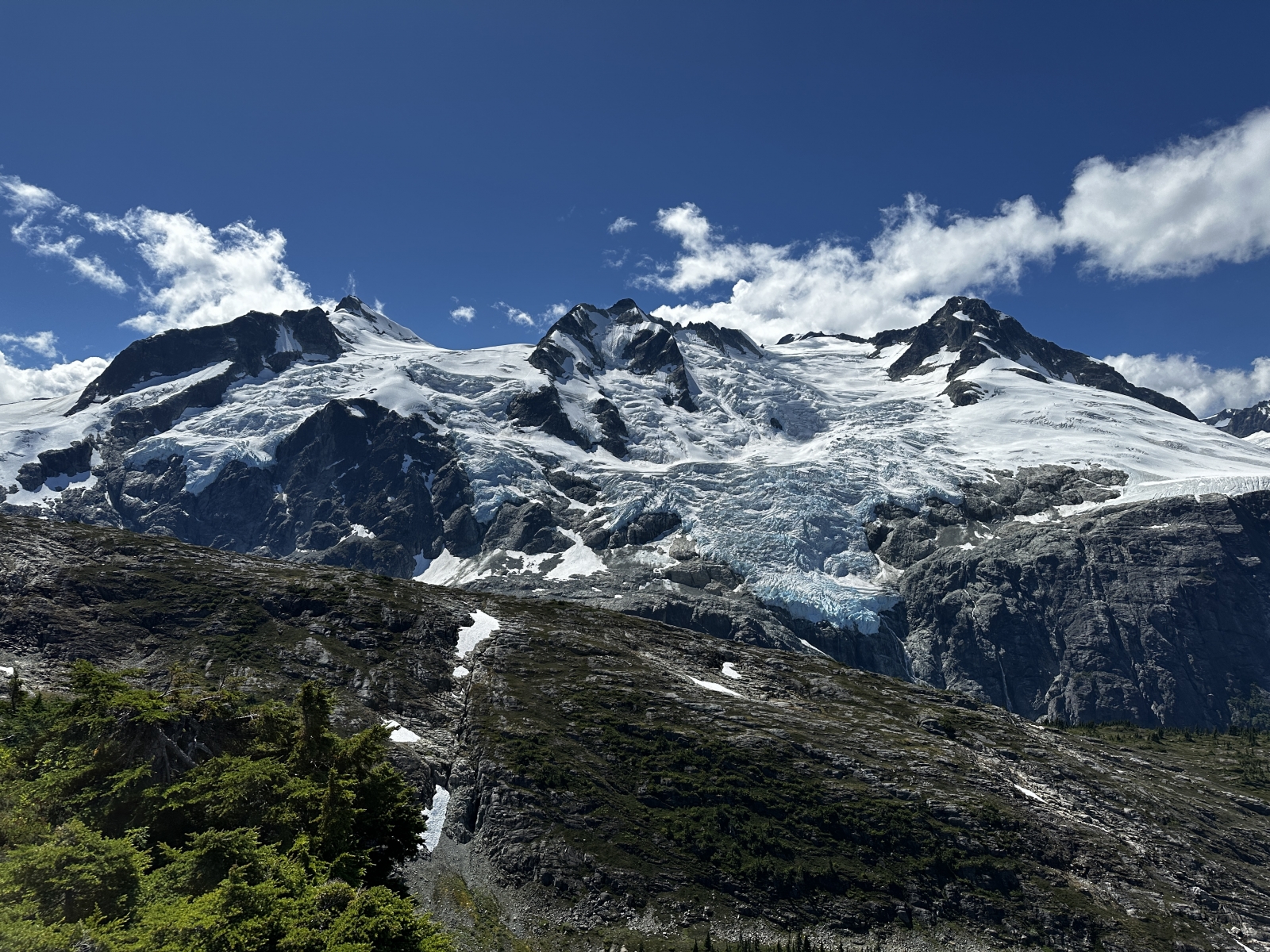
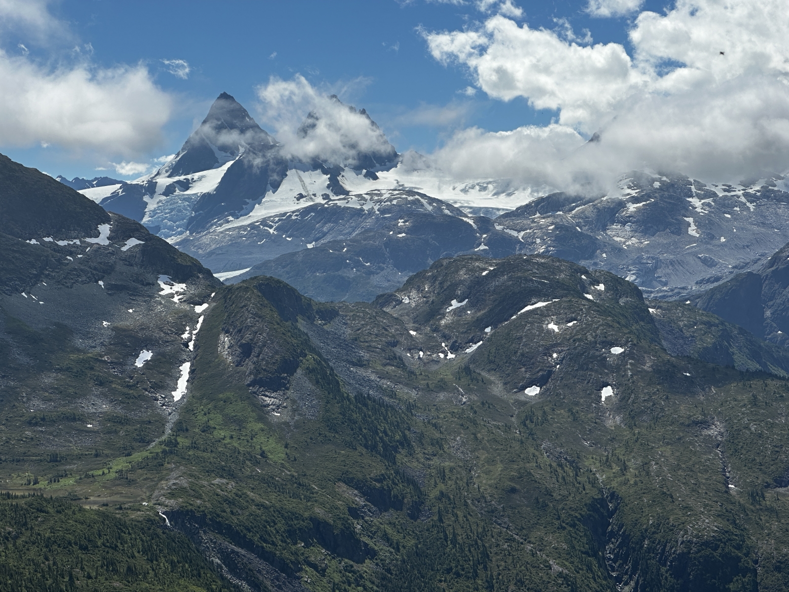
The alpine viewpoint is the final destination of the trail with amazing views of Iroquos Ridge and its glacier ice fall over the Noeick River. Onward to the south-east is the route to Ape Lake and the peaks of the Monarch Icefield, including the looming pyramid of the Mt. Jacobsen summits.
Ape Lake Route:~20km 1400m elevation gain, 1000m descent
Signs on the Nusatsum FSR have 'Ape Lake Trail' written on them. Don't let this deceive you, there is currently no trail beyond the viewpoint and the route to Ape Lake requires a map and compass. It should only be attempted by experienced, well prepared hikers. As of 2025 cairns, flagging and other trail markers are mostly non-existent.
From the viewpoint, continue across talus slope until you get to where the first talus slope ends and a slippery sidehill of flowers begins. Some parties have used ice-axes to chop steps in the dirt, regardless of your tactic, use caution. Trend slightly uphill and dig your boots in until you regain footing on the next talus slope. You might be tempted to start descending at the end of the second talus slope but instead stay high to gain a nice bench. Cross this bench and begin descending near the creeks. Cross the creeks and a small steep sidehill before continuing downhill through talus slope and a sparsely treed shoulder towards a beautiful lake. Cross it near its outflow but use caution as the outflow immediately goes over large cliffs. Though seemingly benign, a misstep here could have large consequences
The lake makes a great camp spot with excellent views across the other side of the Noeick river and winds are generally good on the rock bluffs to keep bugs at bay.
From here climb uphill along the obvious draw. Climbers left is generally easier. As you crest over this ridge, you'll come across a bear stomp trail. Take advantage of this viewpoint shortly after the stomp trail and before heading downhill as it is incredible. Continue down the draw for a bit before bumping onto the shoulder to your right before where waterfalls come down. Follow this shoulder into the lovely flowery creek. The wildflowers here are stunning in July-August!
Stay to your right in the meadows as you cross them for easiest travel as you move across the broad bench and you'll see a weather station ahead. Below that weather station is where you'll aim to want to connect into the subsequent meadows. Dont descent too quickly or stay too high as you work downward through these meadows and you'll find little trails through the short patches of denser trees that break up each meadow.
Eventually you'll near the river and avalanche slide paths with alder will bar onward progression. Here the bushwacking begins, but it's easier than it looks. Stay near the river edge and it is only chest high and gives way lightly. Push through this 200m section and it will spit you out on gravel bar that follows the river. From here you'll connect subsequent gravel bars to eventually reach the shores of the newly formed lake at the toe of the Fyles Glacier. Follow the shore of Fyles Lake until you get to Atavist Creek. This creek can have substantial volume in the afternoons on hot days, especially early in summer, but its many braided channels makes crossing it simple along the lakeshore. It's difficult to keep boots dry so water shoes or crossing barefoot may be necessary.
Near the east end of Fyles Lake the shoreline gets slabby and tricky, and you're presented with a few options: navigate low down through the rock or climb a bit to walk along the moraine crest. Continue through small bands of Alder to eventually reach Ape Lake itself. From here there are many options for roaming, mountaineering, etc. You're at the doorstep of the Monarch Icefield. Many continue east towards Jacobsen Lake and the impressive Jacobsen Glacier.
On this page you can find a KML track for aid in your routefinding.