You are here

Alpine

Warning - information presented here is contributed by users and has not been verified or evaluated for accuracy or safety. Use caution and proceed at your own risk!
KML placeholder

Saugstad Glacier Trail

Experience the Bella Coola 'Himalaya' with this incredible hike through old growth forest and along the Nusatsum River (west branch) to reach the Saugstad NE Glacier. Surrounded by massive rock walls, cascading waterfalls, hanging glaciers, a rock shedding glacier tongue and the 2900m Mount Saugstad this trail provides an incredible end point. This trail can flood in high water levels and is best hiked from Late June to Late September. The intrepid hiker can hike in high water times by bushwacking around flooded areas. Water sources are abundant along the whole trail.

Time: 3-4 hours 1-way
Distance: 7.5km
Elevation Gain: +750m -100m

Trailhead Access: Drive the 2WD Nusatsum West FSR as for Odegaard Falls until KM 13. This trail shares the same small parking pullout as for Nusatsum Boulders. If you reach a bridge crossing the Nusatsum River at KM 13 you've gone a few hundred meters too far. If you haven't visited the Nusatsum Boulders, take this time (5-10min) to check out these spectacular towering boulders tucked in the forest. To find them follow the trail from the parking lot. The Saugstad Glacier Trail starts on an old lush logging road and is a different trailhead from the Nusatsum Boulders. The trailhead is marked by a small cairn and is only a few meters from the parking lot up the Nusatsum logging road. If you're the first hikers of the season, lush ferns, elderberry, etc. may have overgrown and hide the trailhead.

Trail Description: The trail starts on an old overgrown logging road. The 700m of logging road is lush with fast growing soft herbaceous plants, knock back these plants with your hiking pole. You'll descend through an old cutblock to reach old growth forest following the river. Continue along until a log crossing crosses a small newly formed water channel. Follow the trail to reach a slightly flooded area where some hopping might be required to keep boots dry before crossing another log back to the dry side. The trail continues through the forest for another 700m before climbing and side-hilling for a few hundred meters to pass through a ravine. The trail then gently descends back to the river leading to a log crossing (pictured below), follow along the forest again until a short section of river bank walking leads to a final log crossing. The next section is a mix of river bank walking and forest sections continuing for the next few kilometers. Keep an eye out for cairns and flagging that lead back into the forest and for where the trail turns towards the river out from the forest. The last section of river bank walking lasts almost a kilometer. Though footing can be tricky along the river rock, be sure to look up at the incredibly prominent peaks jutting above you.

The trail then leads along a gangway of fallen massive trees before climbing the steep hillside in short switchbacks. This is the main elevation gain of the trail and continues up for 1.3km. An incredible giant cedar and big burled spruces dot this section. Finally, the trail exits the forest into the alder covered basin extending from the retreating glacier. Follow the cut section through the alder and along scenic rock slabs. A cairn at the top of the rock slab marks an incredible viewpoint. You're almost there, continue through the alder and talus to reach the glacier toe.

To download the route KML file for loading into your phone or GPS, look for the download button at the top right of the description.

CAUTION: The glacier presents a hazard. Rocks shedding off the ice are a constant risk so keep your distance from the ice if swimming or walking up to the glacier. If you continue uphill along the glacier edge following the moraine, you can eventually gain the ice easily. The lower glacier ice is blanketed by rock and is easy walking for the most part. If snow is present, it may hide crevasses and is incredibly dangerous. Also, solid gravel, sand and rock may slide easily on the ice. Extra care should be taken on the glacier surface. Avoid holes, snow and any steep areas.

Camping: Follow the glacier toe upstream and to the right a bit to a big flat area. Water is abundant. The sound of rockfall, calving ice and splashes are ever present.

Wildlife: Grizzlies and blackbears frequent the area and bearspray is recommended. Please be bear aware and respectful of wildlife.

Maintenance Updates: Cleared and flagged as of summer 2023.

Goat Ledge > Goat Ridge circuit

An aesthetic, intriguing and somewhat adventurous mini-circuit combining the Goatskin wall descent trail (aka Goat Ledge) and Goat Ridge.

Take the Upper Bluffs trail towards Enso Pool, turning uphill at the 2nd water feature to take the Goatskin wall descent trail. Follow the cut and flagged line steeply through bluffy terrain for about 400 vertical meters to gain the long treed Goat Ledge feature. Pick your way through the boulders and dense forest for about 2km, enjoying the many views overlooking the vast wall. As the ledge opens up, follow talus uphill towards the base of a steep, clean ~100m wall. Before the base of the wall, exit right on up-trending ledges to gain the alpine. Follow the mostly open granite ridge East, then down the Goat Ridge trail.

There is no defined trail from the East side of Goat Ledge until the alpine ridge. The features are simple enough to follow, but large talus blocks, sections of thick brush, and weather-related visibility issues could complicate matters. Some route-finding required.

Goat Circuit (4 Mile ridge to Goat ridge via Goat peak)

An alpine ridge linkup including Goat/Latin peak, starting and ending at Saloompt Bluffs trailhead. Can be done as a multi-day, enjoying many exquisite campsites and side-trips, or a single long day. Trails are cut and flagged through the timber to gain each ridge, and mostly easy travel along the granite ridges in between. Lots of tarns along the ridges, yet no running water on the entirety of 4 Mile ridge (between Enso pool and the green meadows in the 4 Mile/Goat saddle). Plentiful seeps on both sides of Goat peak.

Start up either 4 Mile ridge (https://bellacoolatrails.ca/content/4-mile-ridge-saloompt-bluffs) or Goat Ridge (https://bellacoolatrails.ca/content/goat-ridge-saloompt-bluffs) and finish down the other.

~32km distance
~2600m total elevation gain

A wild walk in the sky!

Nusatsum Meadows (Mosquito Pass)

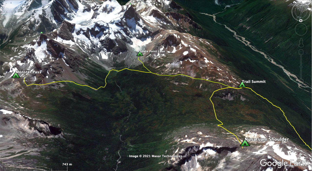
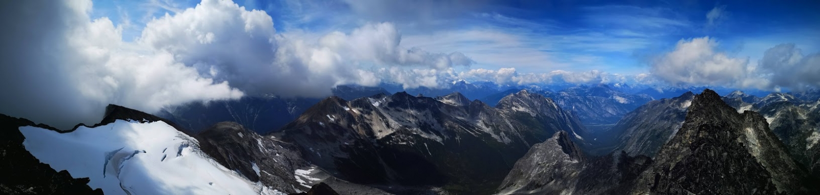
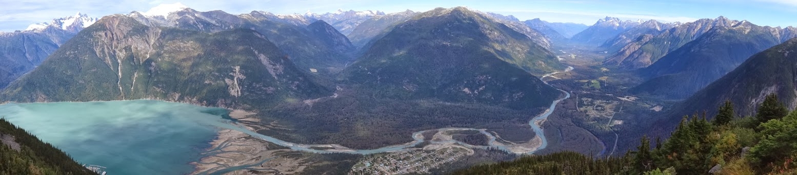
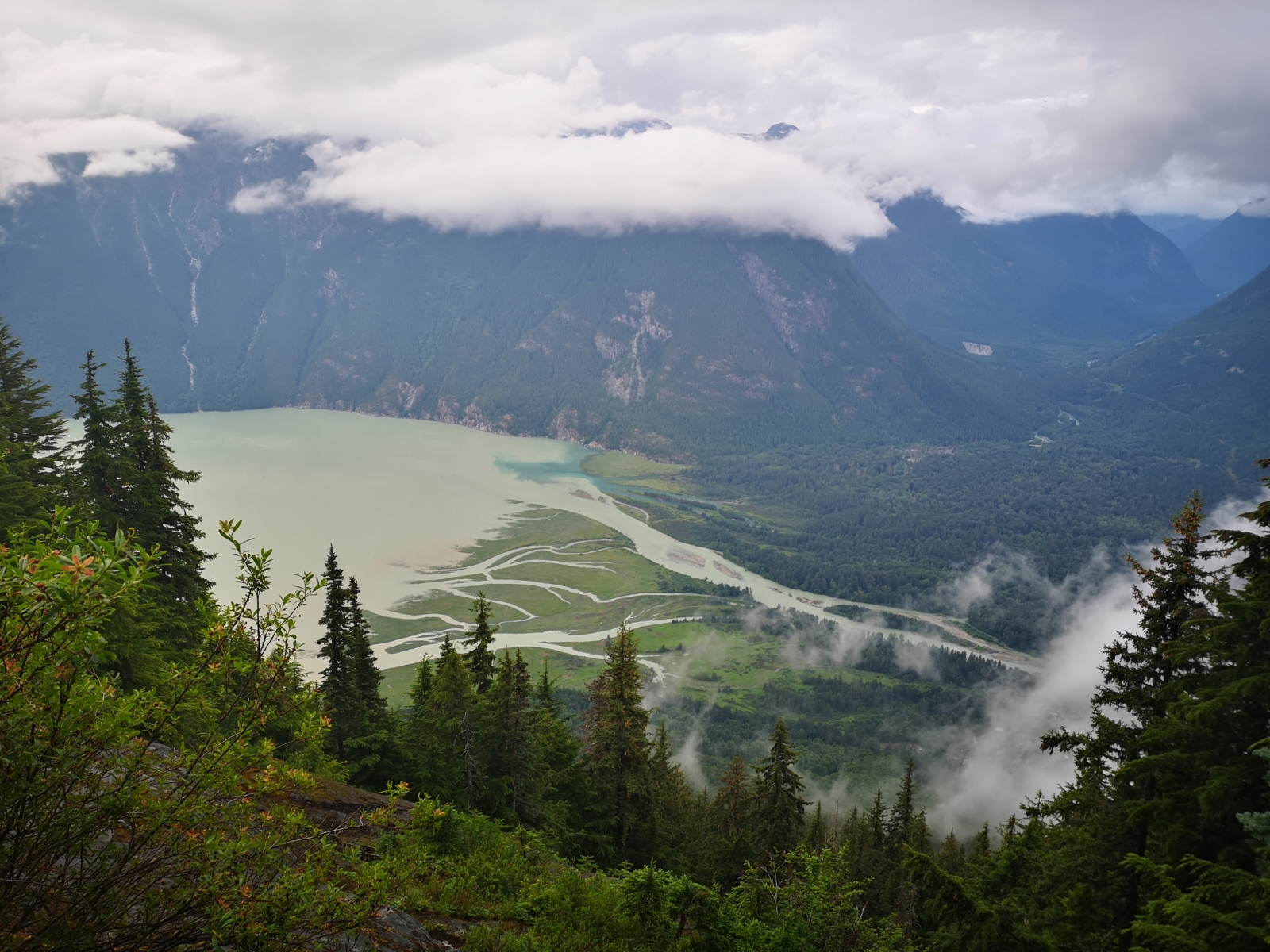
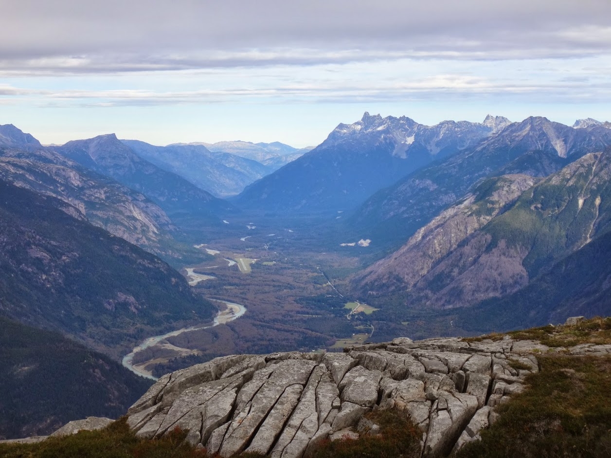
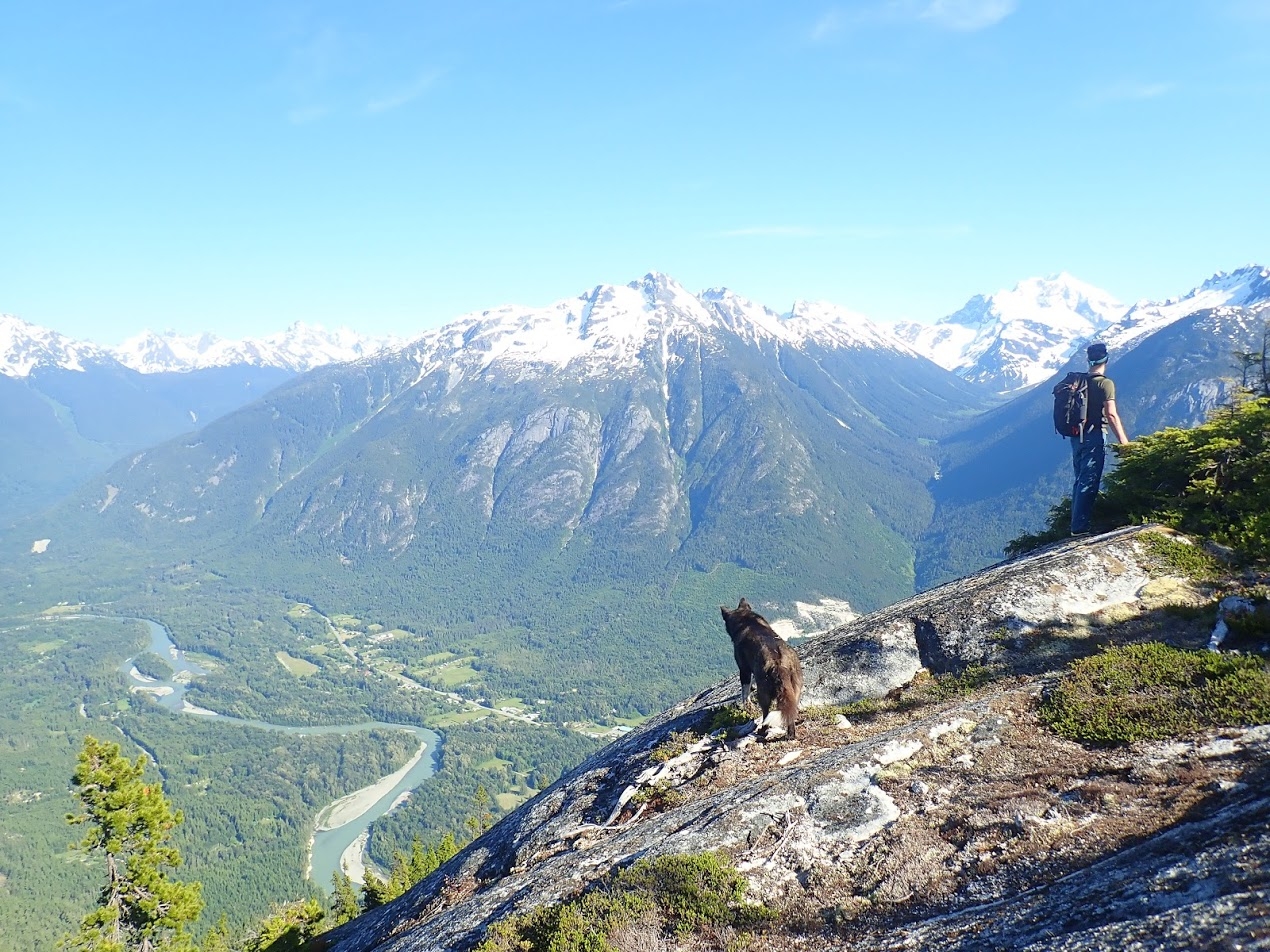
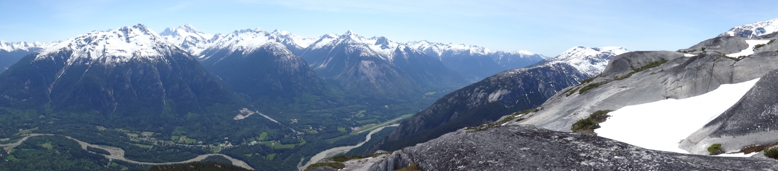
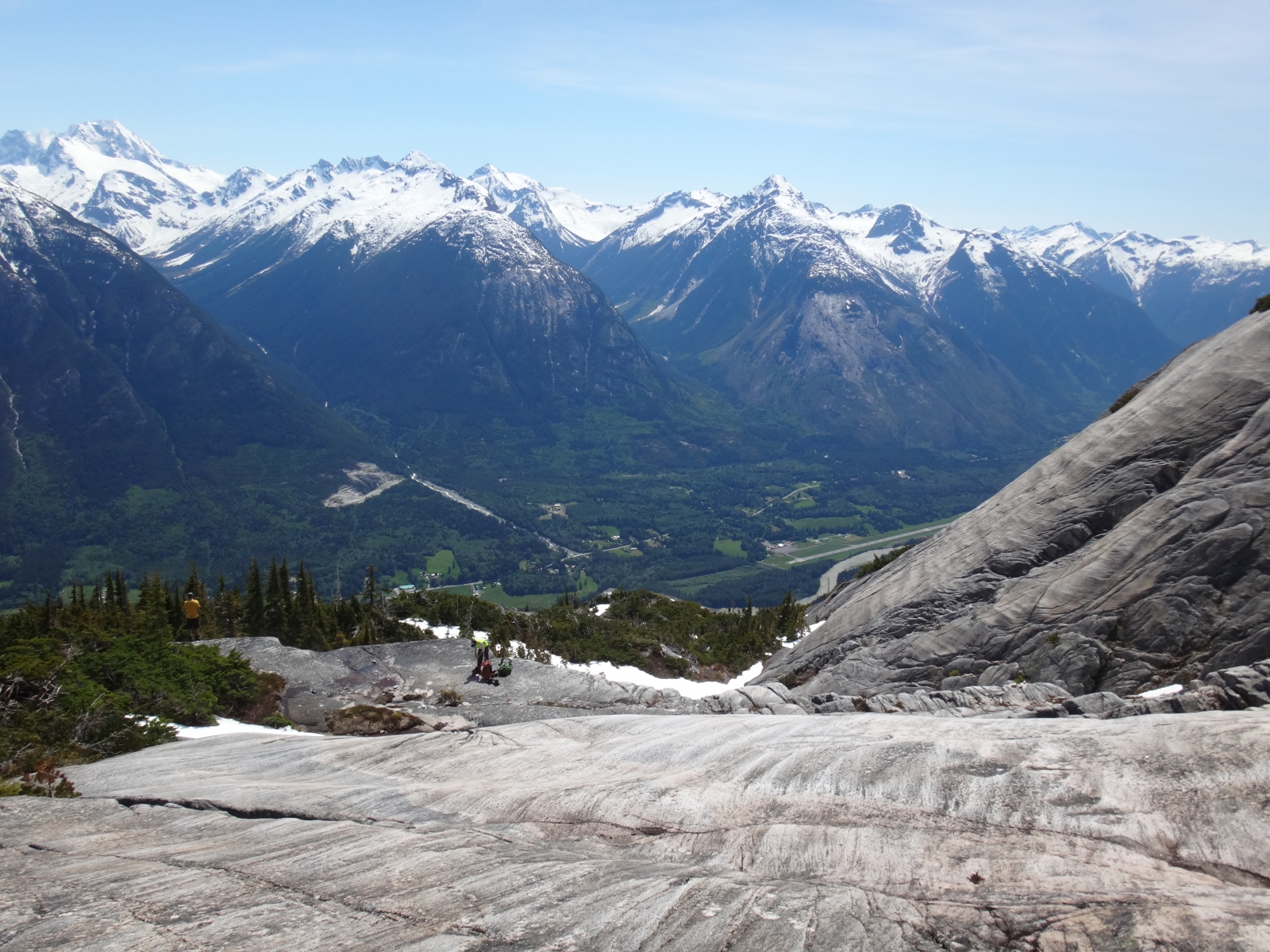
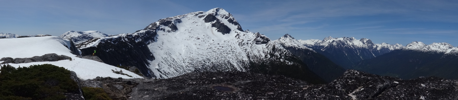
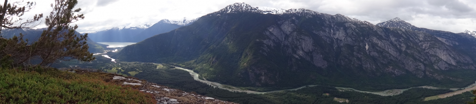
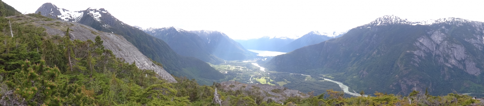
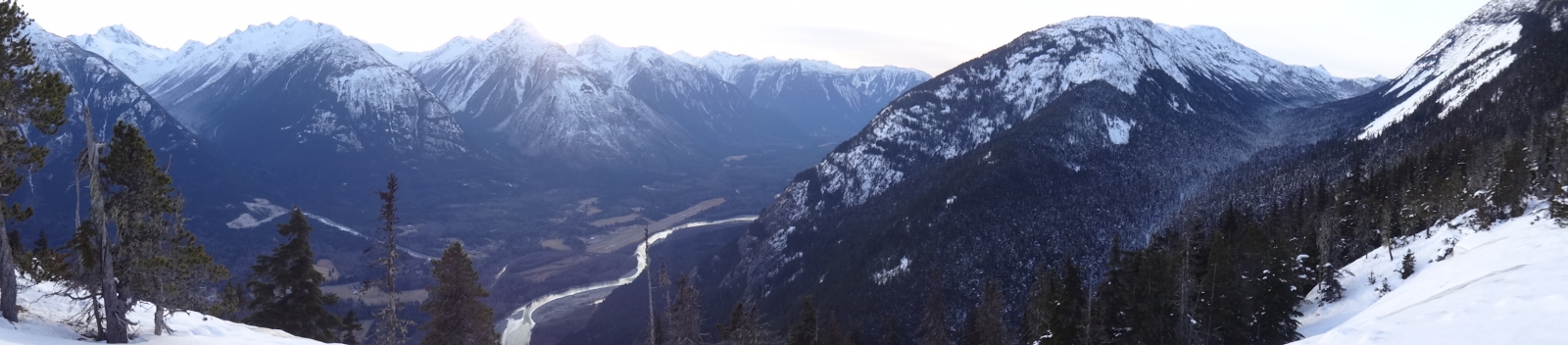
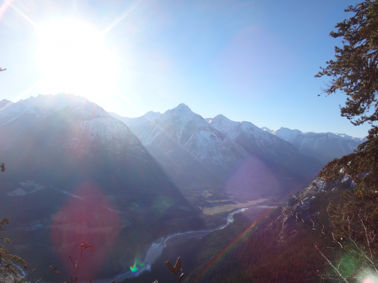
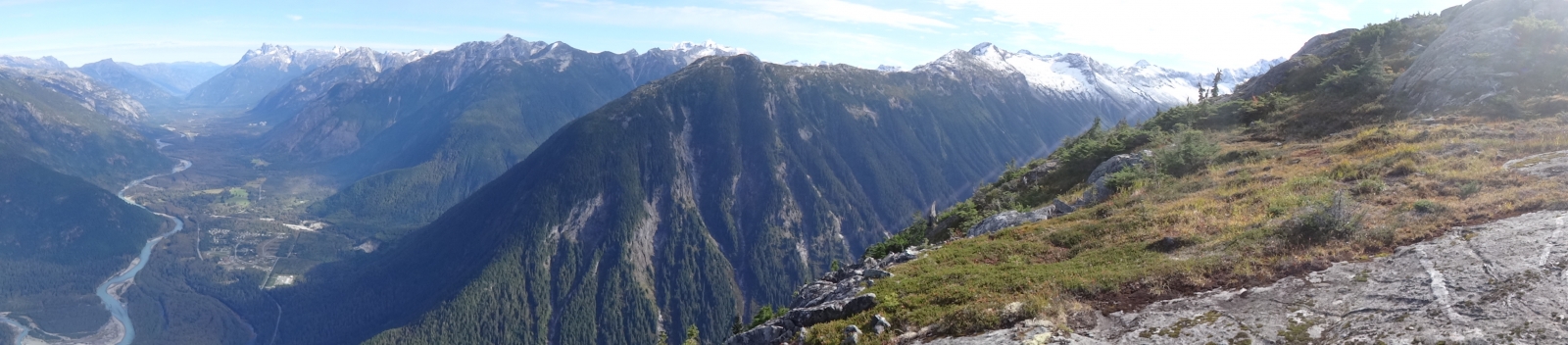
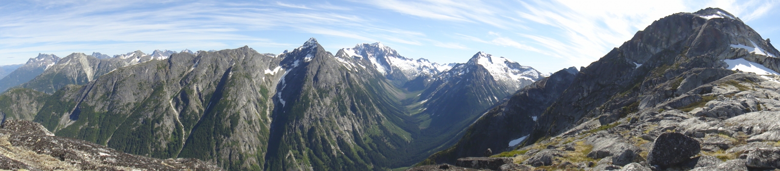
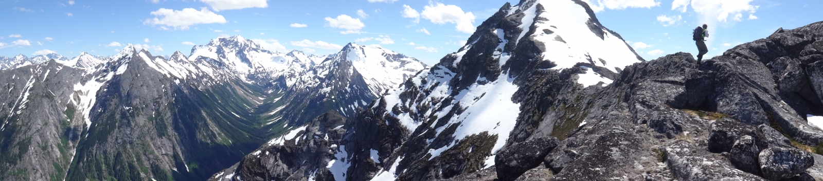
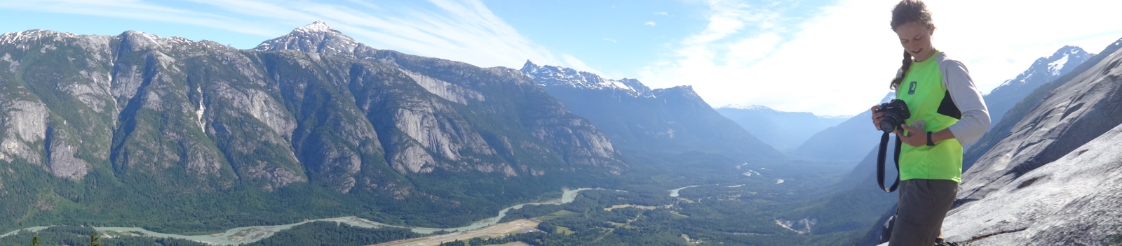
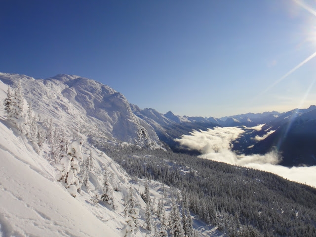
This new hiking route replaces the old 'Frank Cook Route' to the Mosquito Pass area for accessing the amazing meadows overlooking Nusatsum Peak. Lots of exploration opportunities exist from this area including hiking up the ridge below Space Point Peak to overlook Mt Saugstad and the mountains lining the Nusatsum River, travelling to Monster Pass and the upper Noomst Valley, or traversing under Space Point into the Dog Valley. Mountaineering objectives abound this area including Space Point Peak, the many summits of Nusatsum Mountain, Mad Dog, and from Monster Pass, Defiance and Happy Dome. Lots of ski touring opportunities exist up here for the winter adventurers also

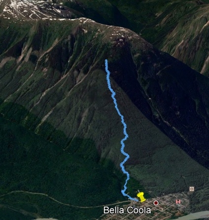
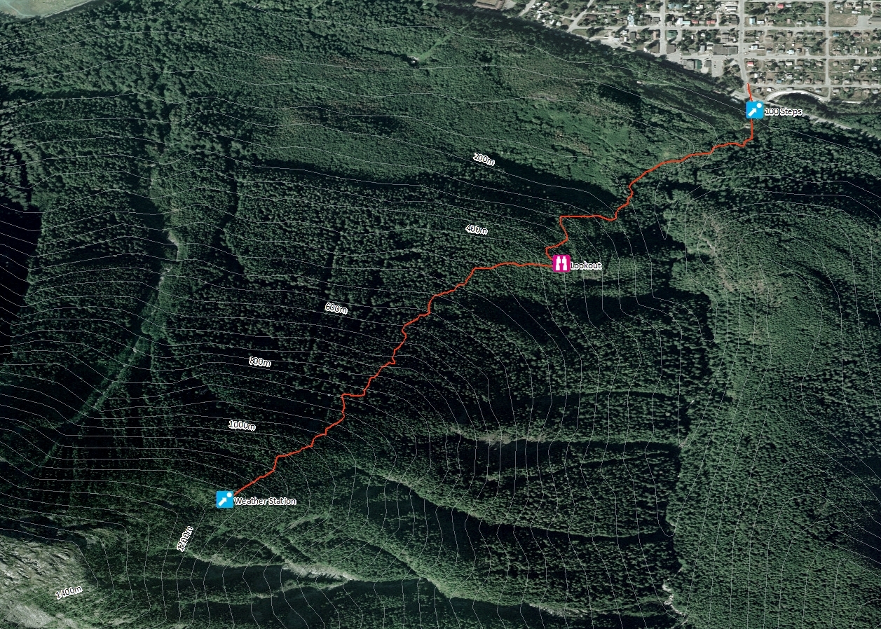
Time: 4-5 hours 1-way
Distance: 6km
Elevation Gain: 1200m

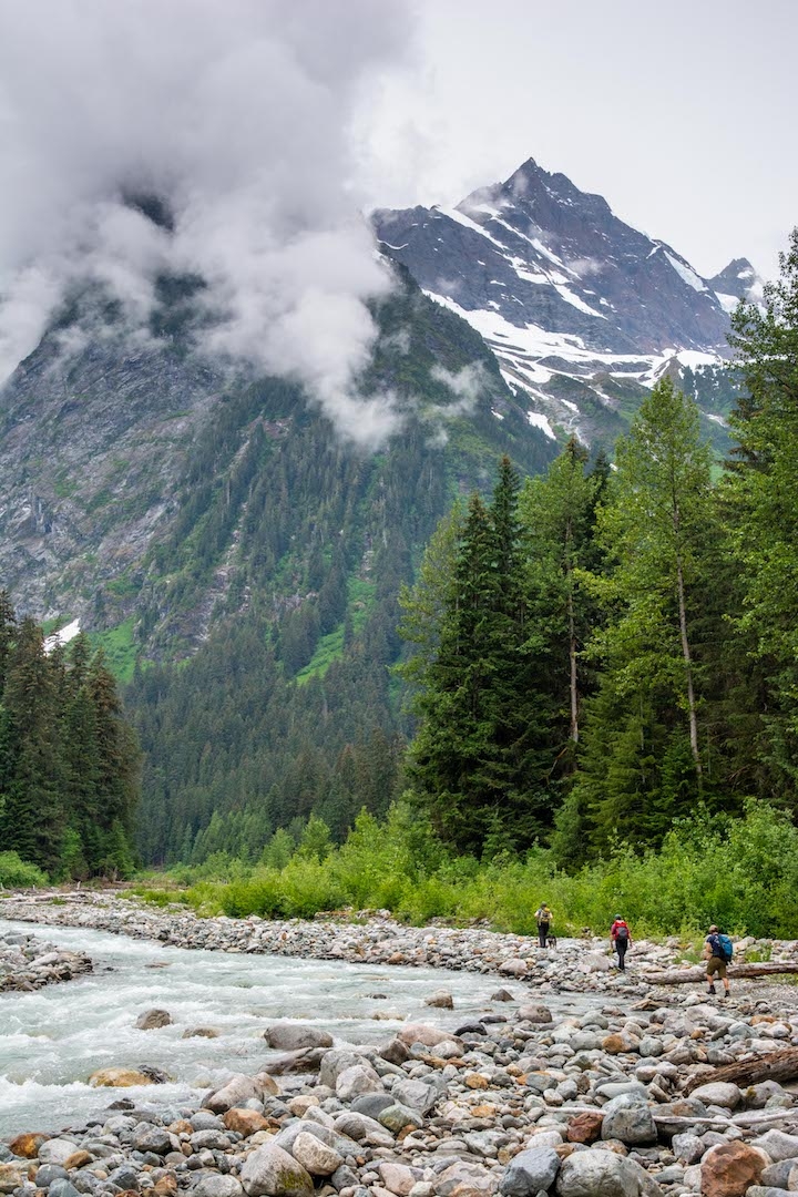
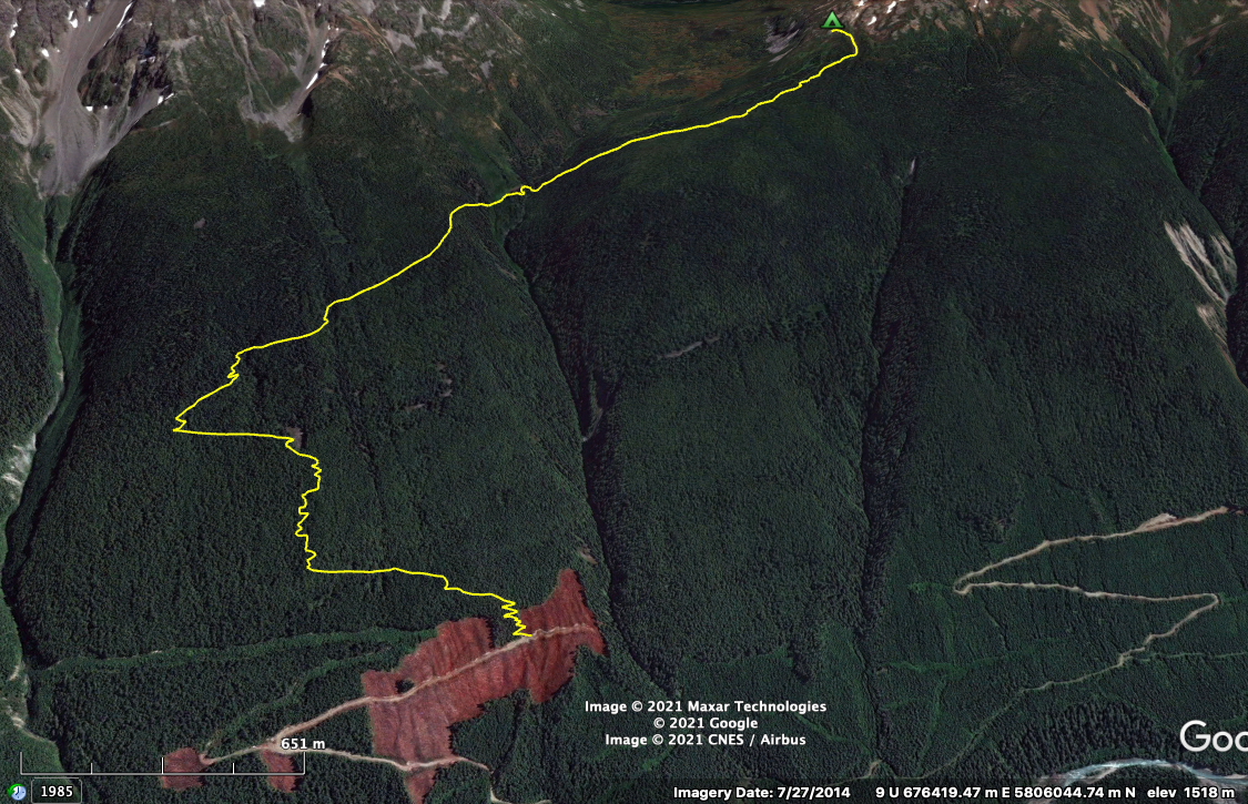
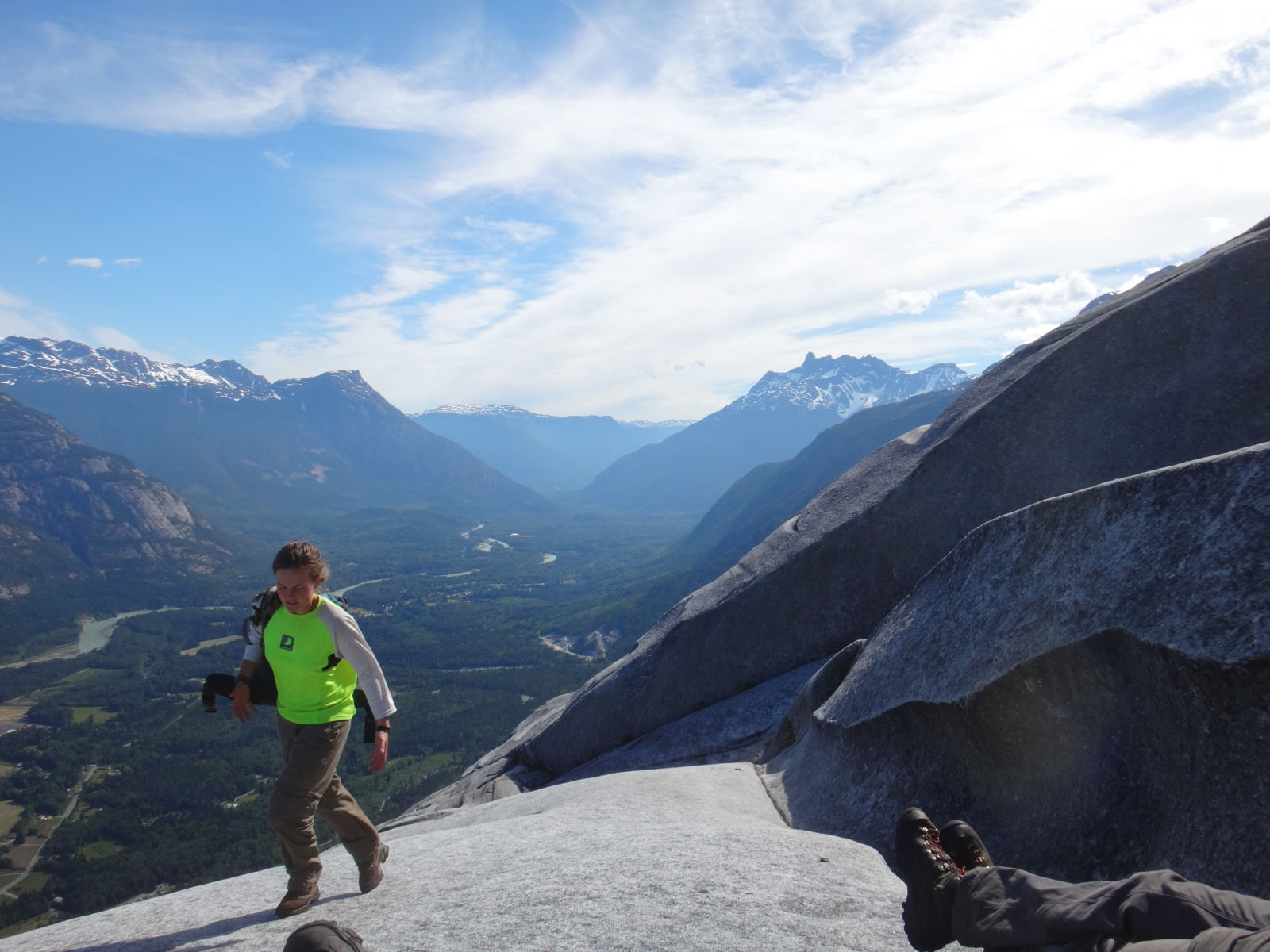
Trailhead Access: Drive the 2WD Nusatsum East FSR staying right at the Medby Rock fork early on and look for an obvious left fork leading uphill at ~3km. Some vehicle clearance recommended, most SUV's will be fine. Follow this switchbacking road as it ascends for 1.4km and its end. Near the end an obvious cairn marks the trailhead. Drive past the cairn for a turnaround spot and extra parking towards the end of the road. Room exists for 6-8 vehicles and more parking exists at the last switchback, with only a short walk to trailhead.

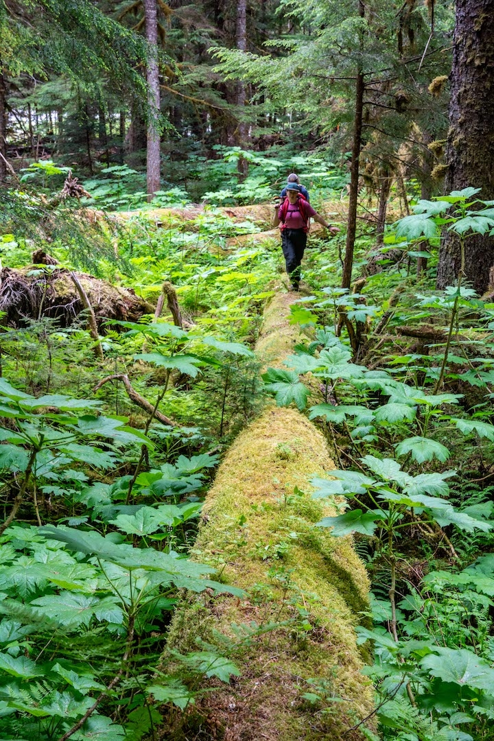
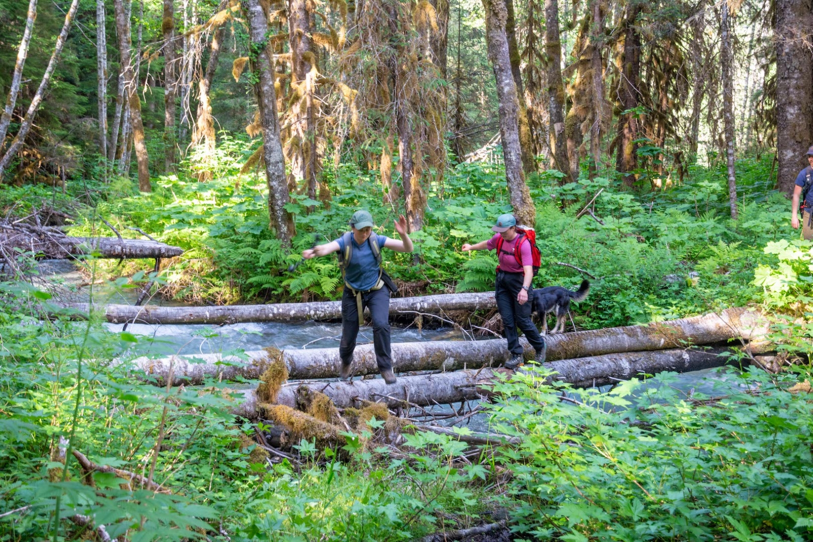
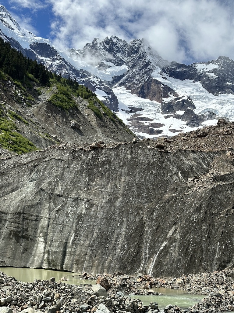
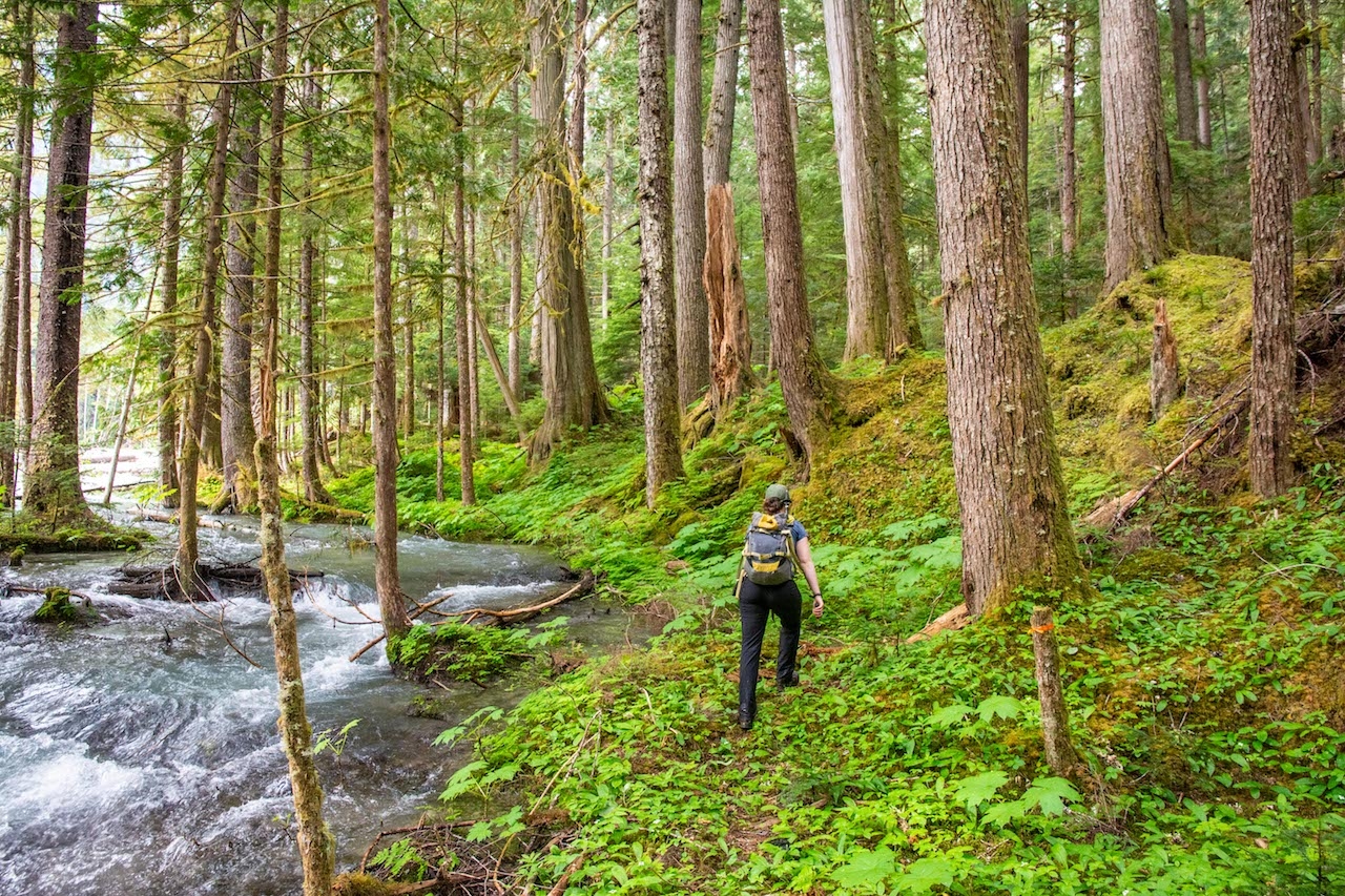
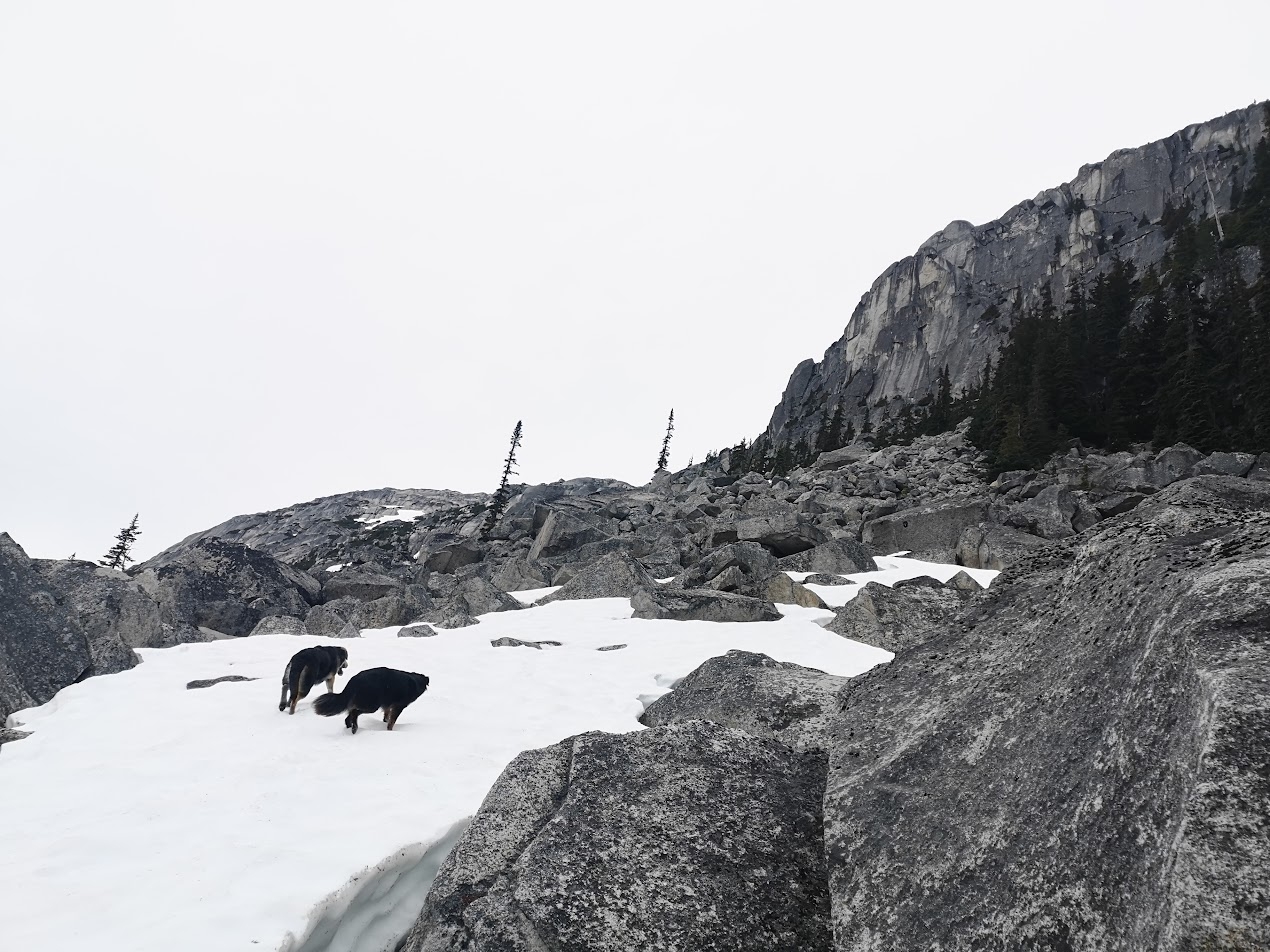
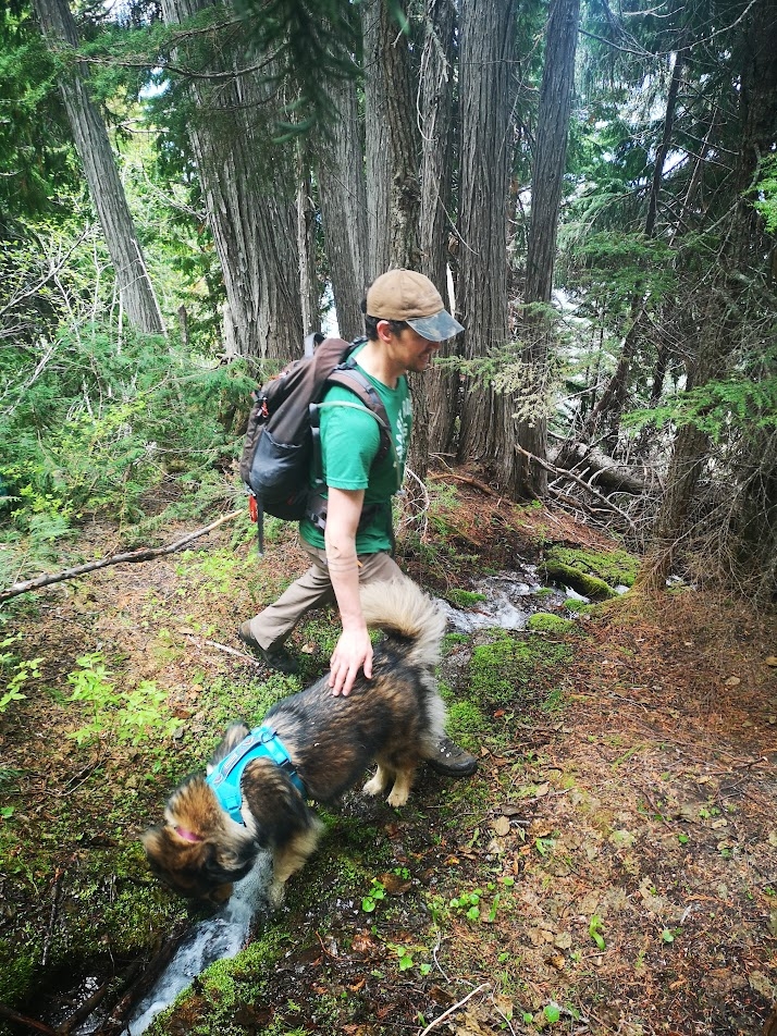
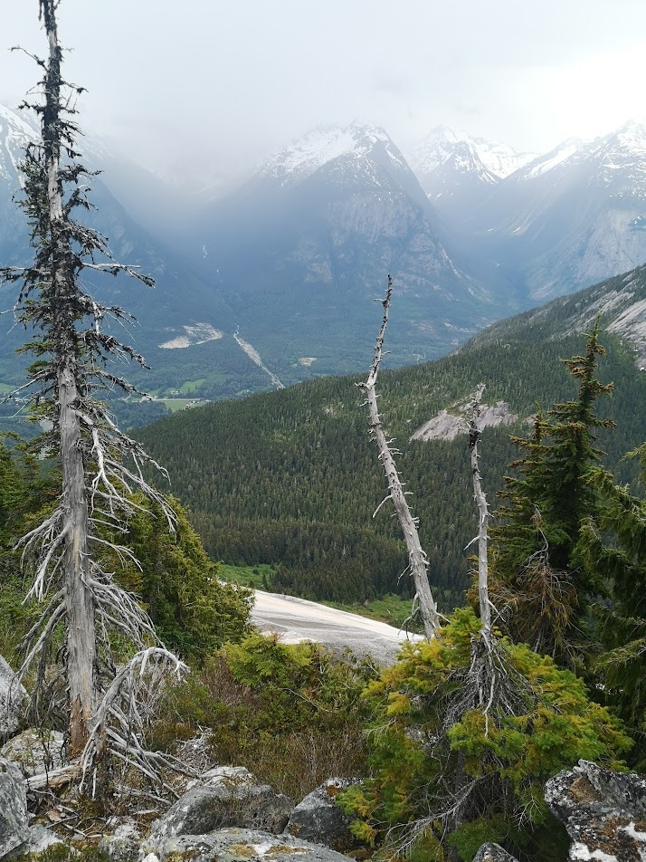
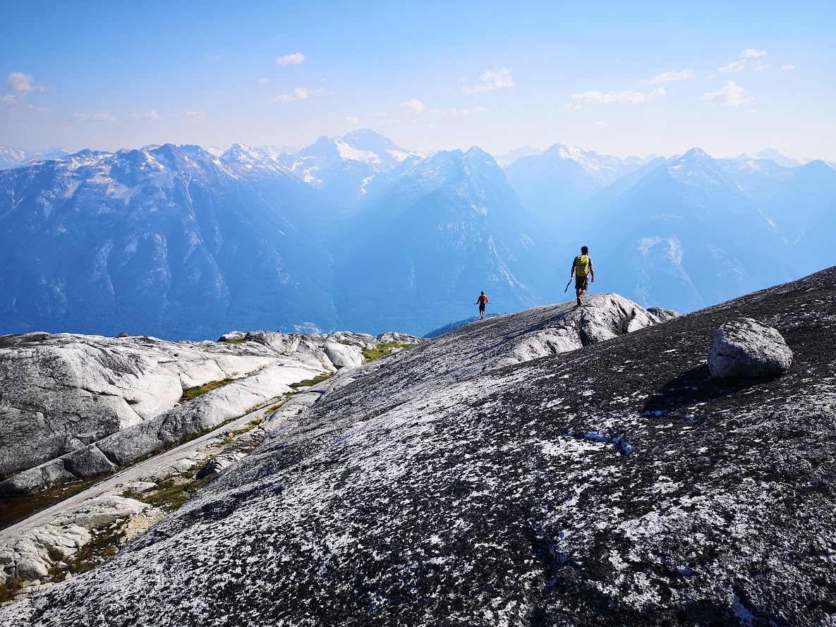
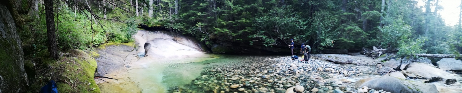
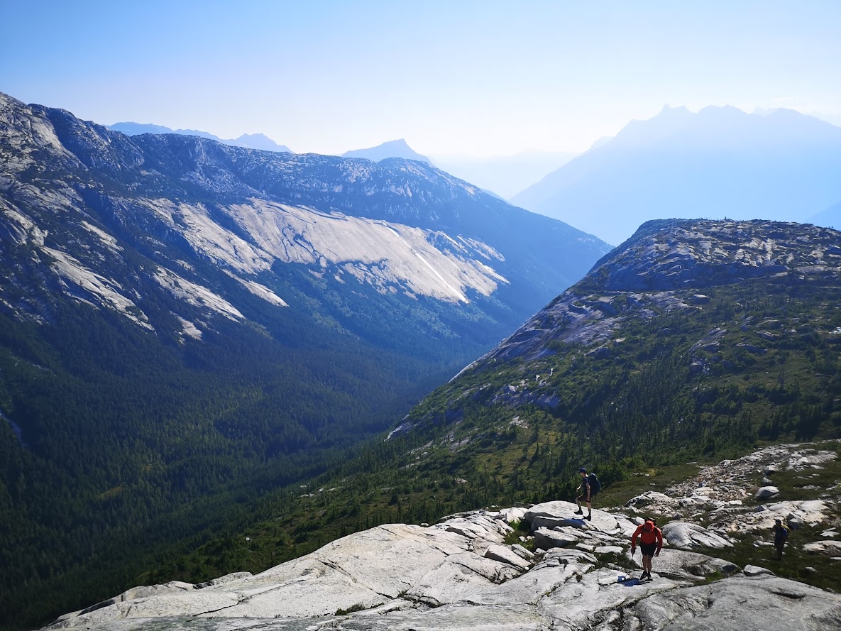
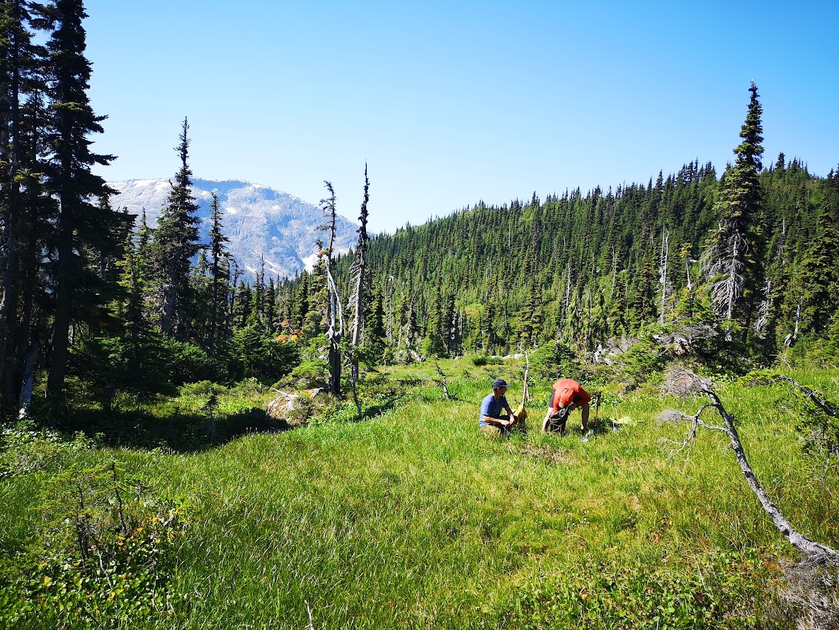
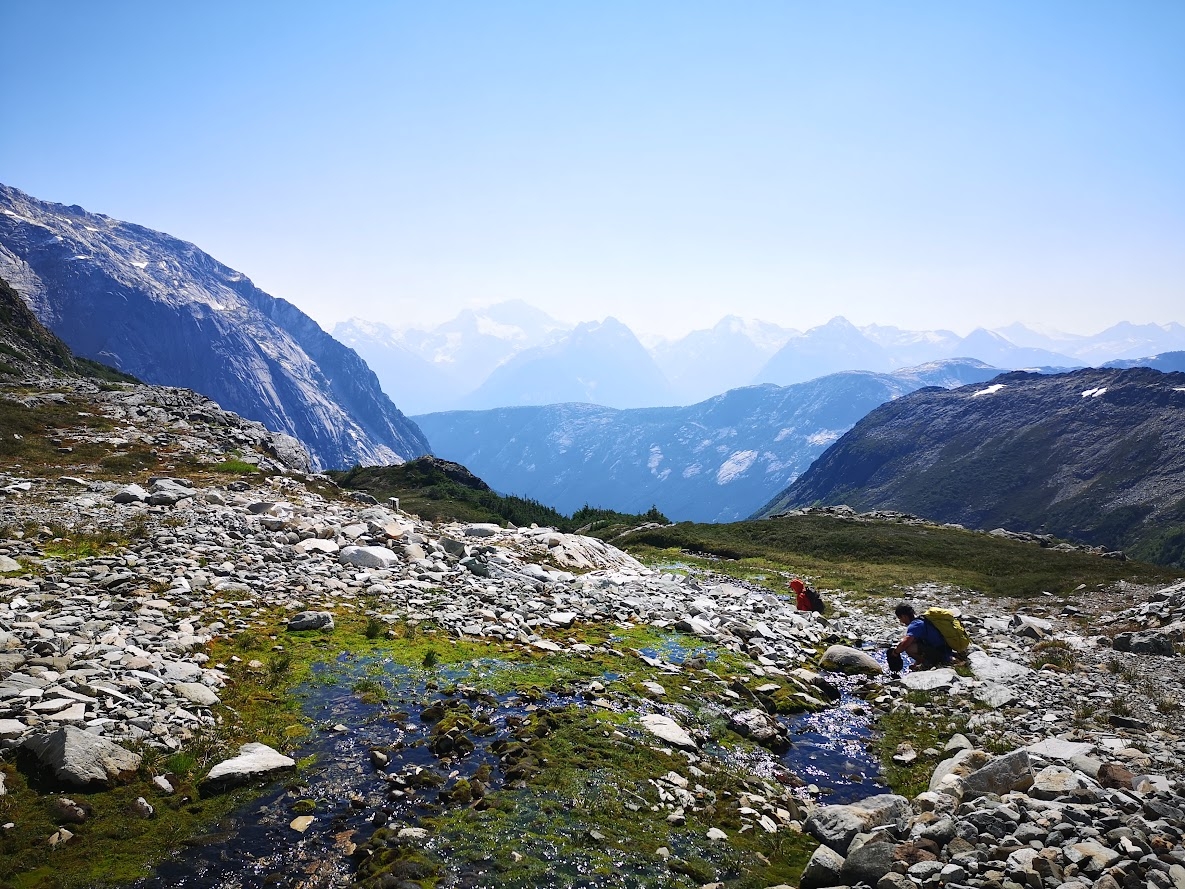
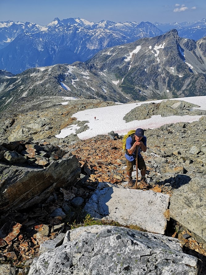
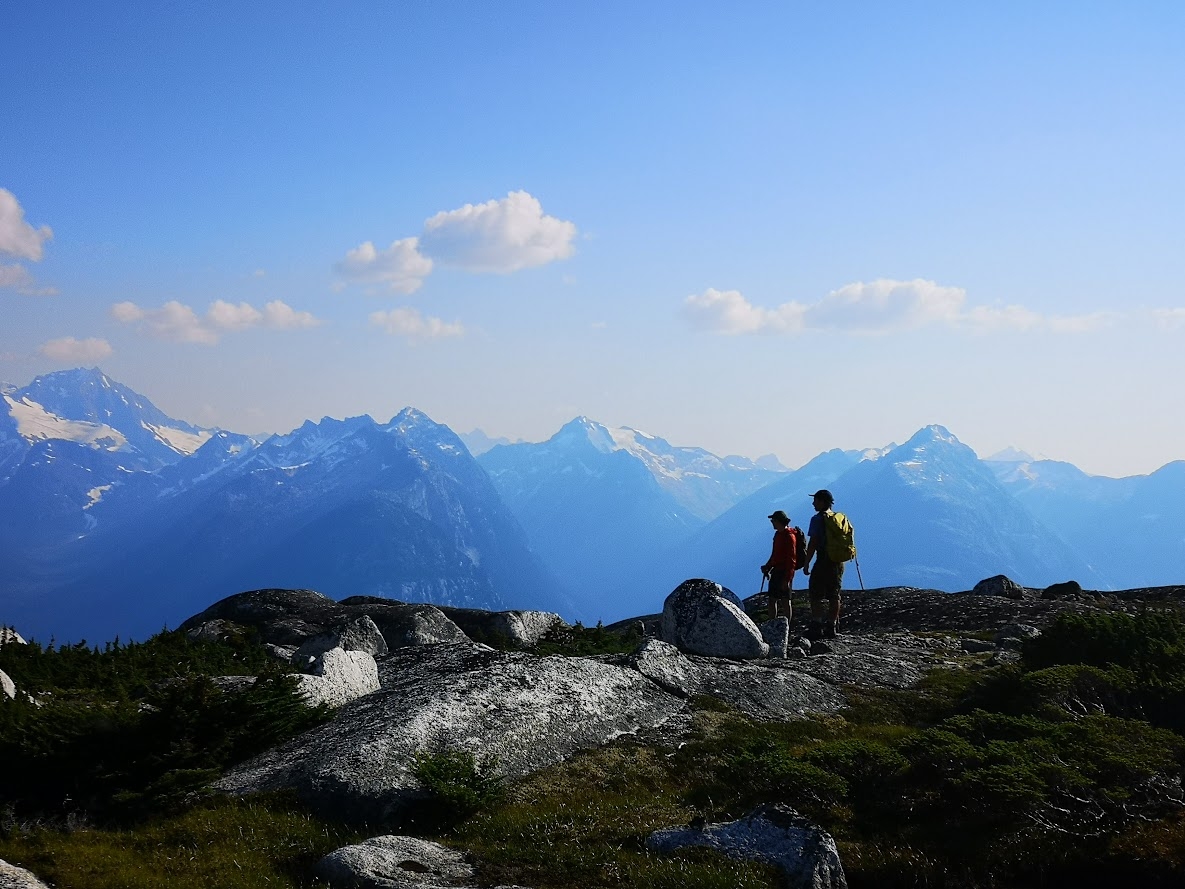
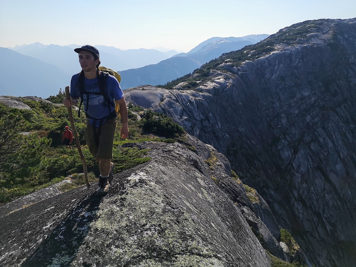
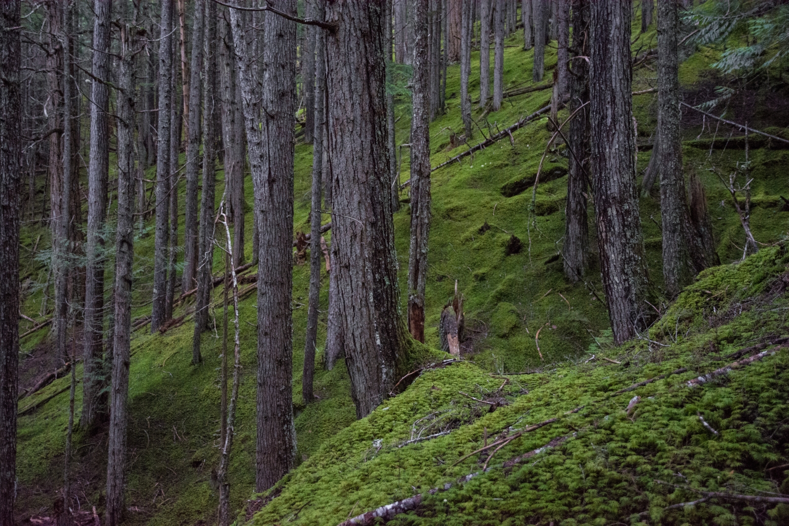
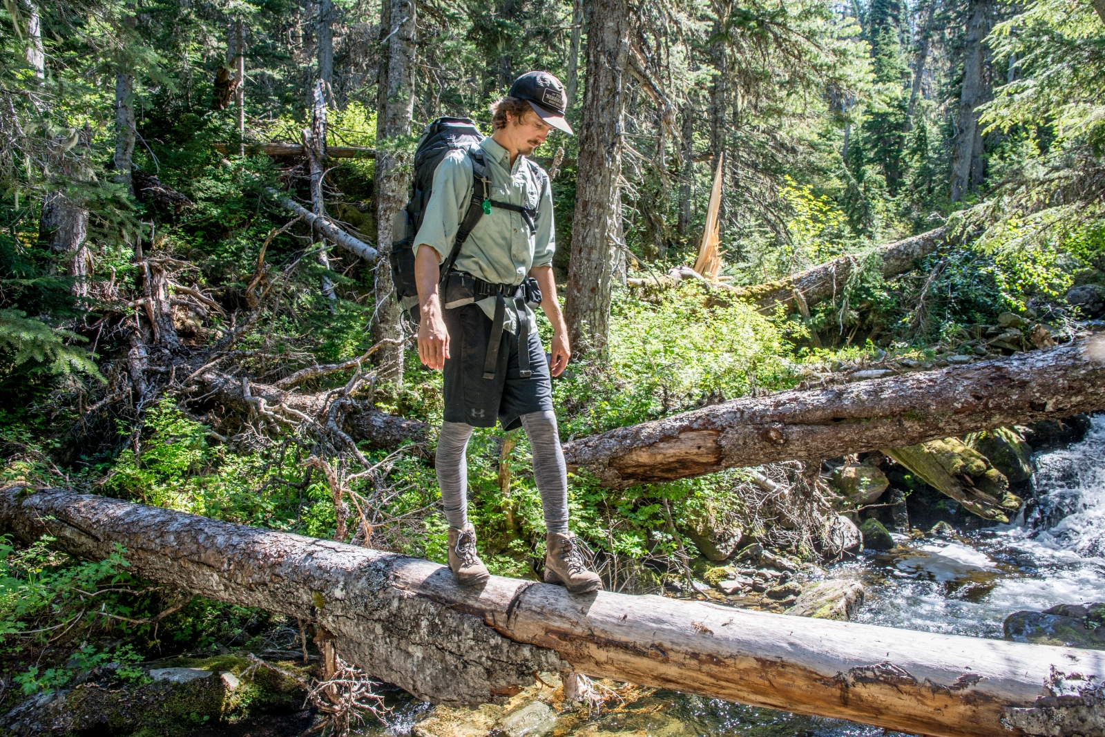
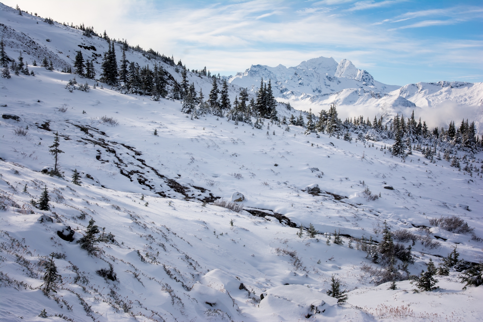
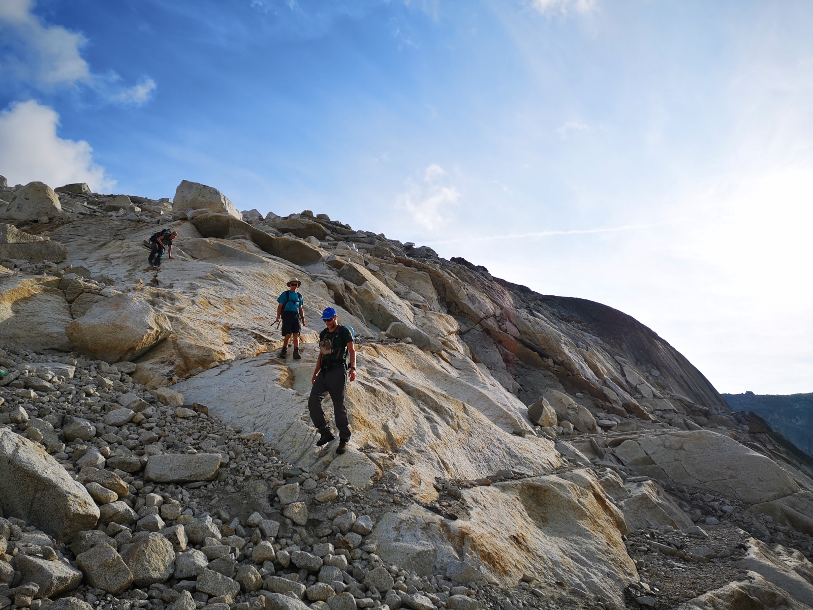
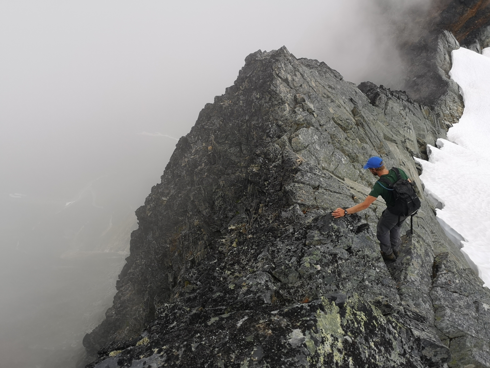
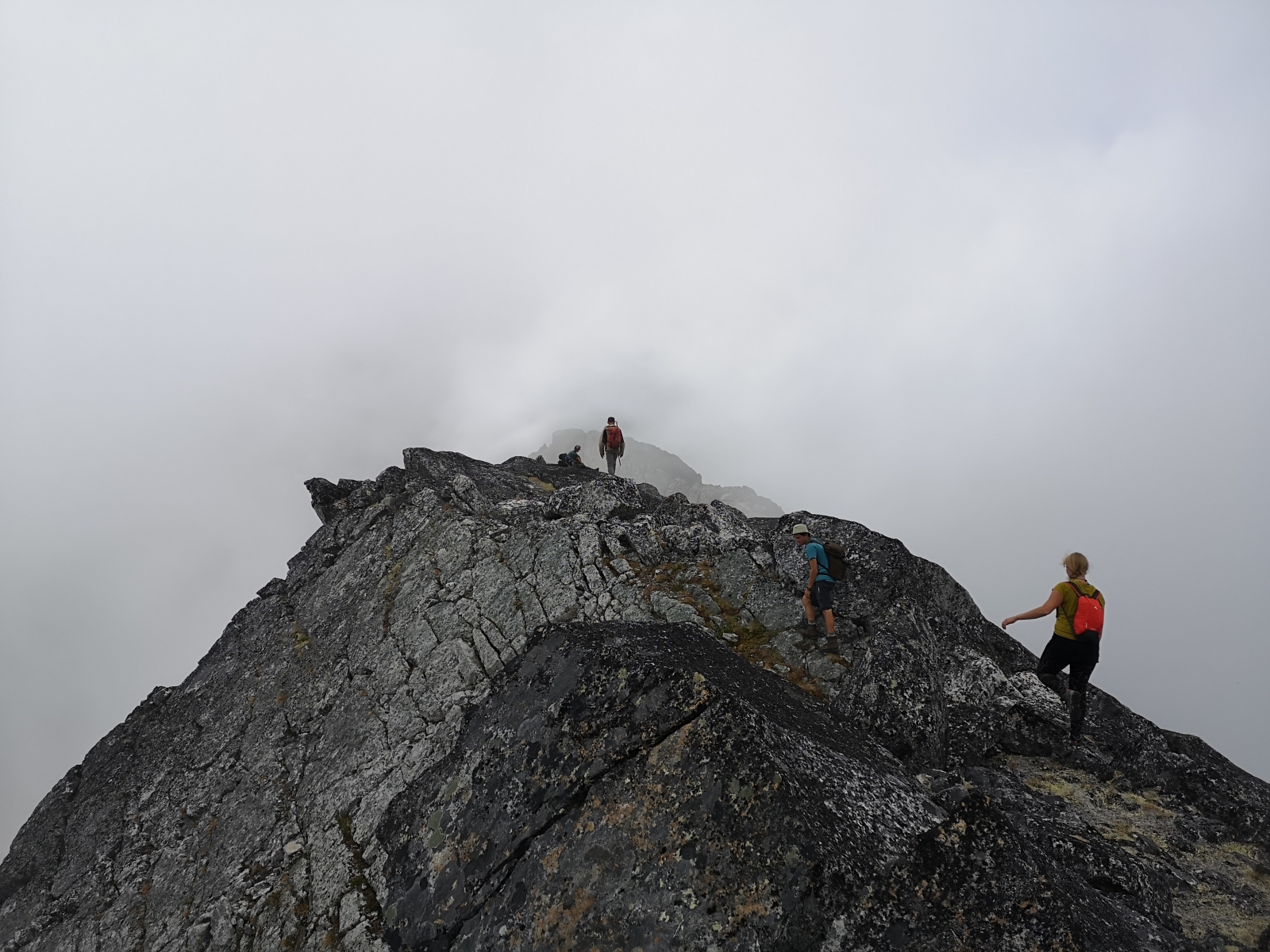
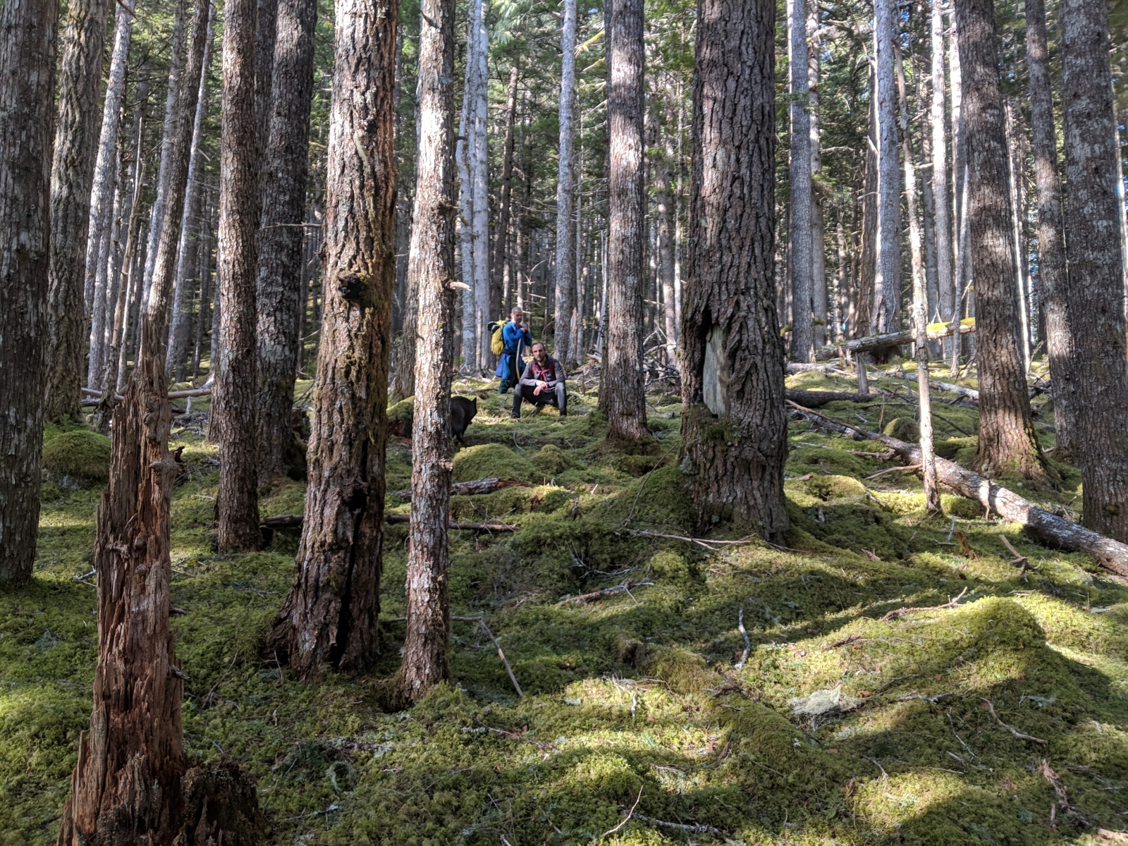
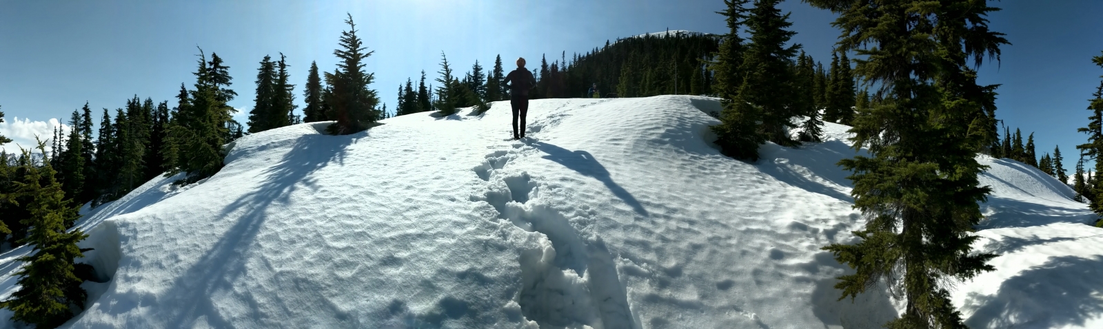
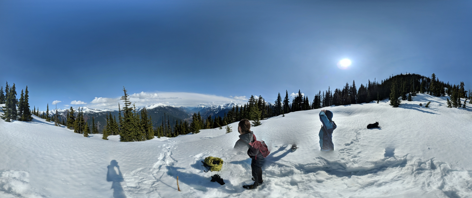
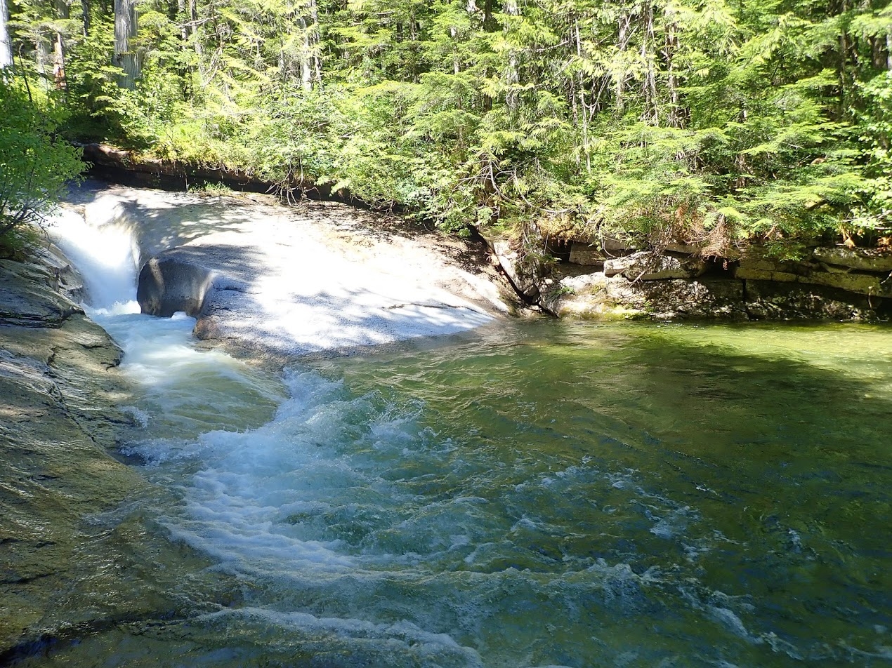
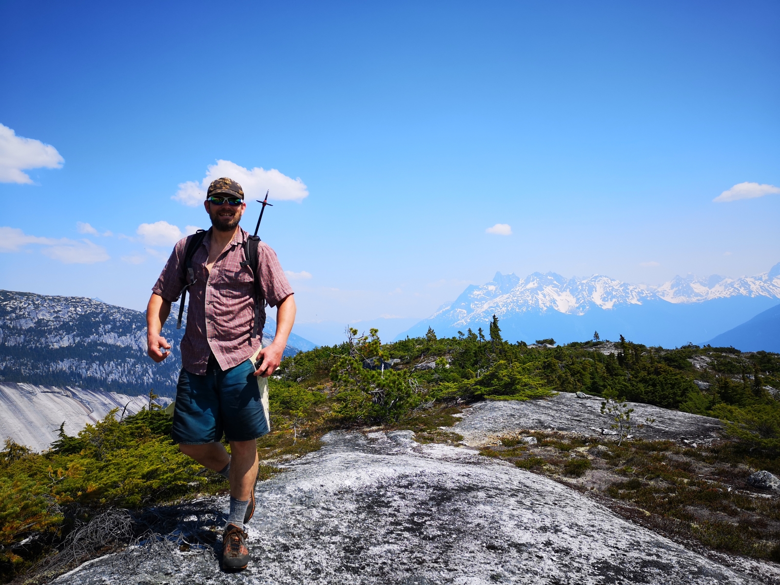
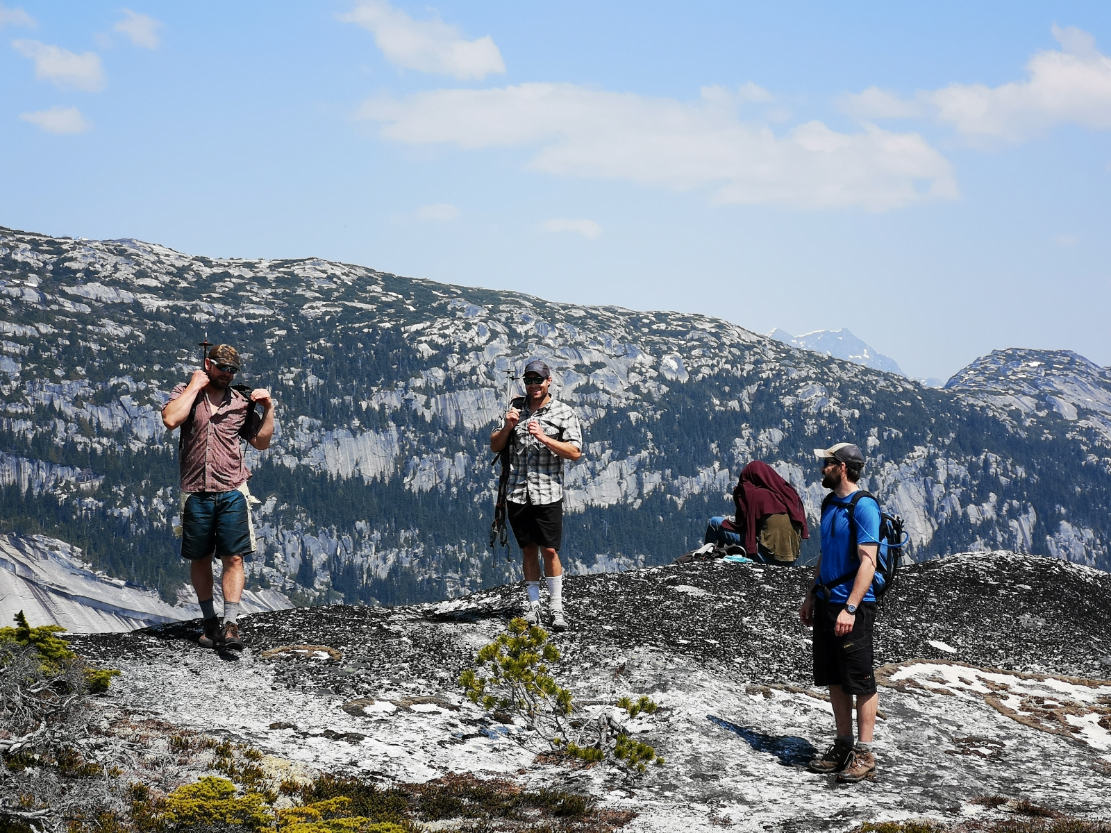
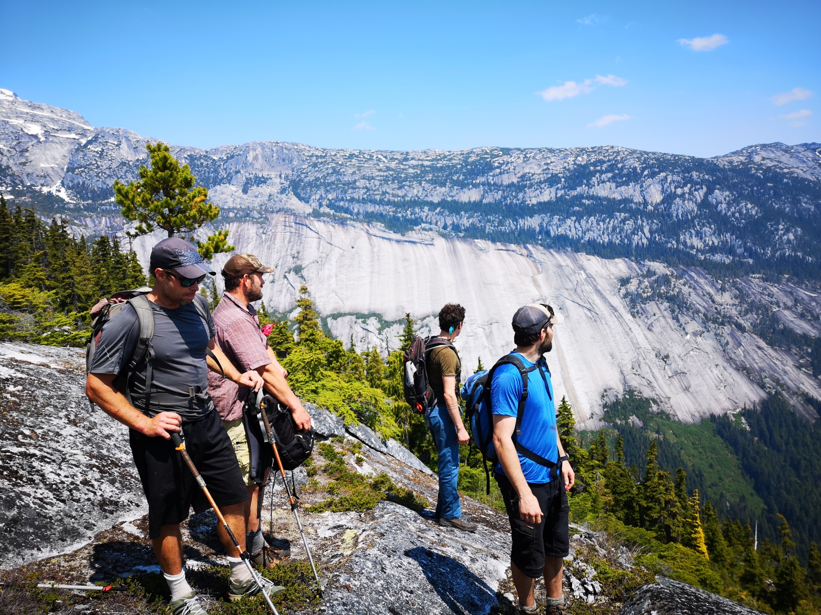
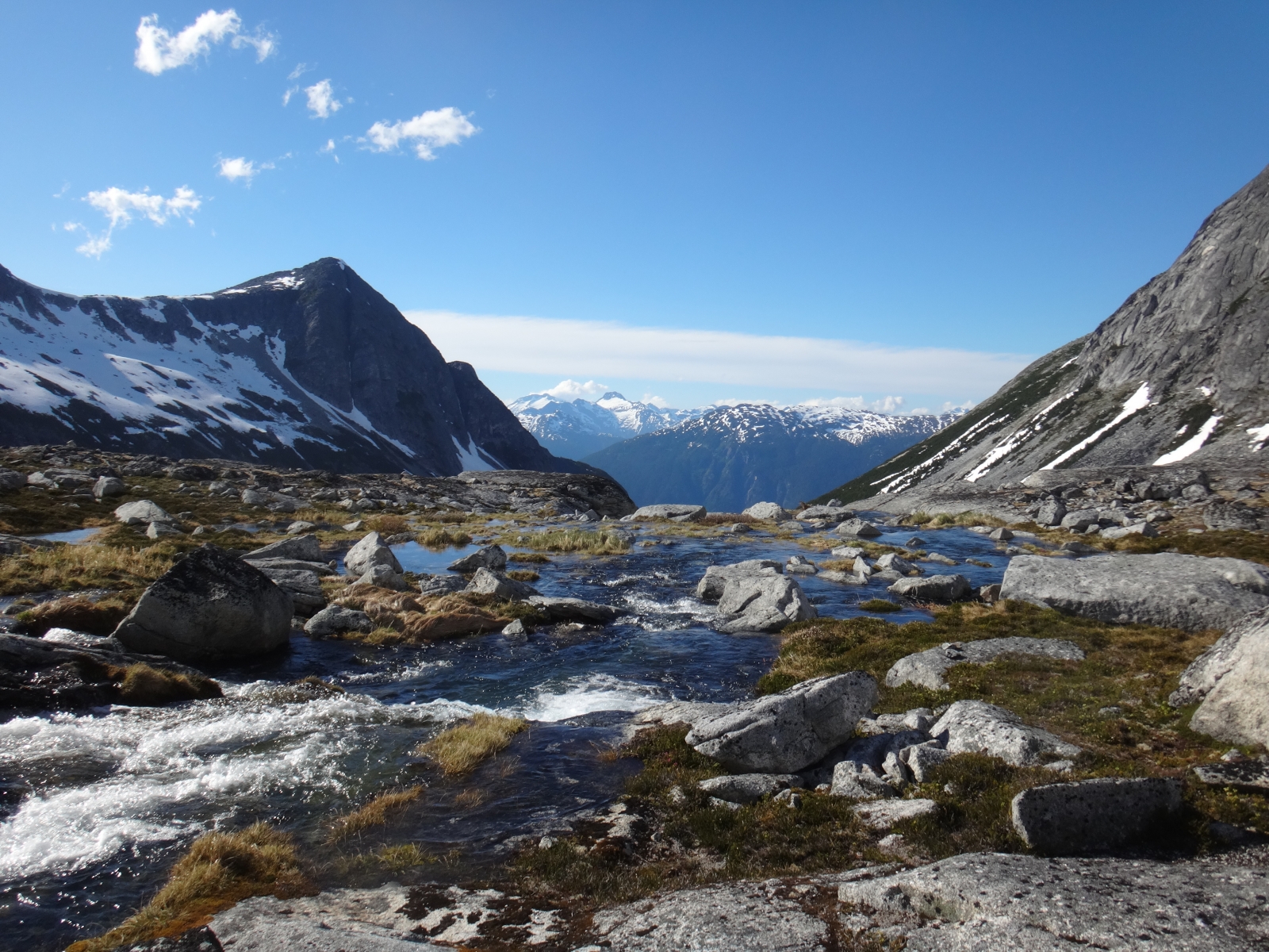
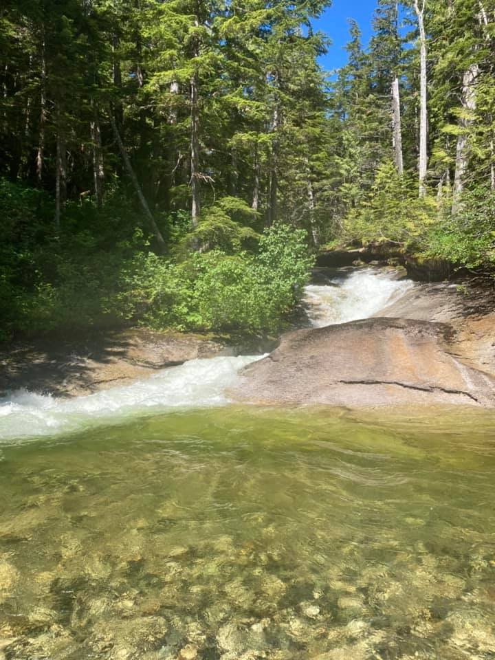
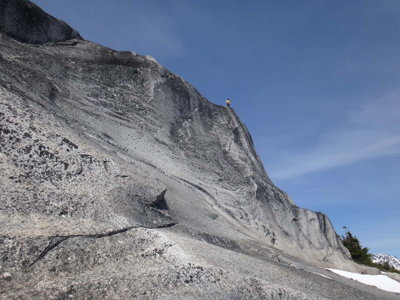
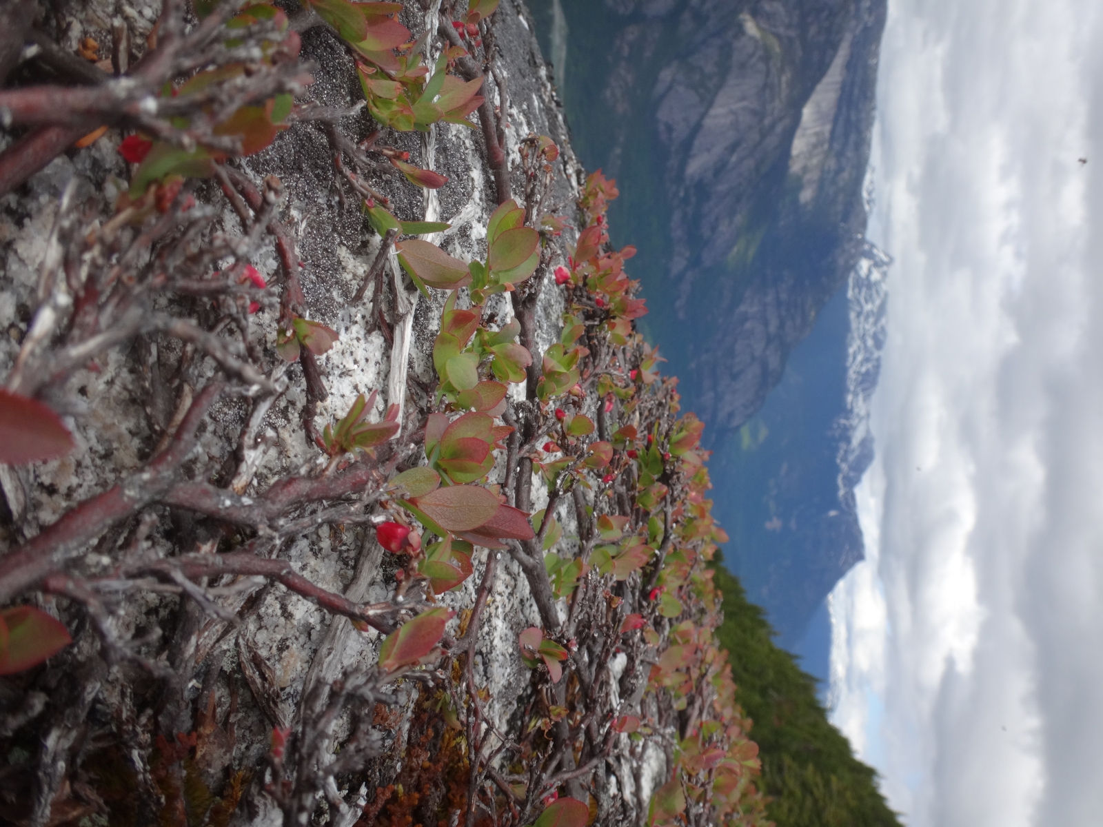
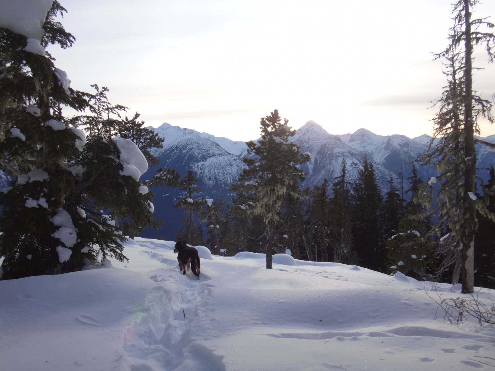
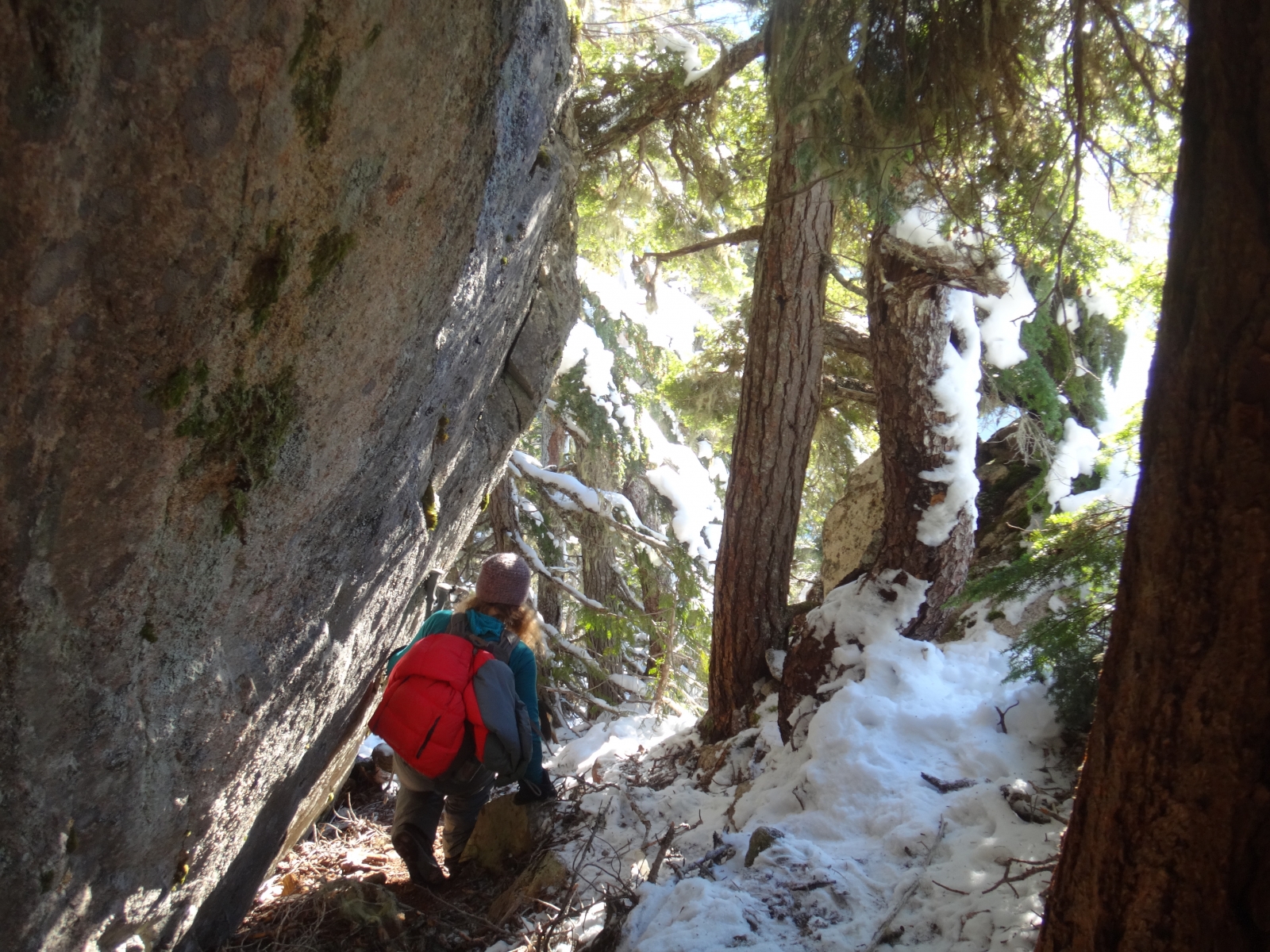
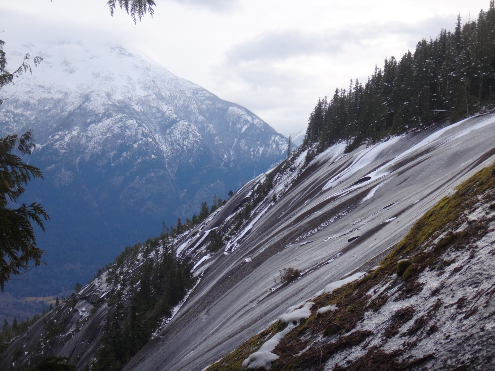
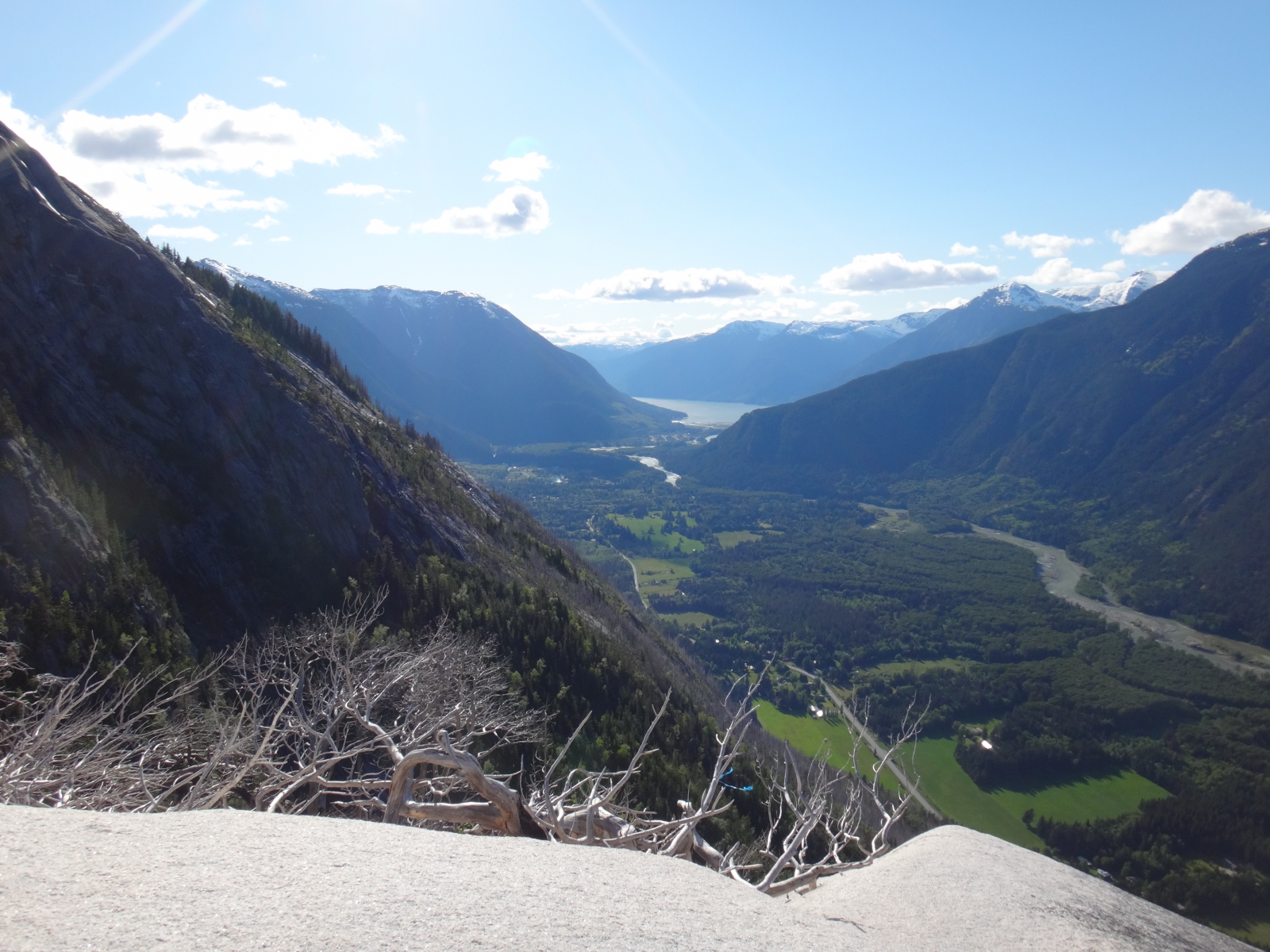
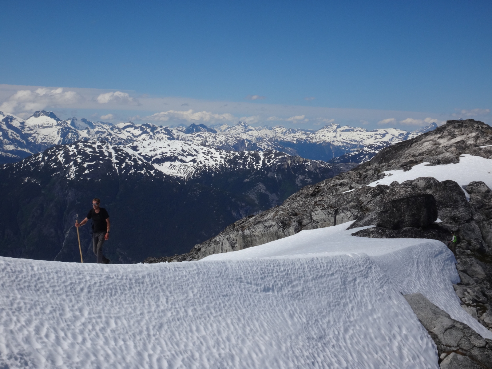
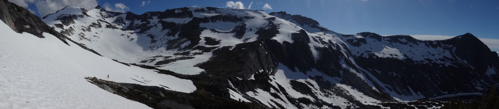
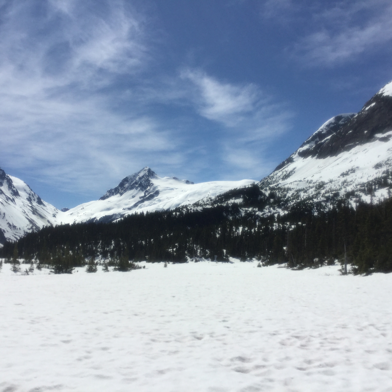
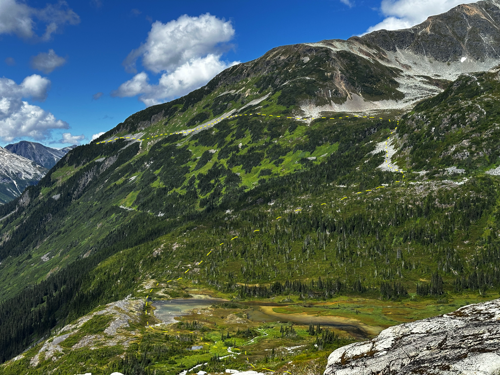
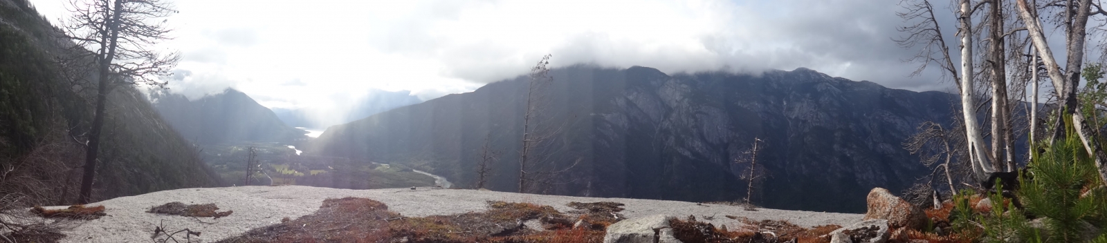
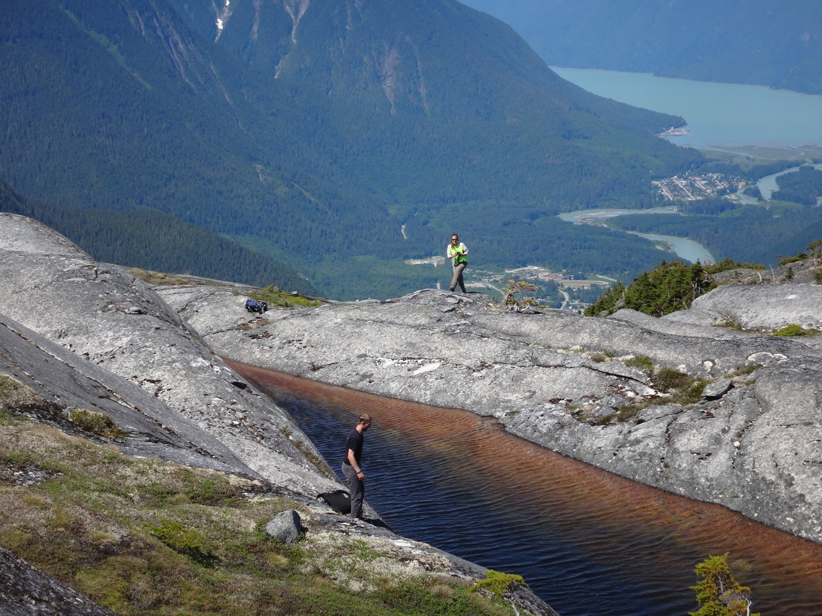
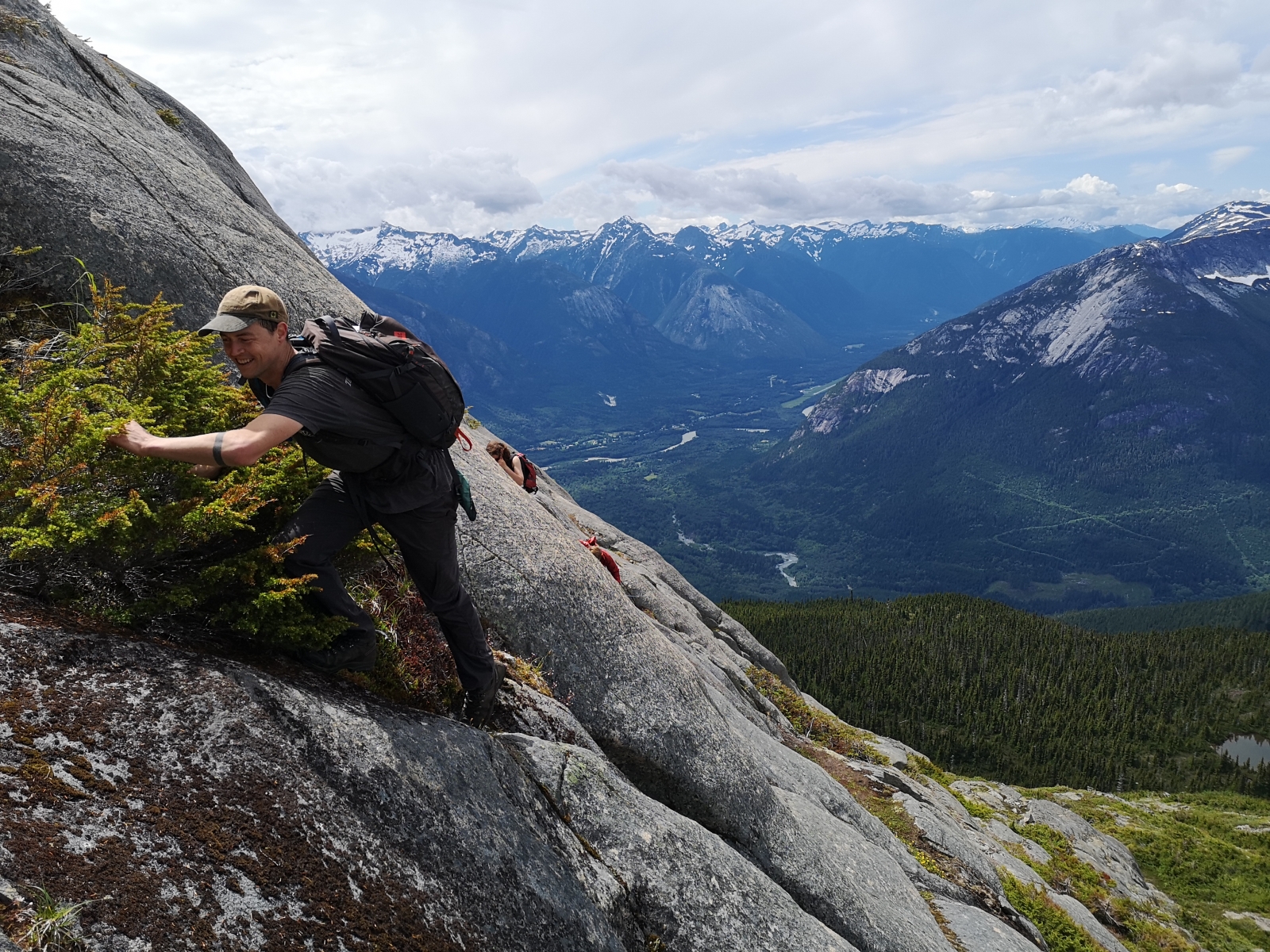
Trail Description: Follow the well flagged and fully cut (2021) trail through ascending switchbacks. A nice lookout over a talus field exists at 950m 1.6km in. The next 1.2km of trail continues to ascend through the forest but involves sections of steep side hilling. Sturdy boots and hiking pole recommended until the trail receives more work. Caution: If the ground is frozen in late fall or winter this section can be dangerous. The mountain slope eventually eases and you will continue traversing towards the creek and descend a short distance to reach a prominent avalanche path. Cross this avalanche path and look for where the trail re-enters the woods. Follow this to a beautiful cascade and onward to a log crossing of Mosquito Creek. The log crossing is easy over little water. The trail then ascends for 350m distance through shrubby forests before opening into beautiful heather meadows. Follow the flagged route through the gentle meadows for another 1.5km, eventually reaching a prominent creek, follow that creek up to the full alpine!

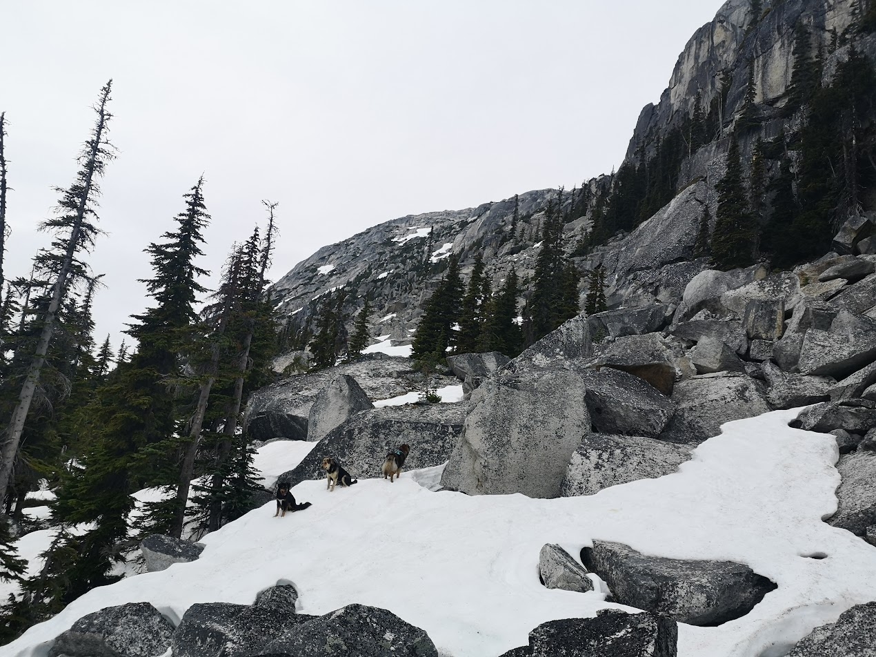
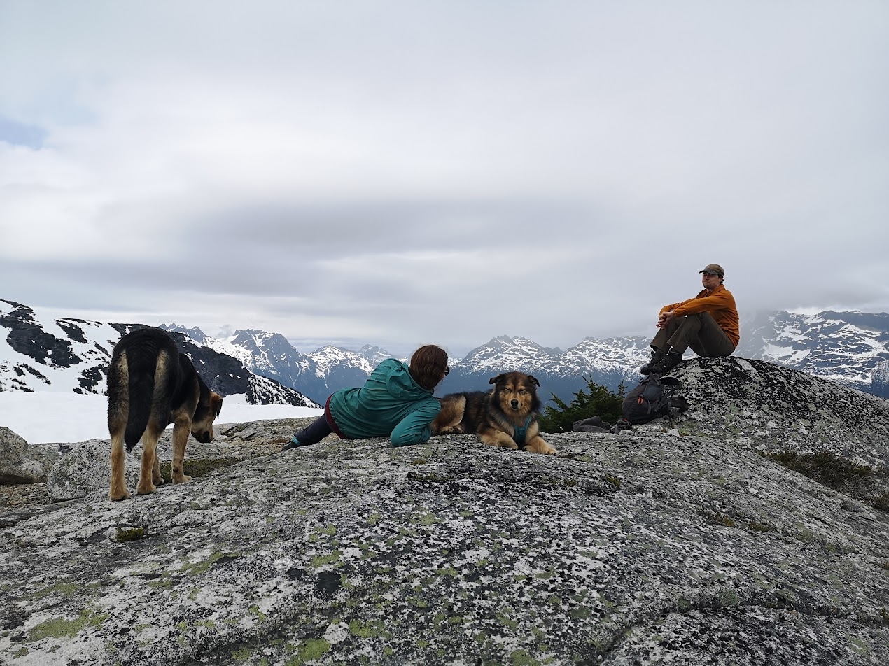
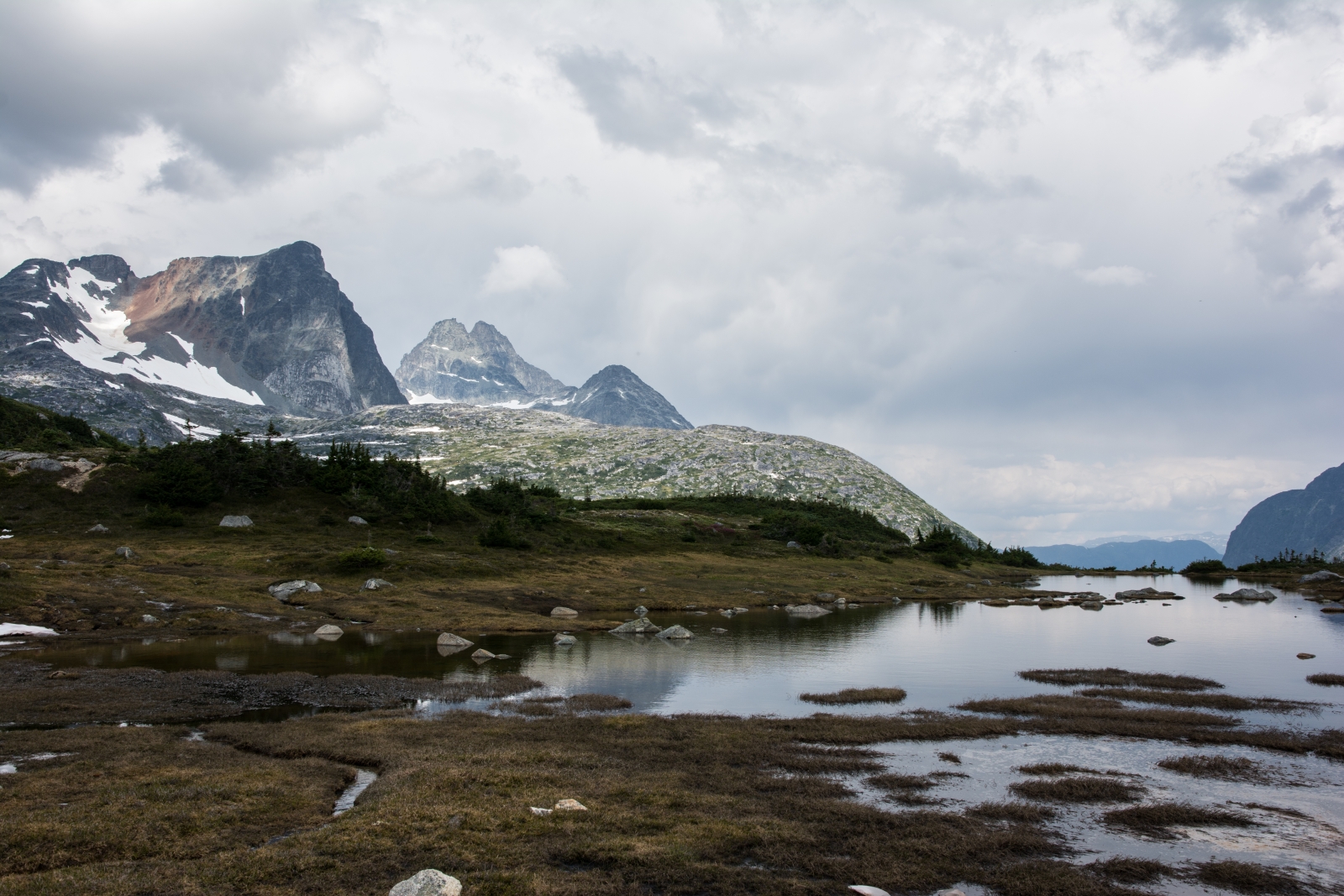
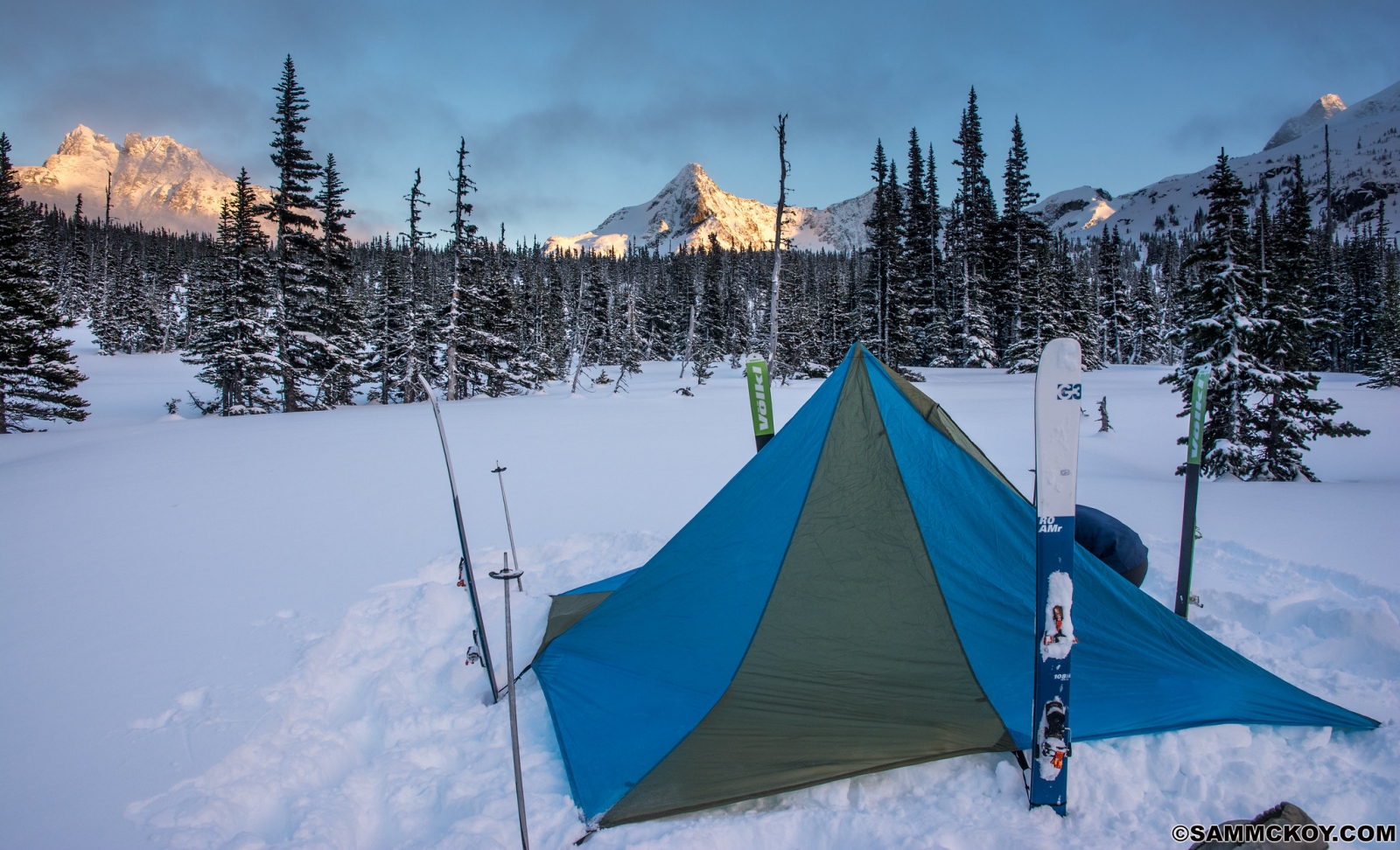
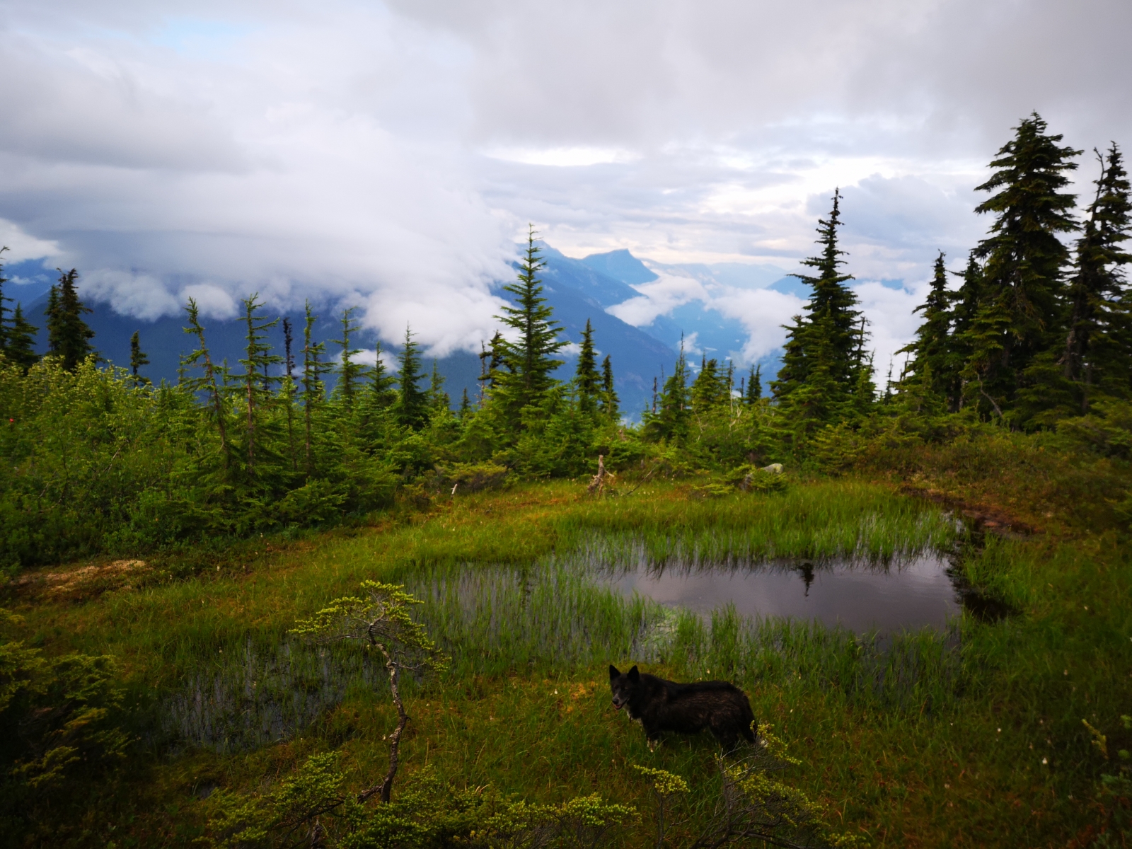
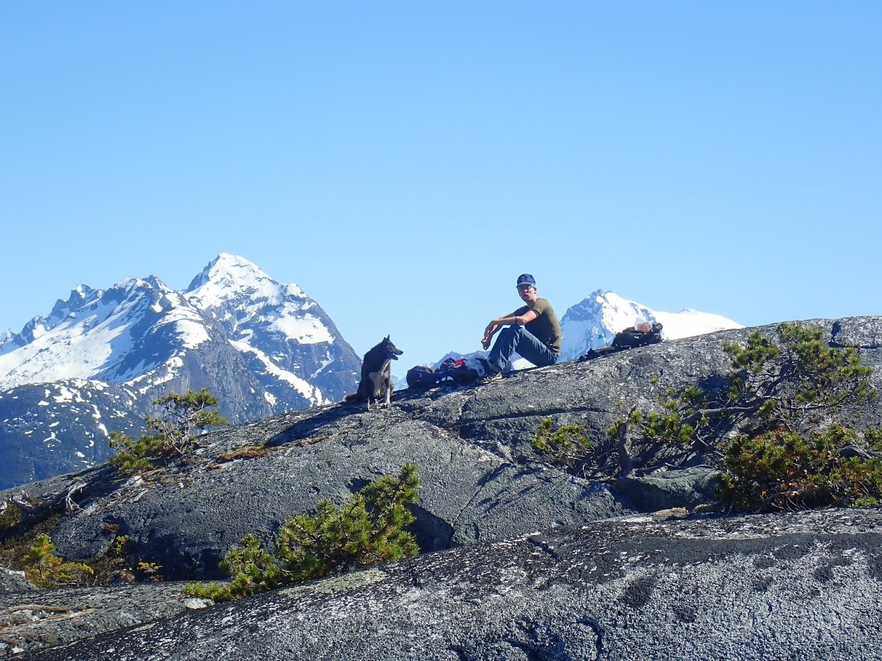
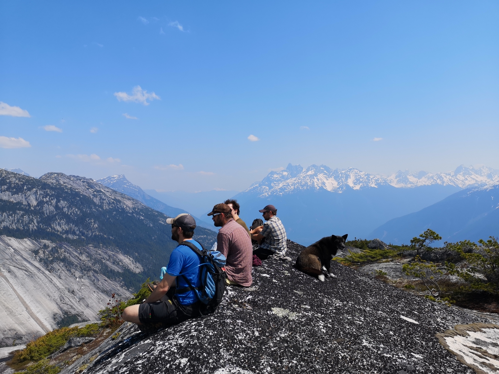
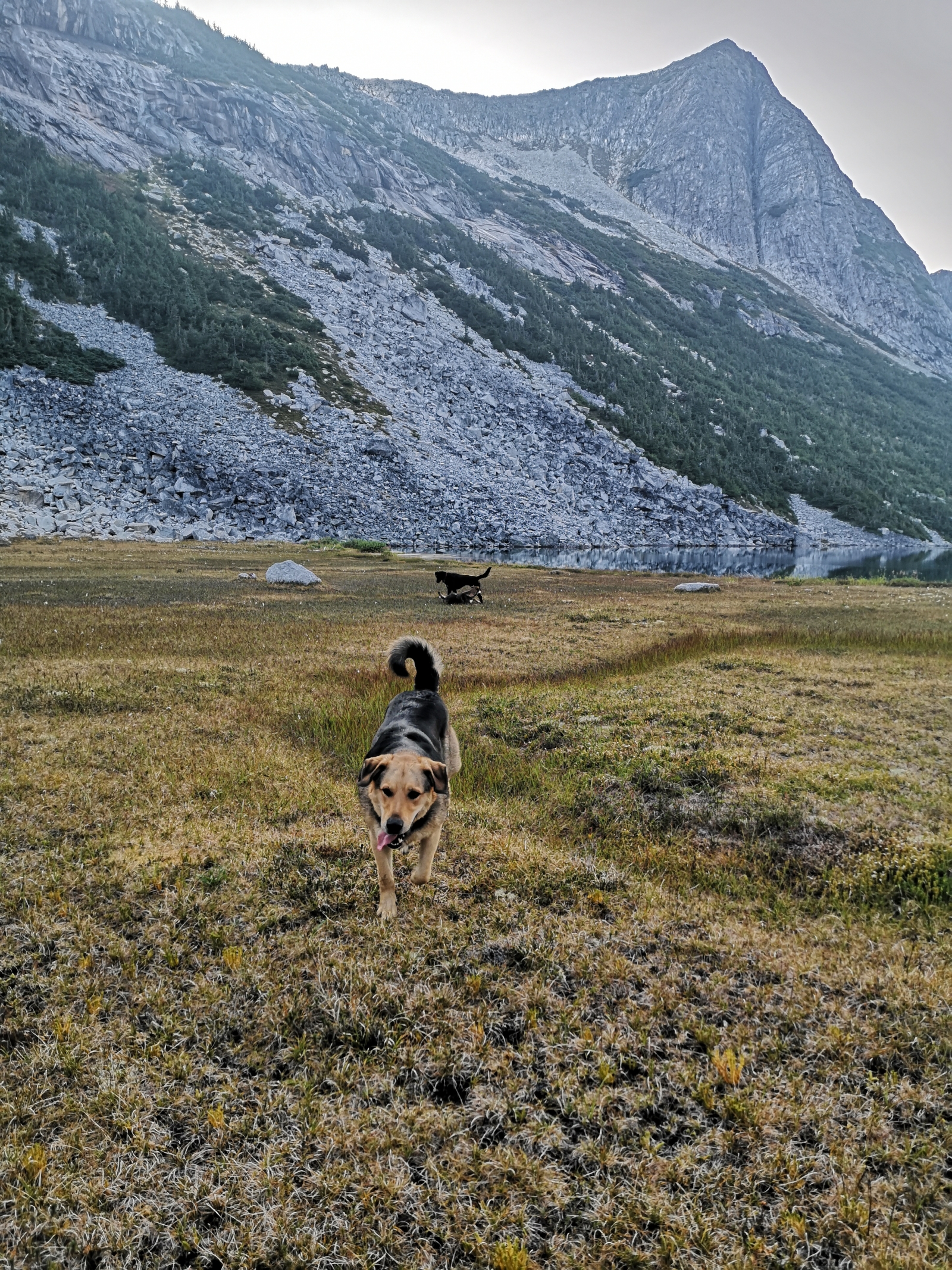
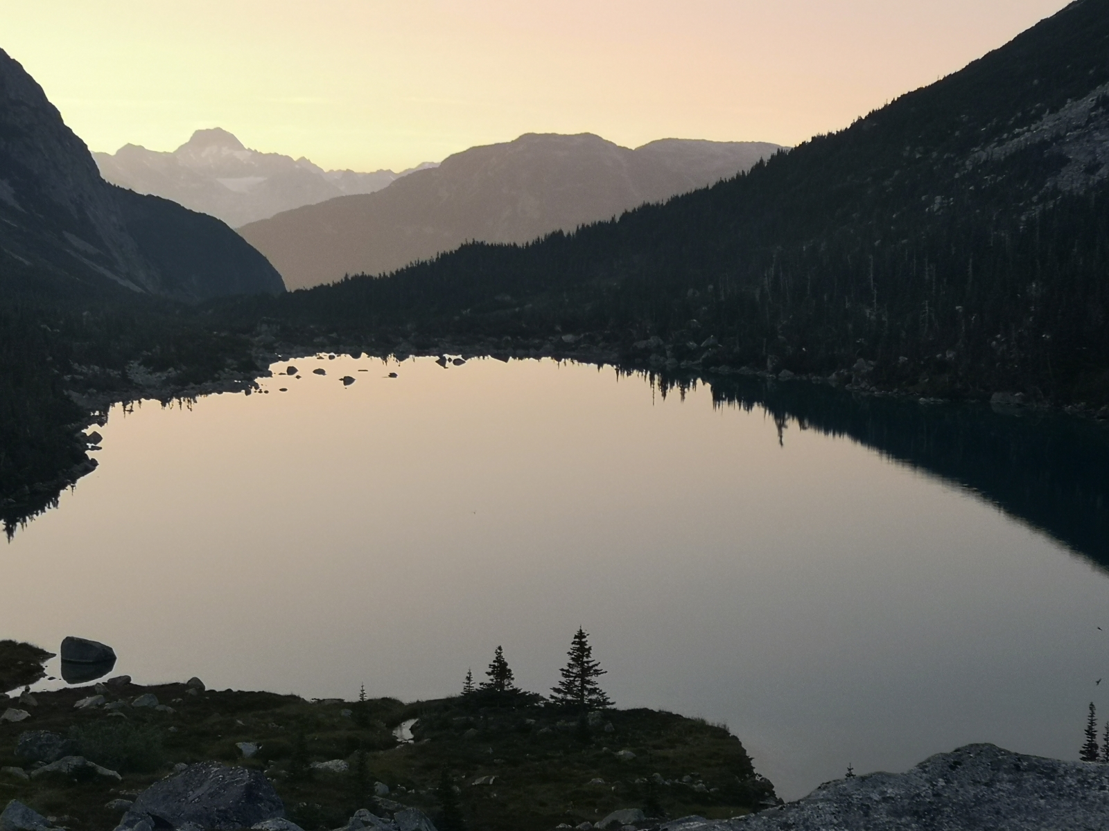
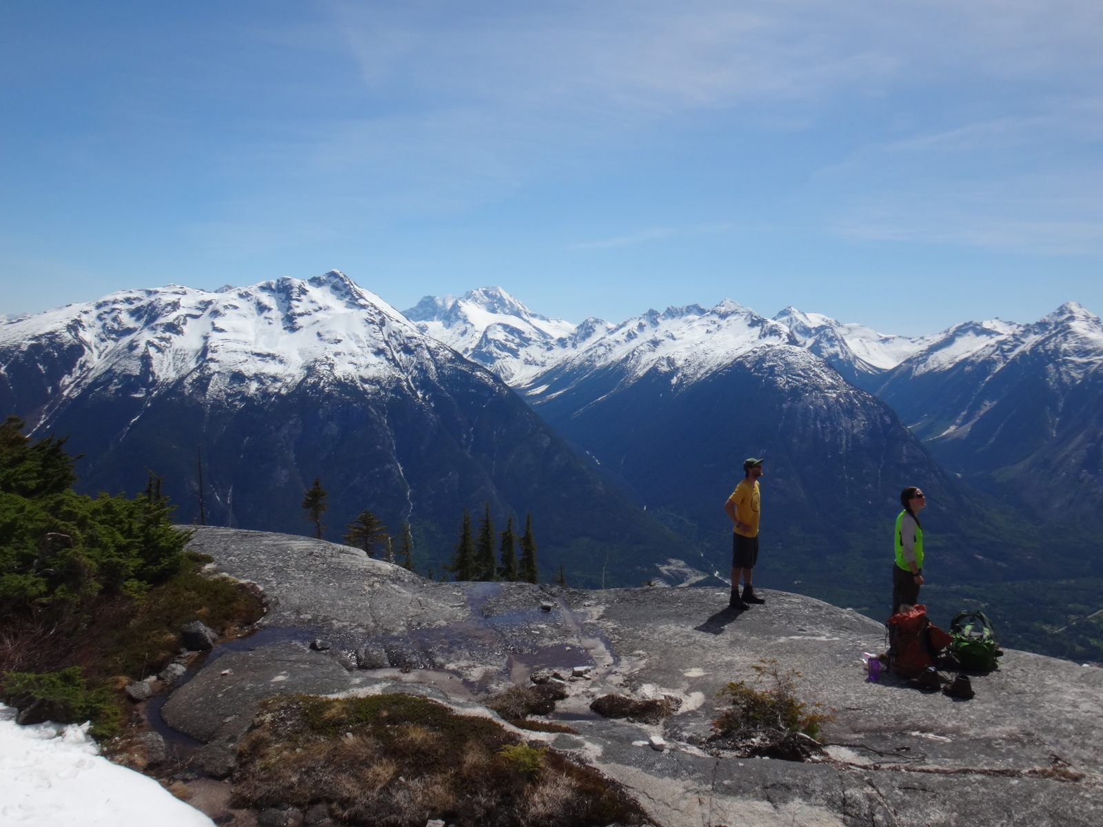
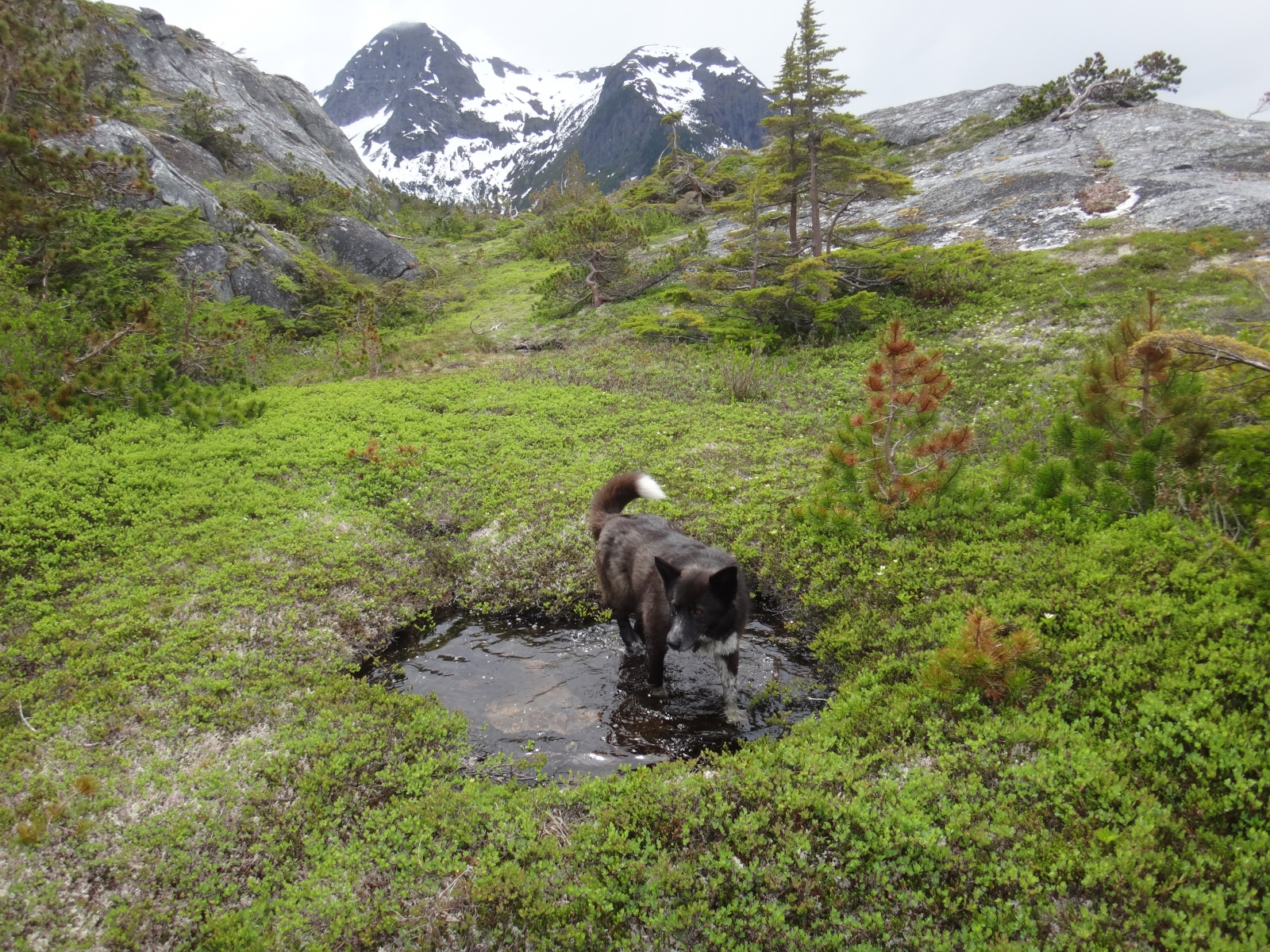
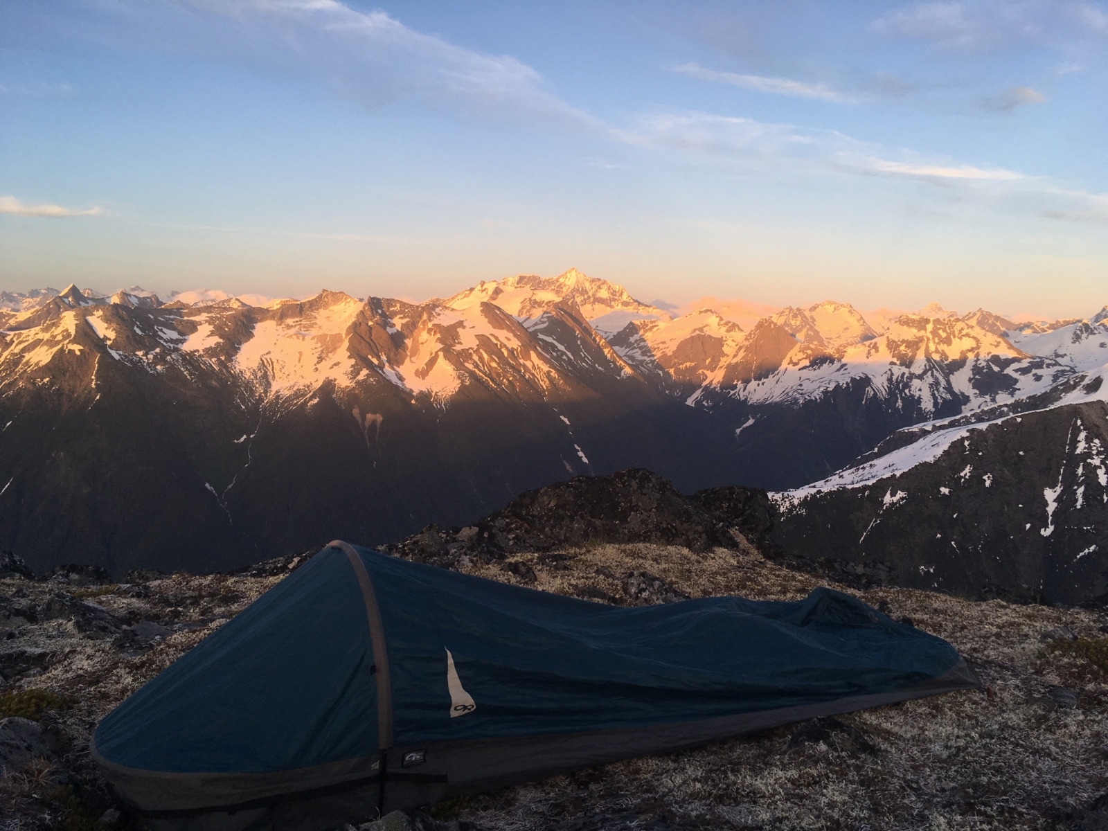
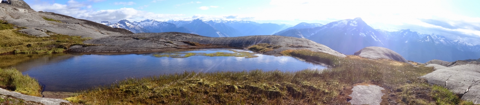
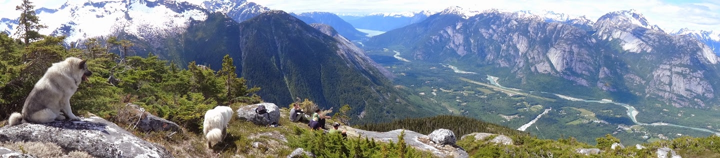
Camping: the flagged route leads to a beautiful flat ridgetop with amazing vistas and nice tent spots near the creek. The windy ridge keeps any bugs at bay. Please practice Leave No Trace camping and dig poop cat-holes to the north of the ridge (facing Mosquito Pass's wetlands) and away from the water source to the south.

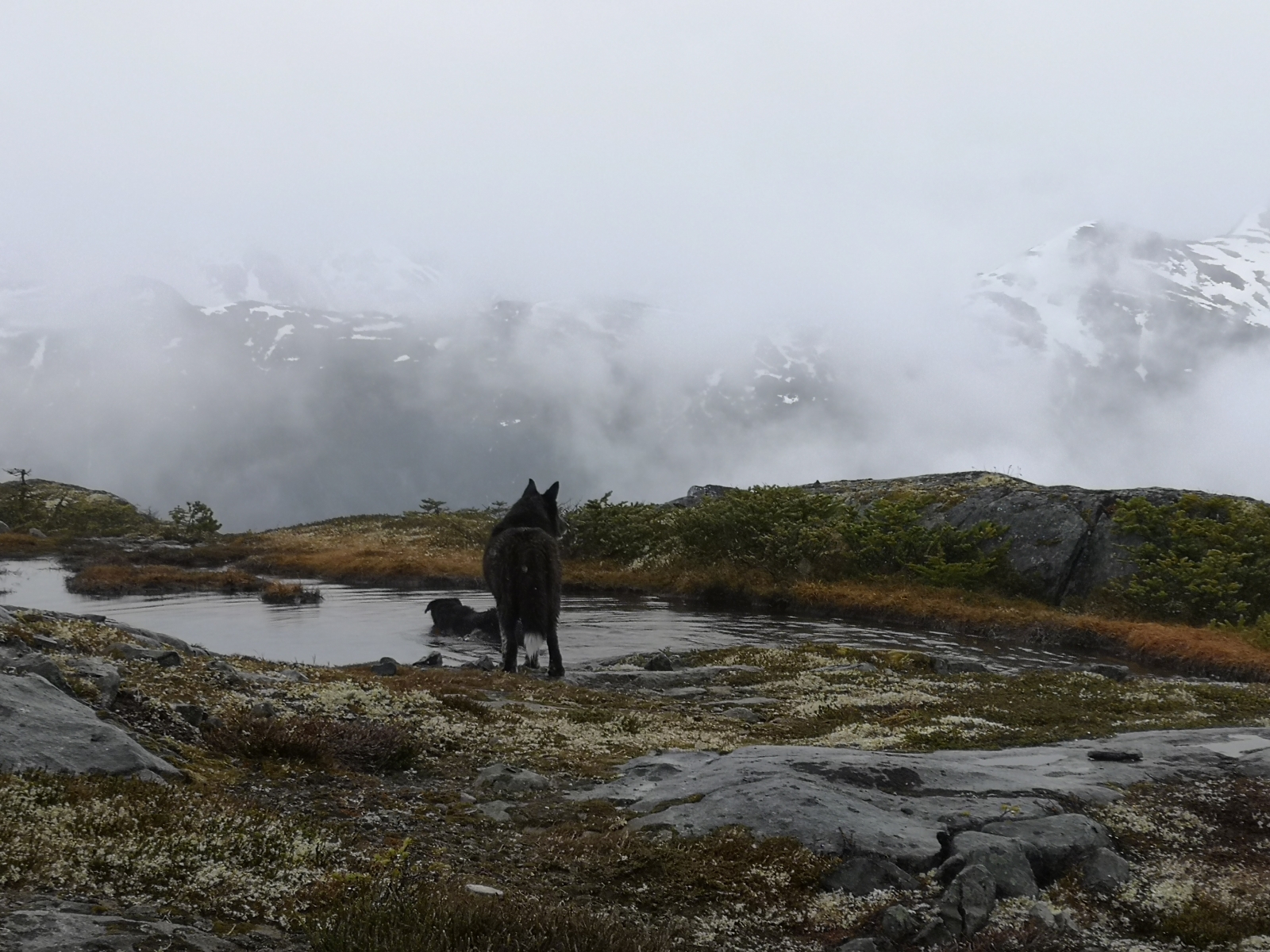
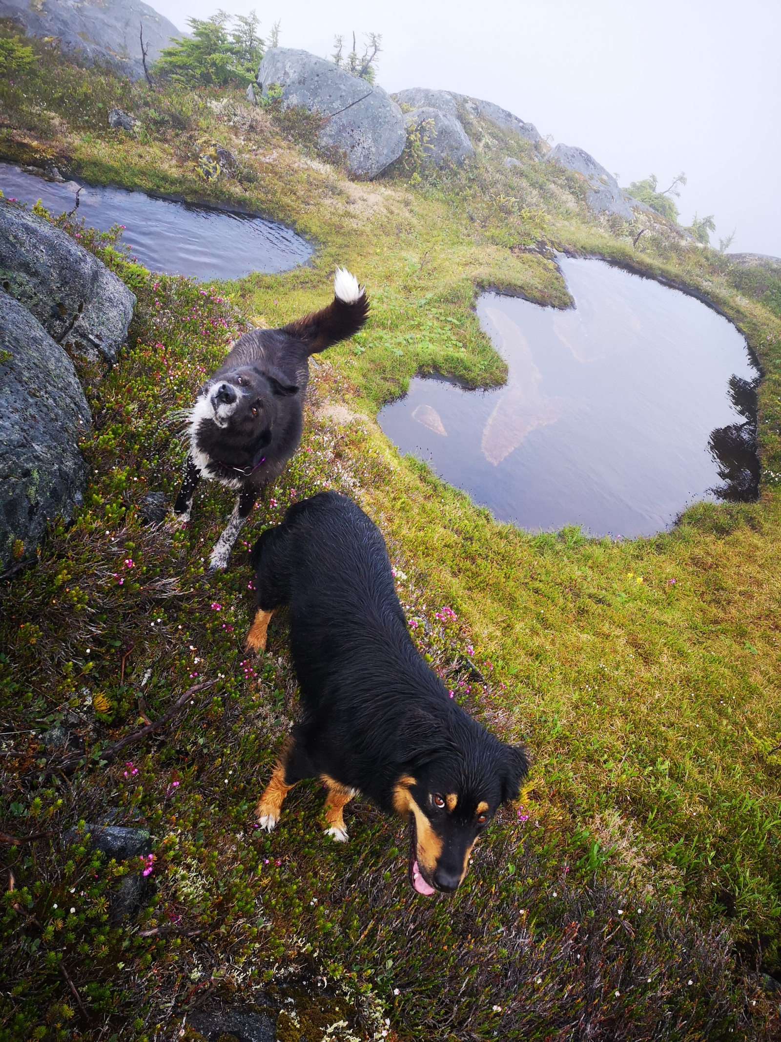
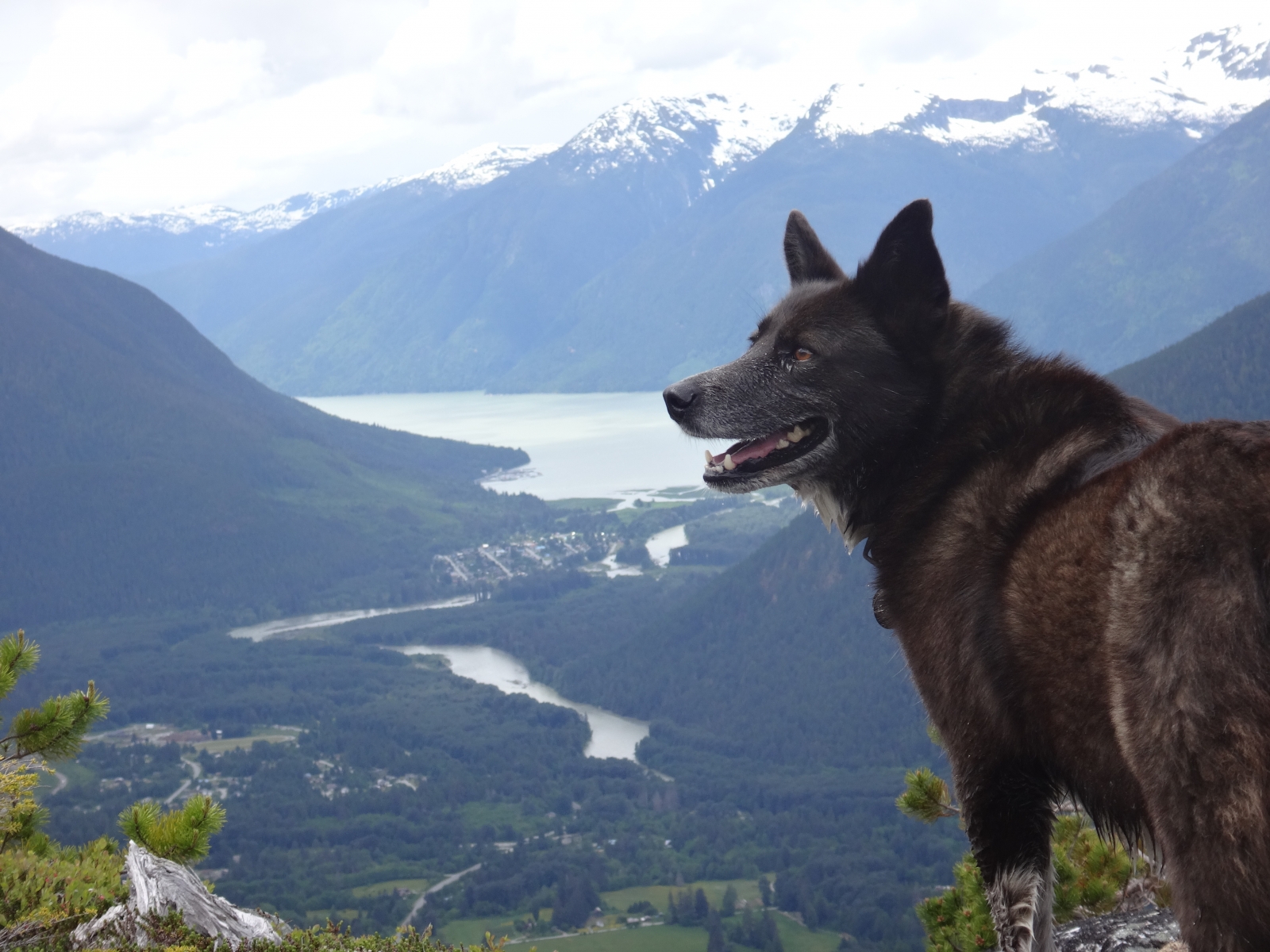
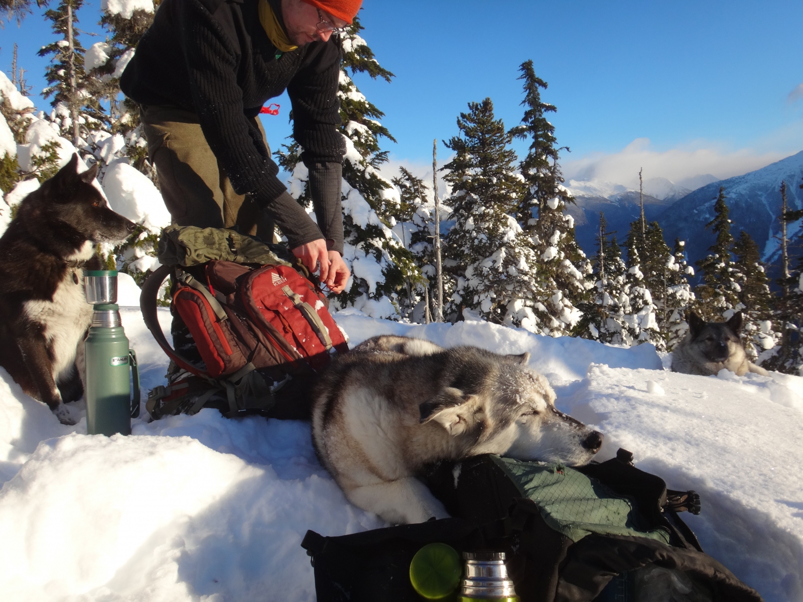
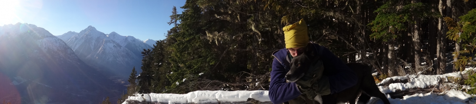
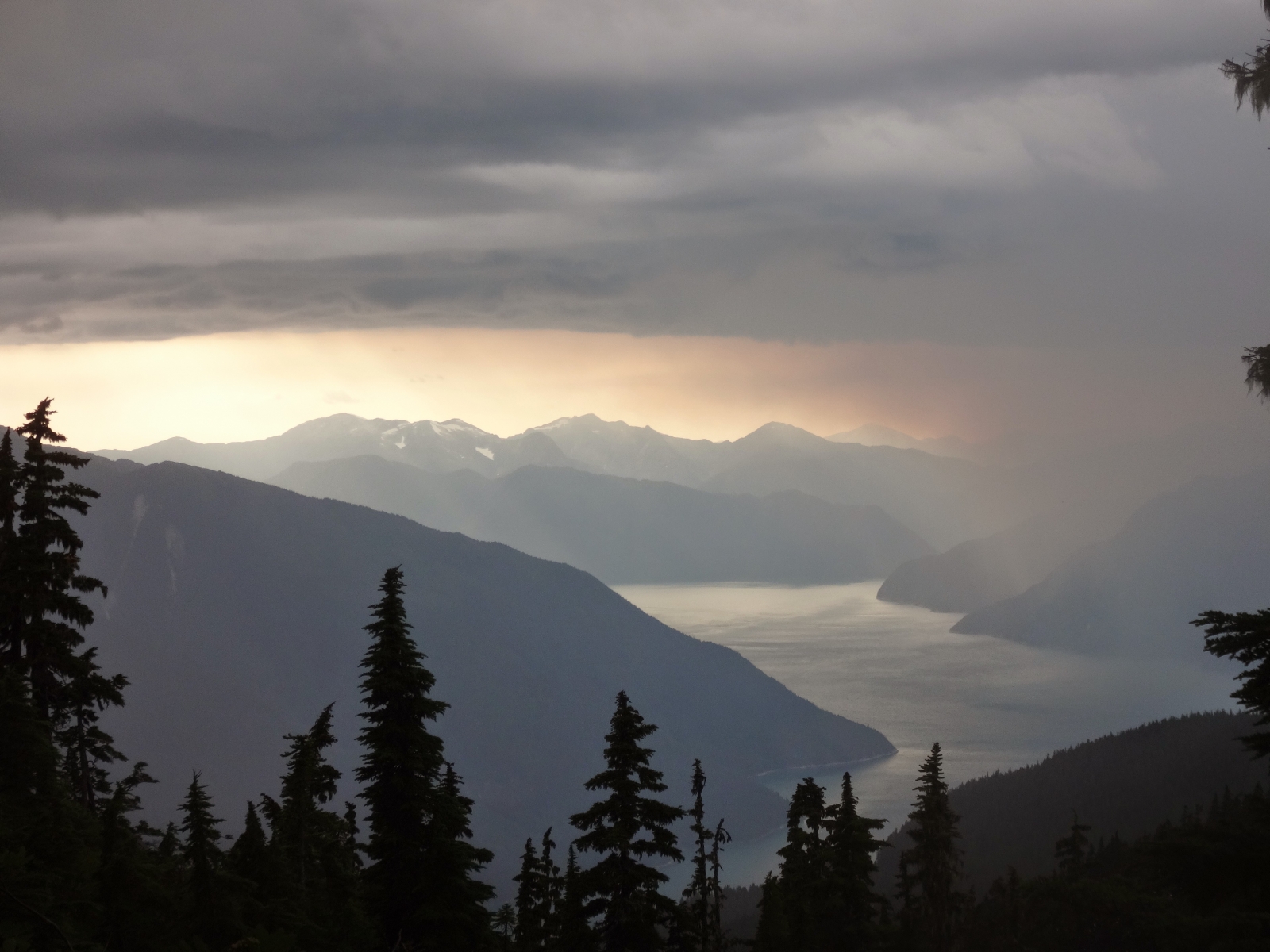
Wildlife: The Mosquito Pass area is a prominent corridor for wildlife including black bear, grizzly, mule deer, wolverine and more. A resident herd of mountain goats occupy the area also. Please be bear aware and respectful of wildlife.

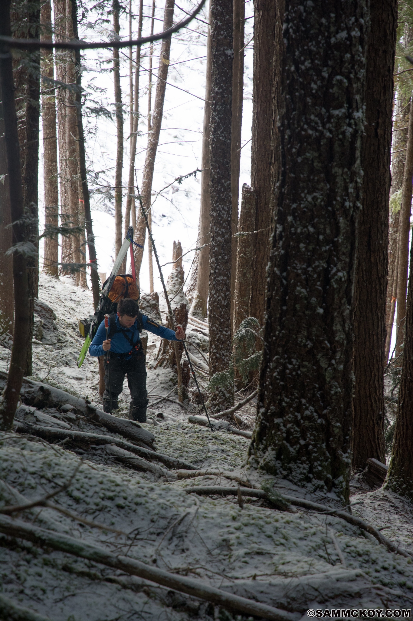
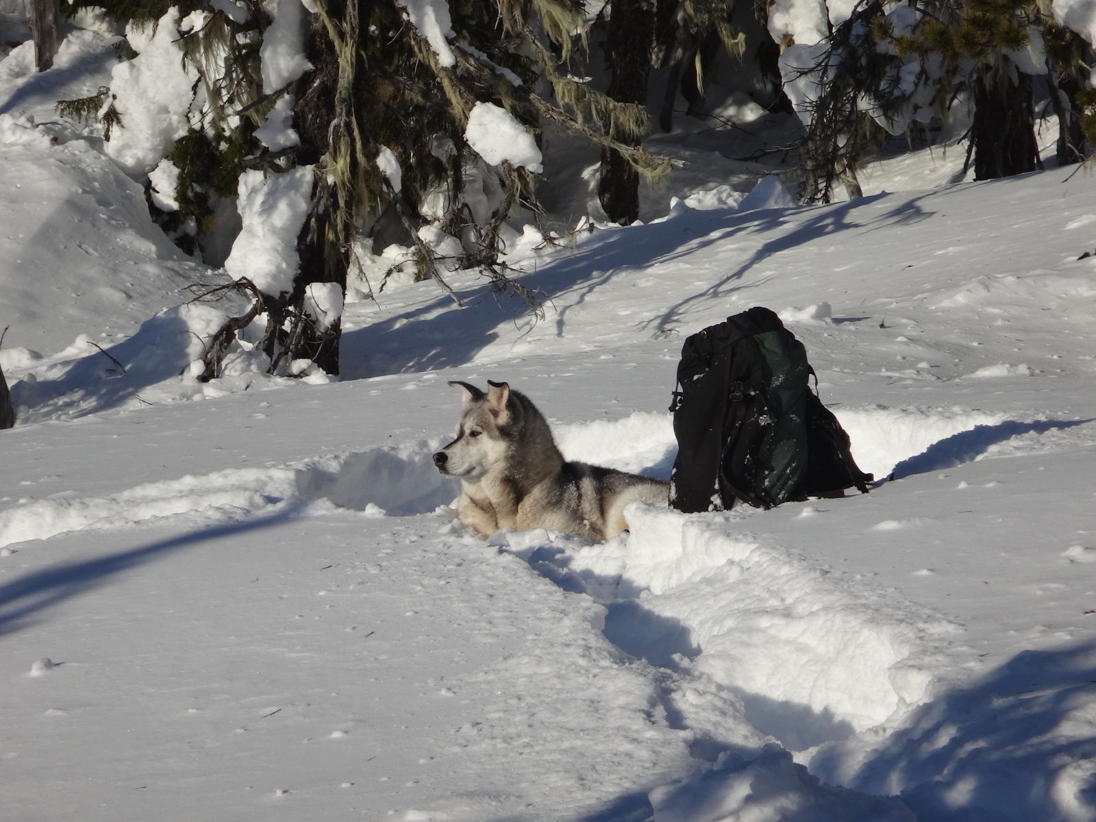
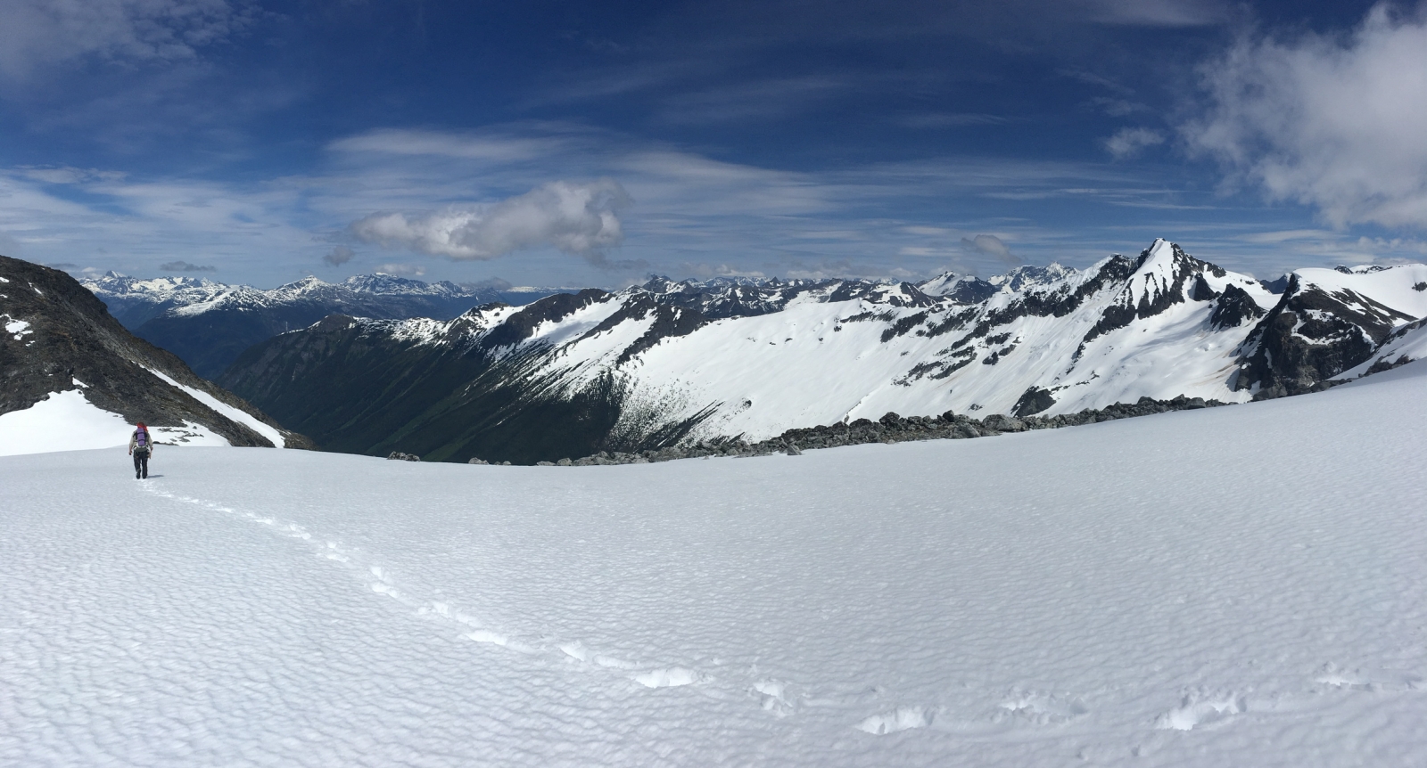
Ski Touring : For ski touring access, upon reaching the avalanche path at km 3.6 climb to the top of the path before crossing the creek in a spot similar to summer travel. Then continue upstream and east into the Mosquito Pass proper. Running water usually exists in the pass if you search for it.

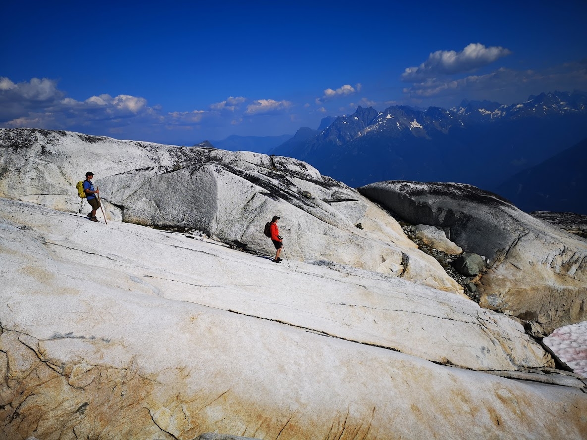
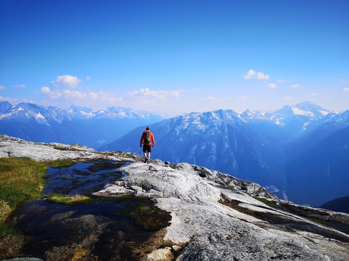
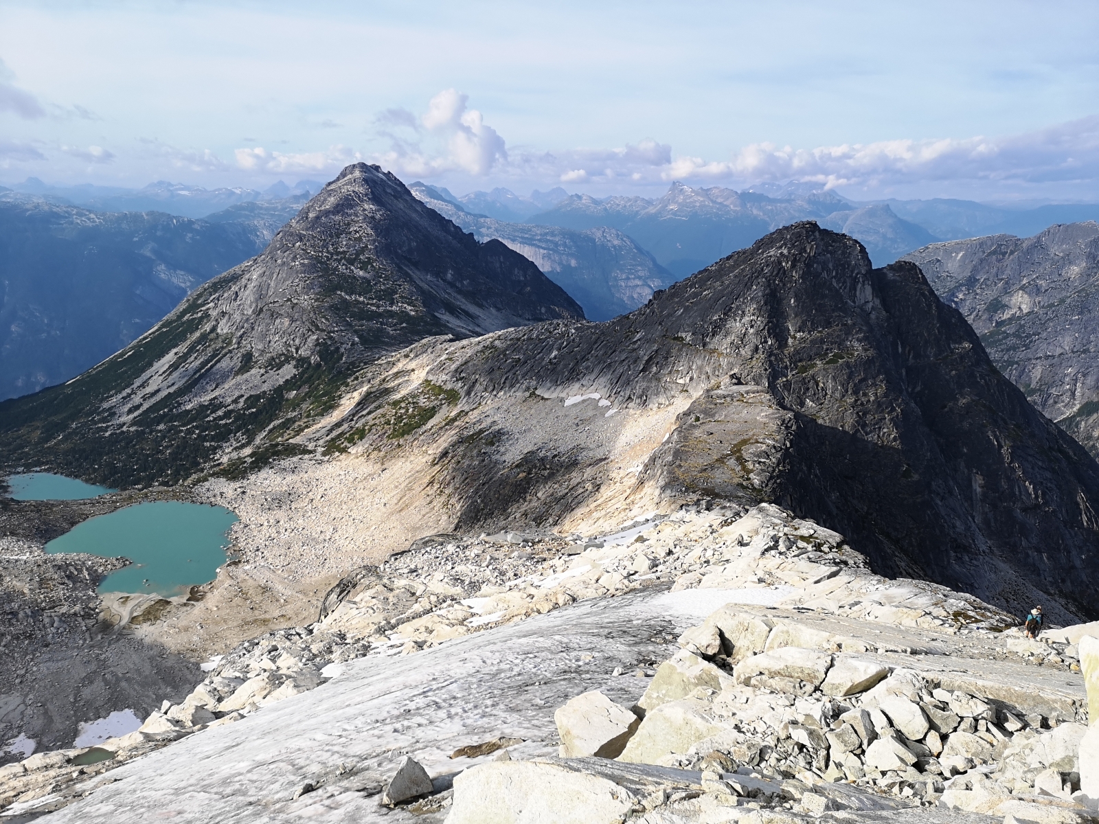
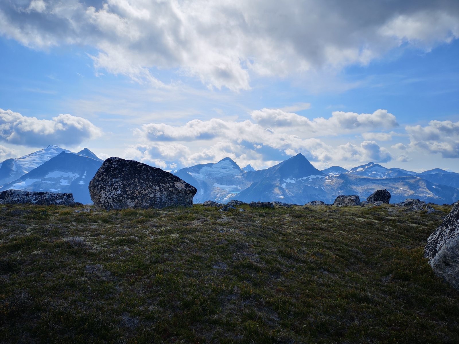
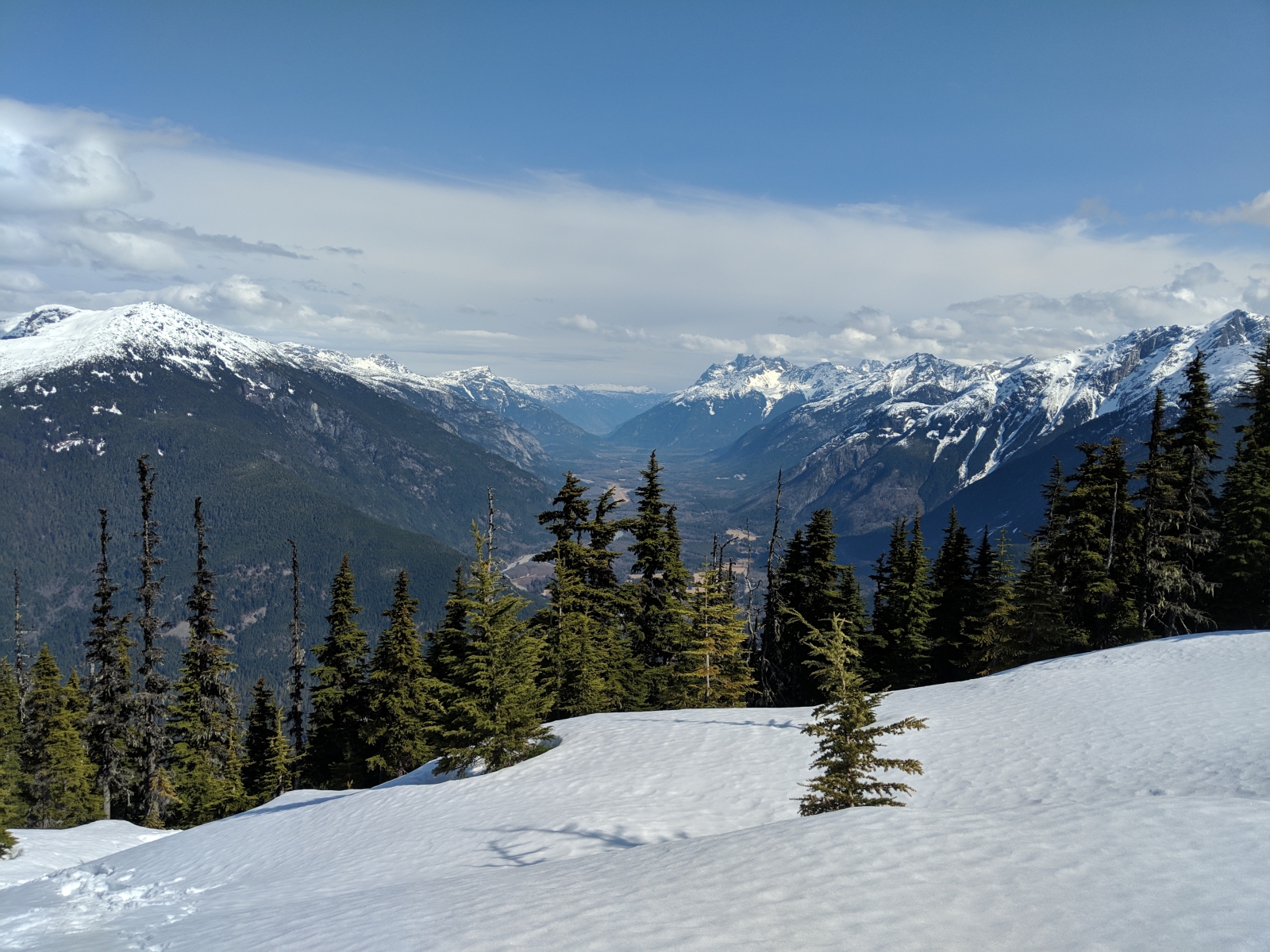
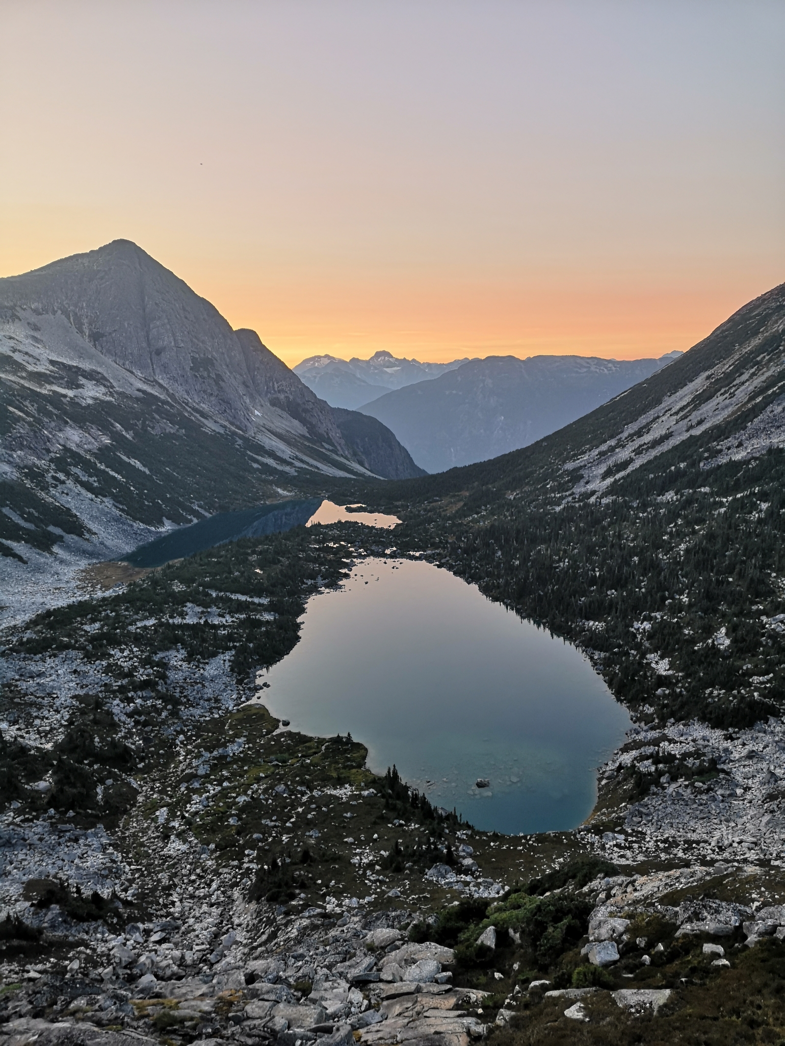
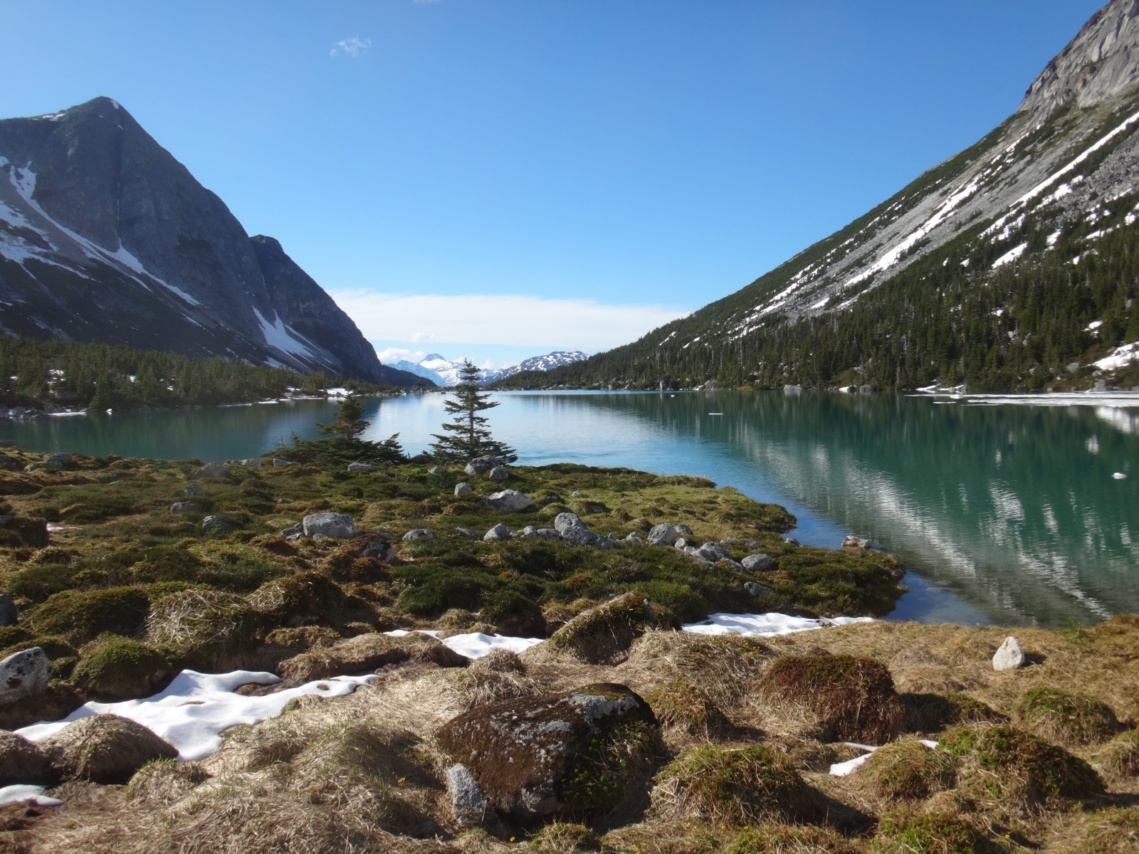
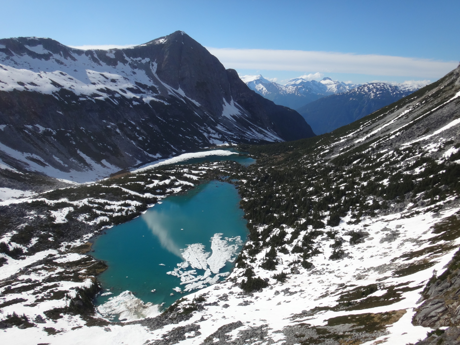
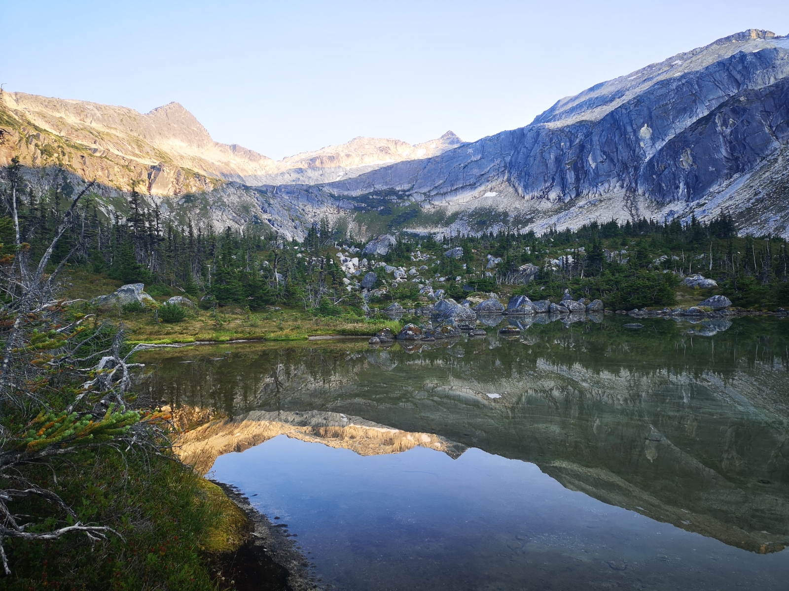
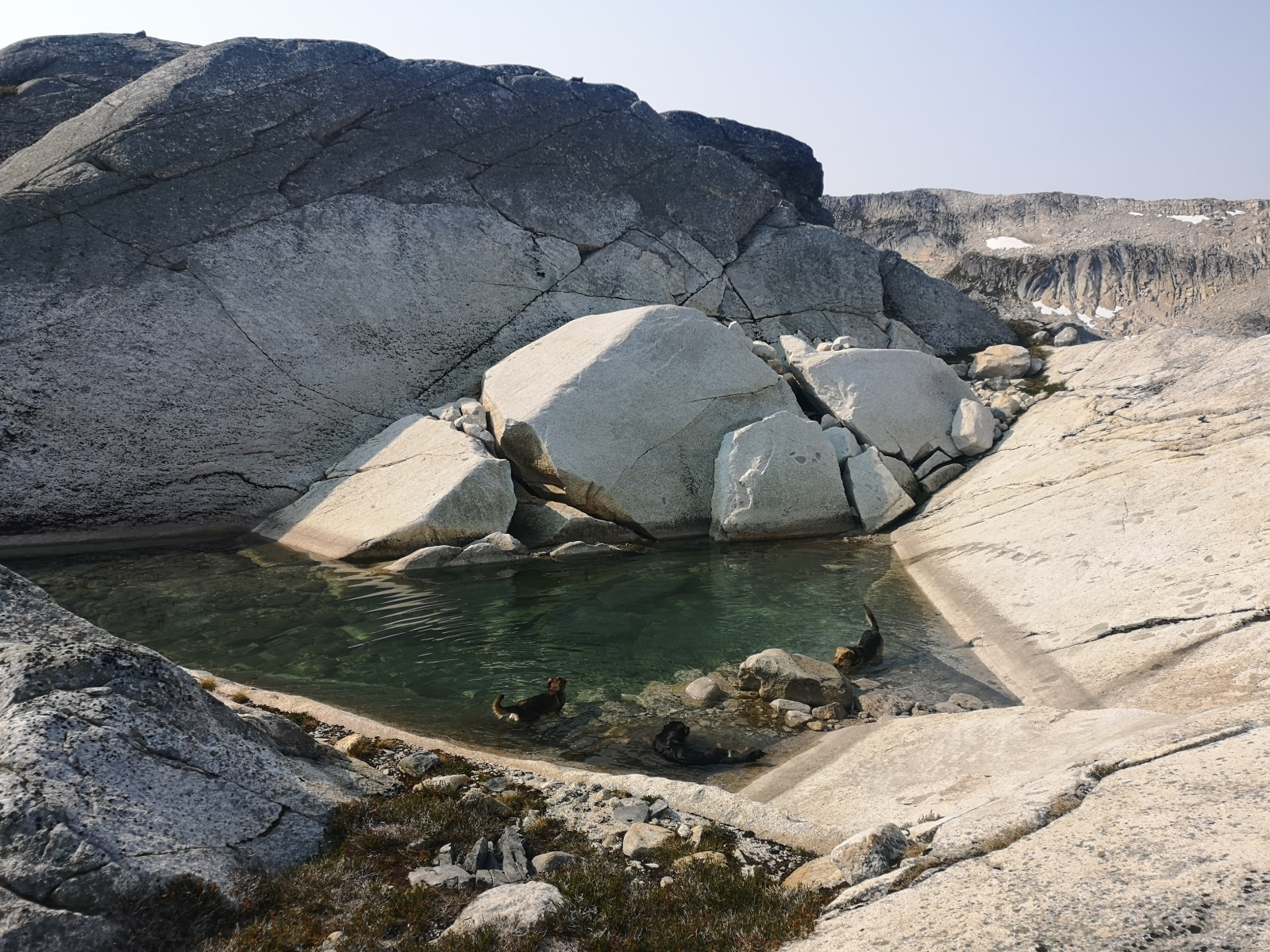
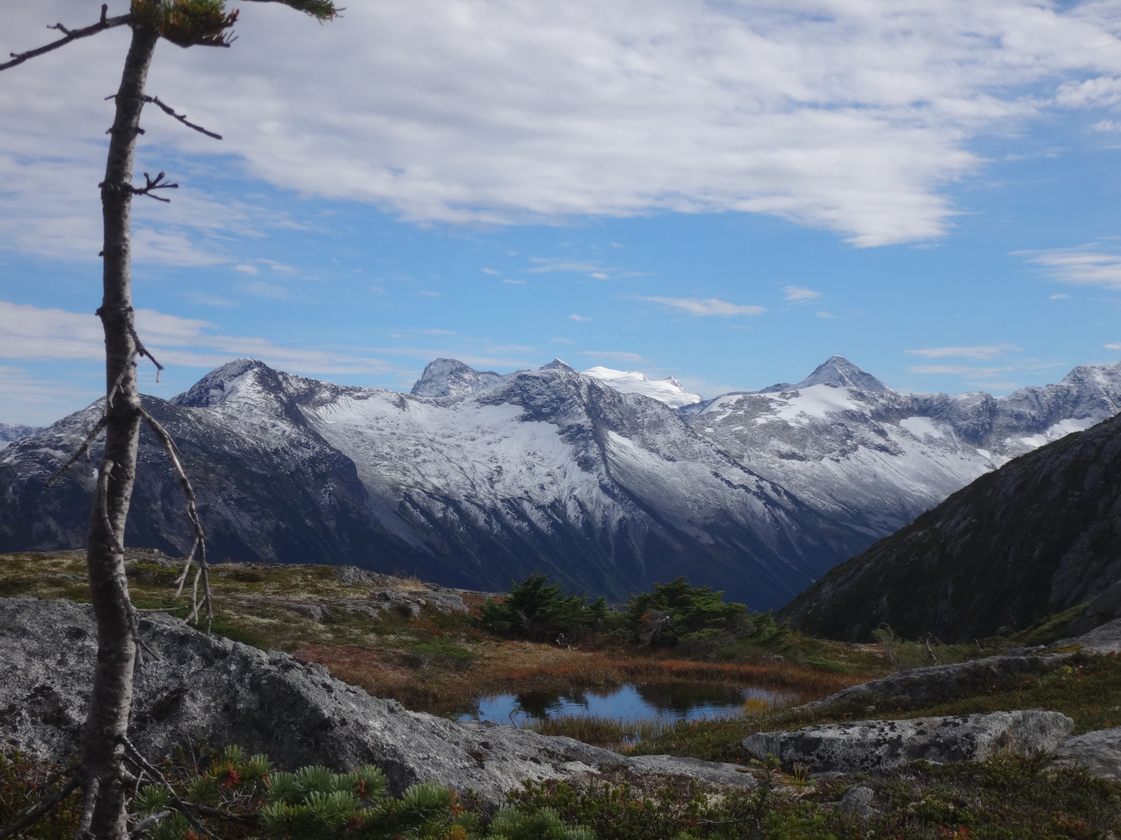
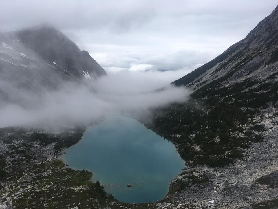
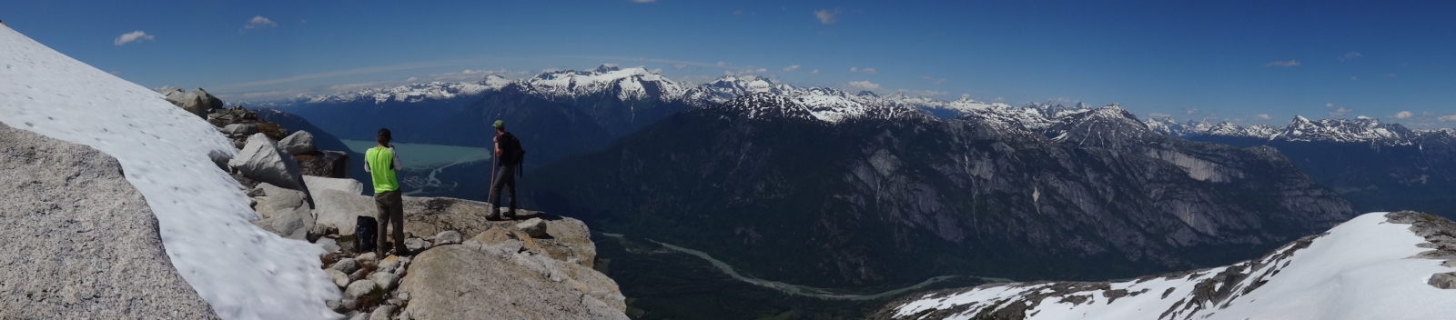
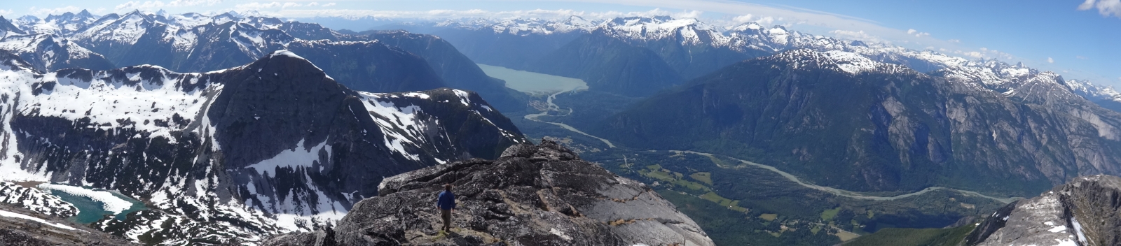
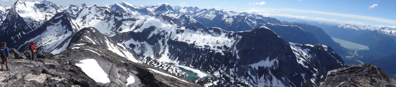
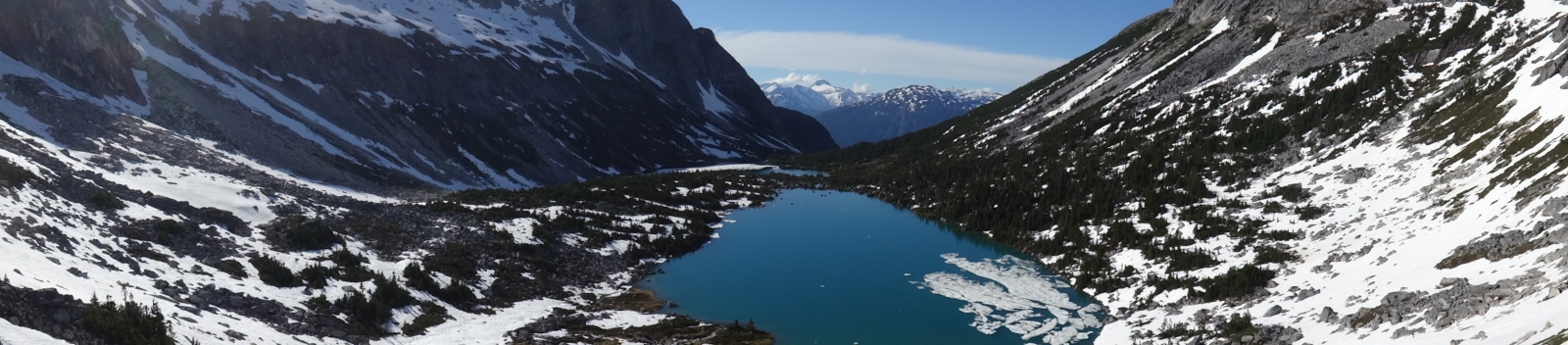
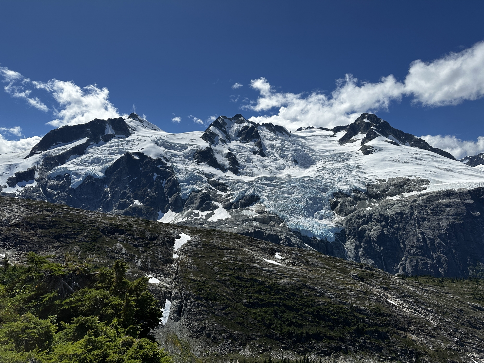
Space Point Lake: Space Point Lake is a gorgeous overnight camping destination or easy jaunt from the trail summit camp. From the camp spot at the height of the flagged trail route (1650m) traverse along beautiful meadow benches heading east along the headwaters of the Cacaotin valley for 3km before reaching the obvious lake with floating glacier. Total distance is 3km +150m -200m from trail summit.

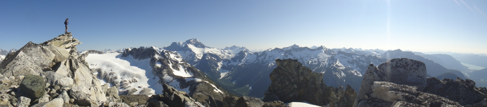
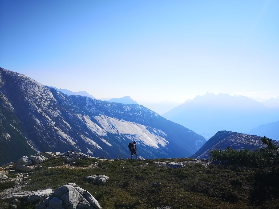
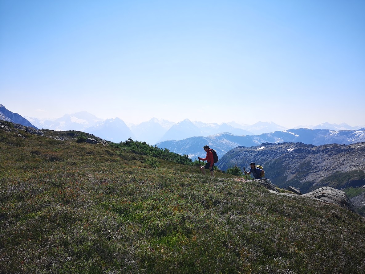
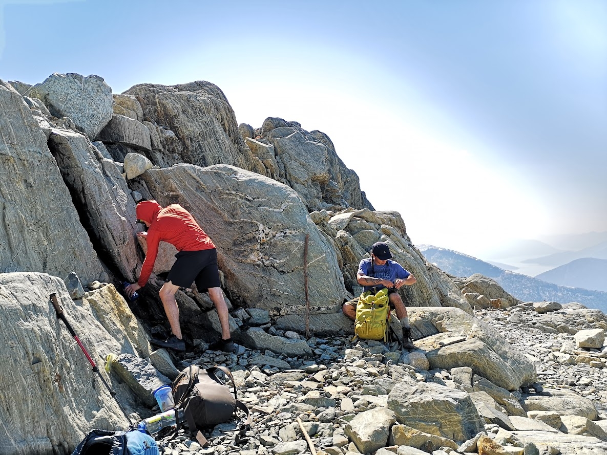
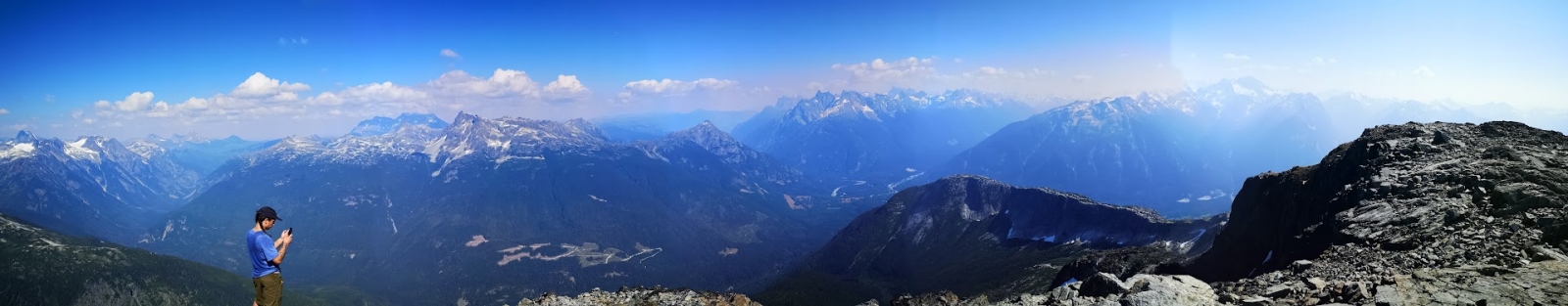
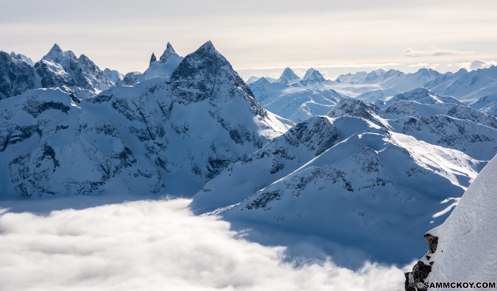
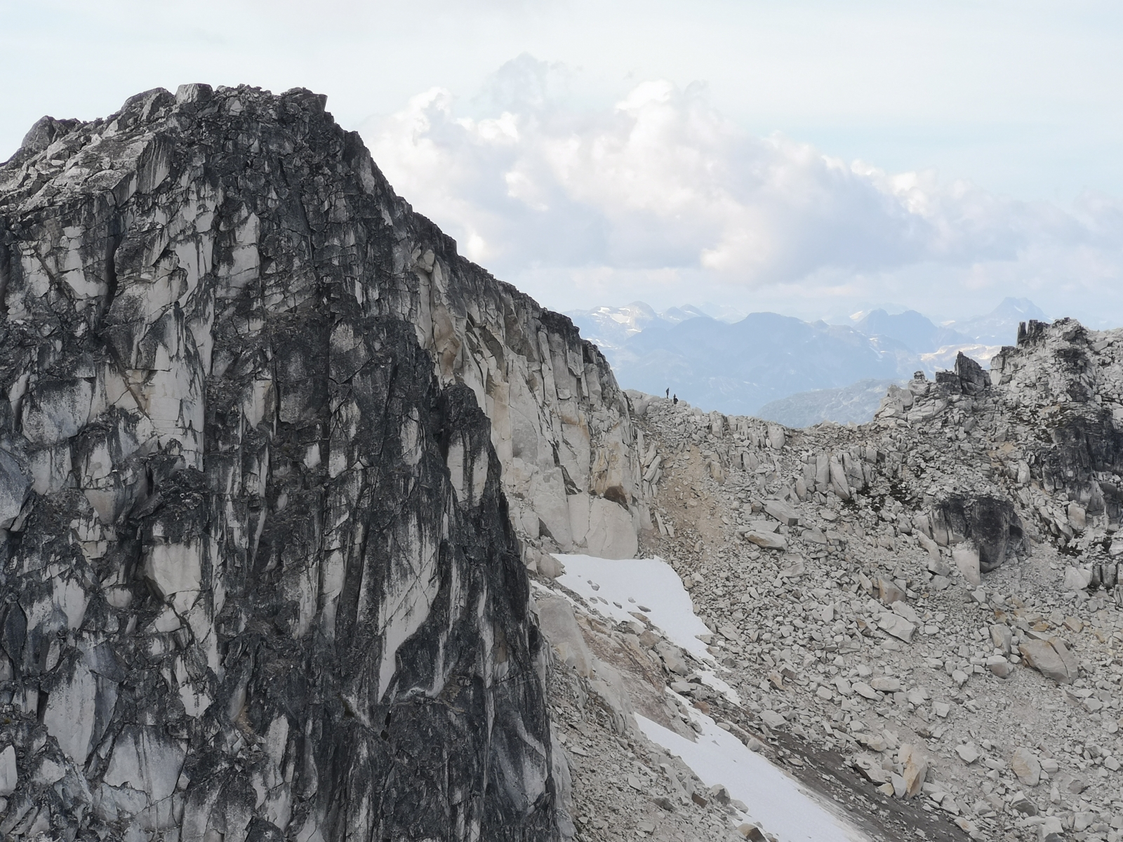
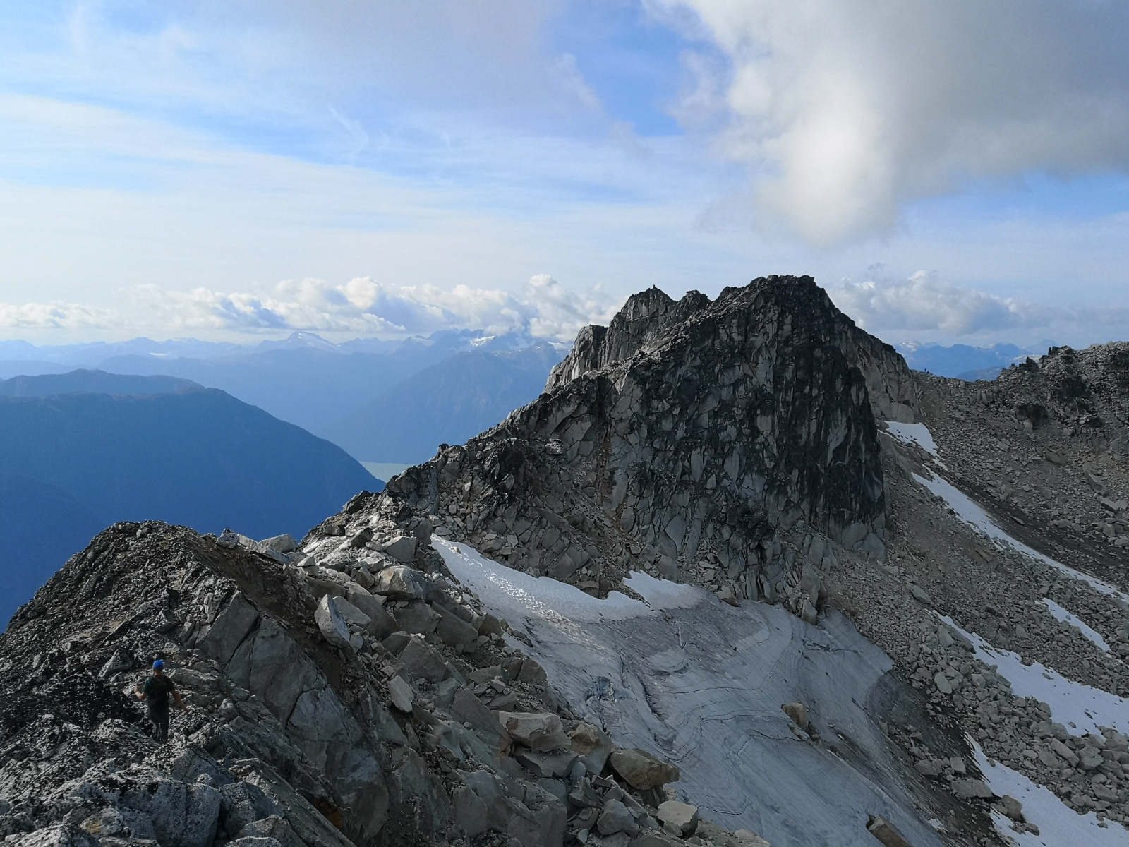
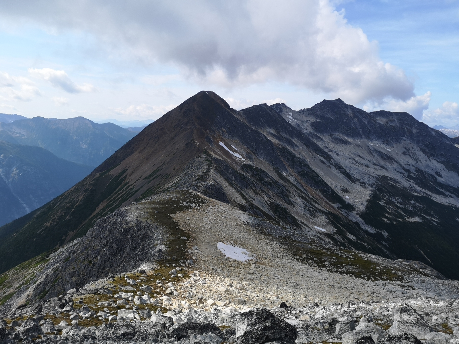
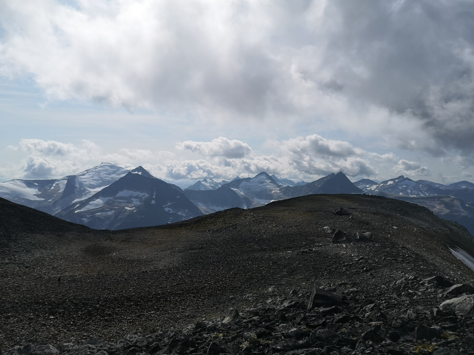
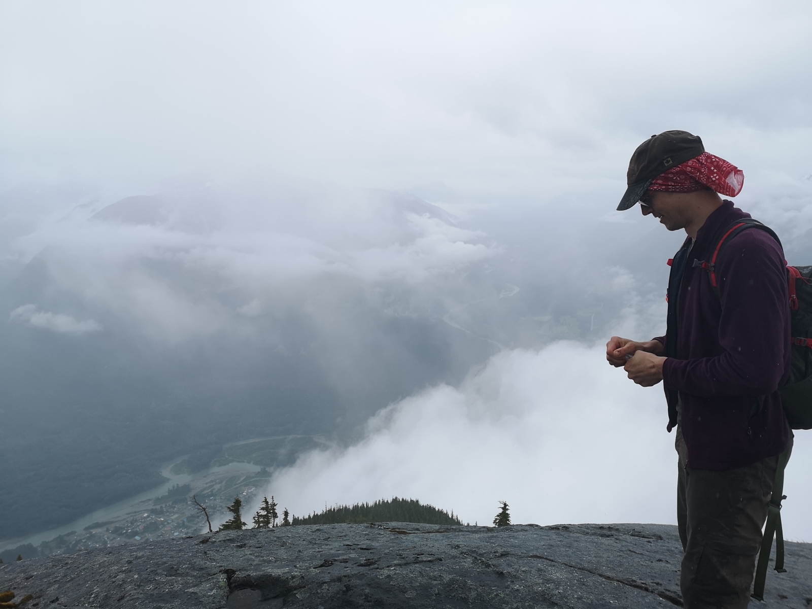
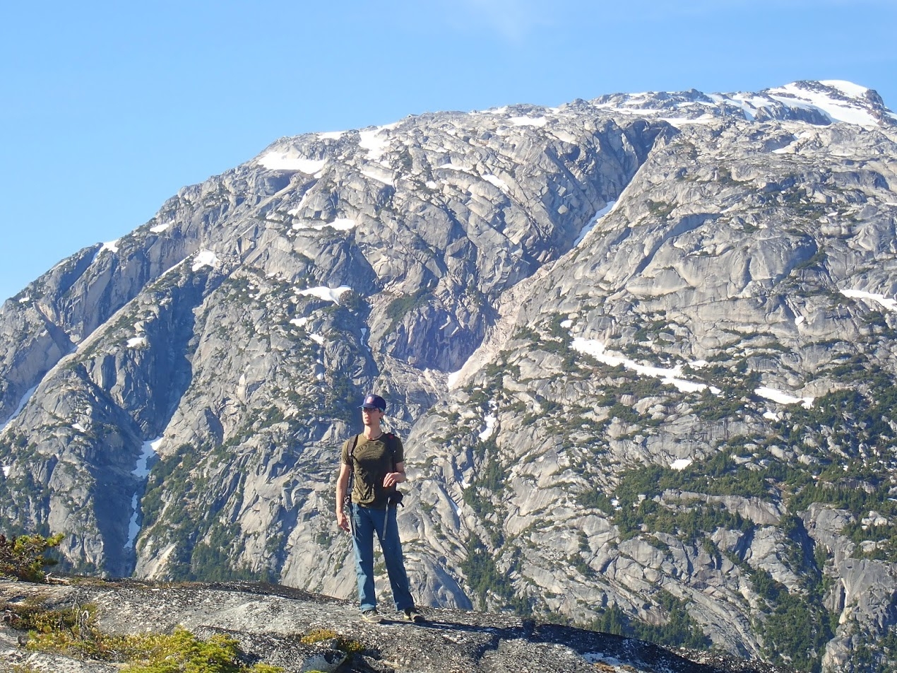
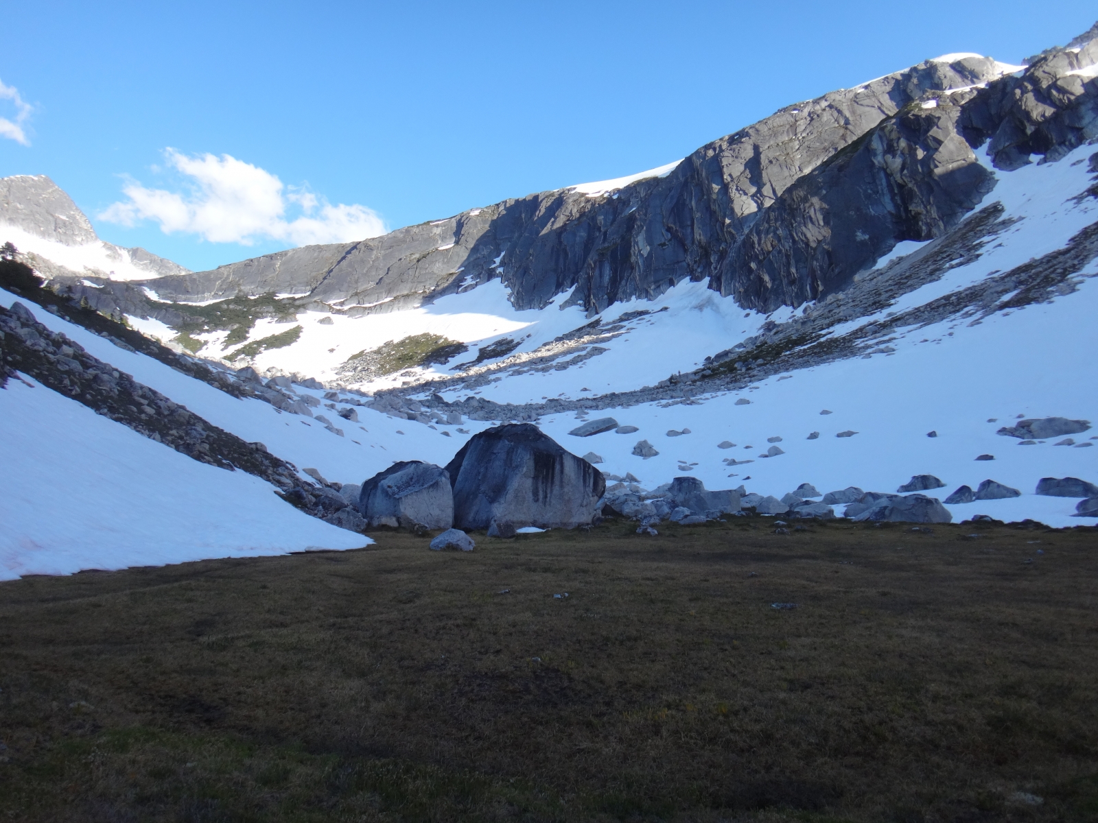
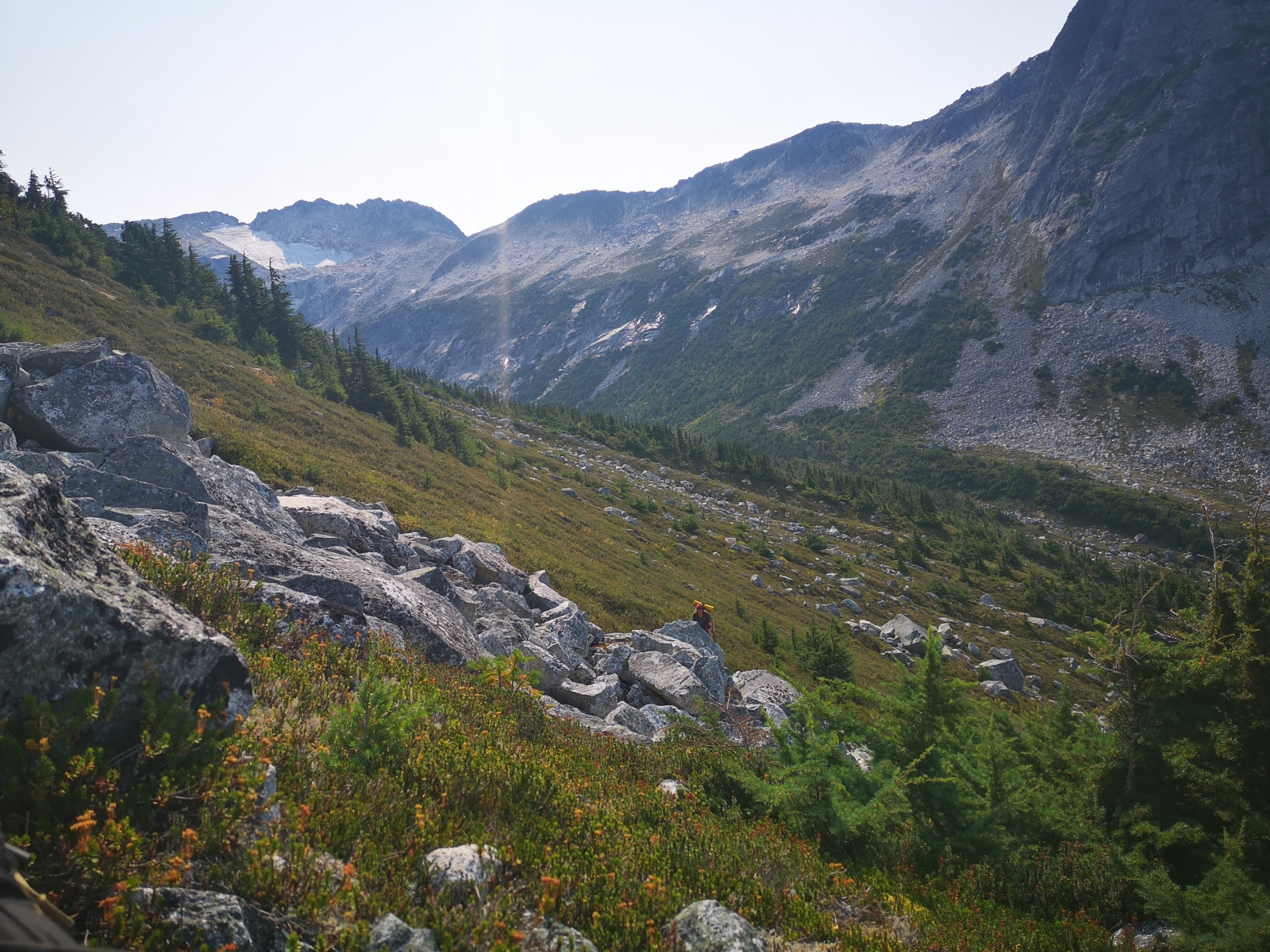
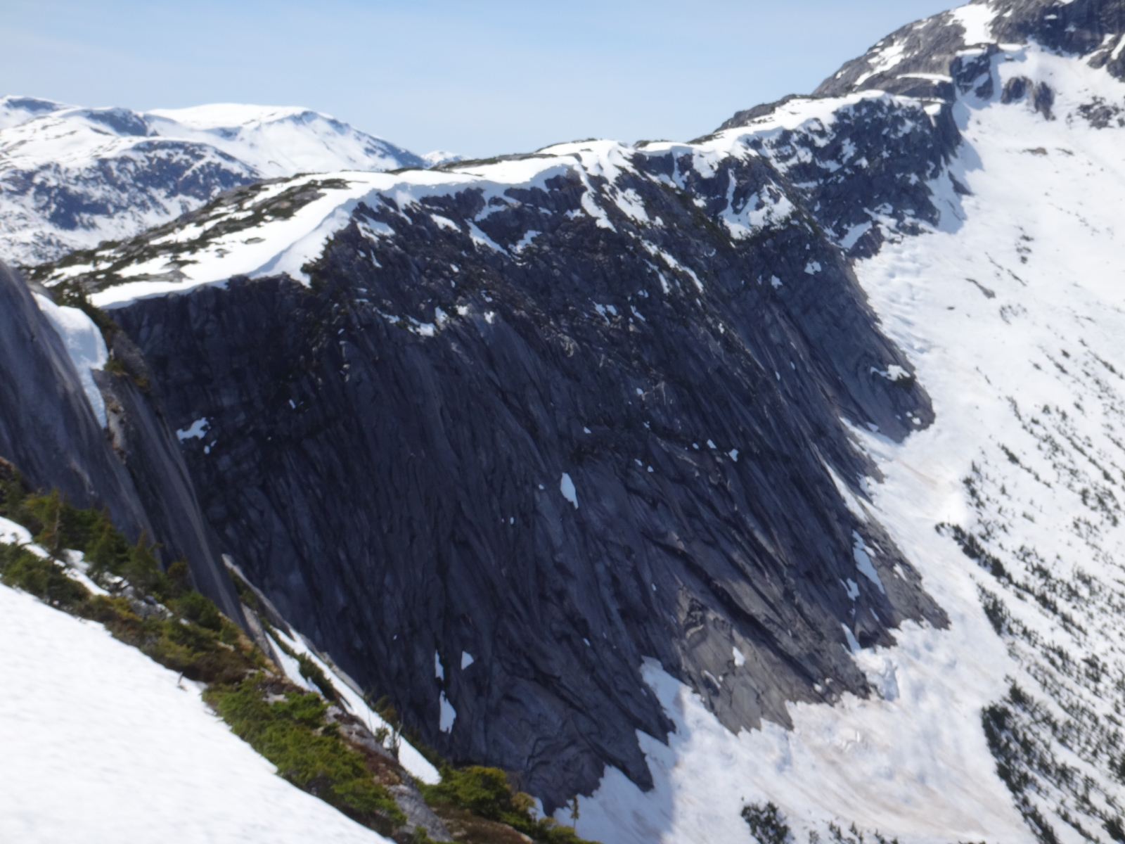
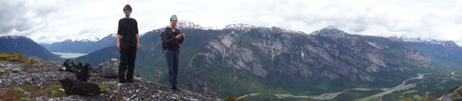
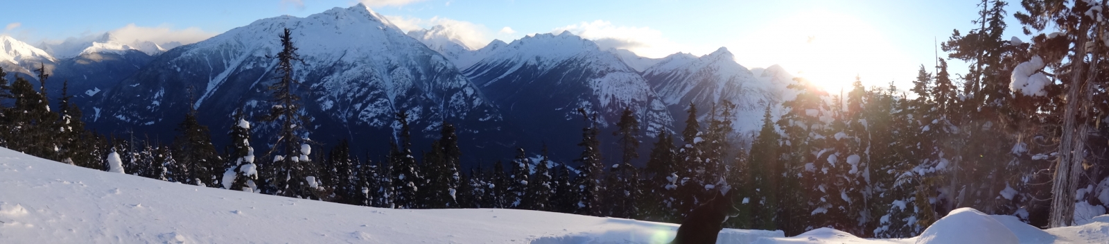
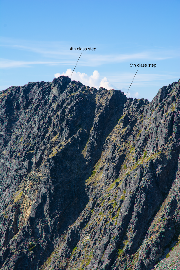
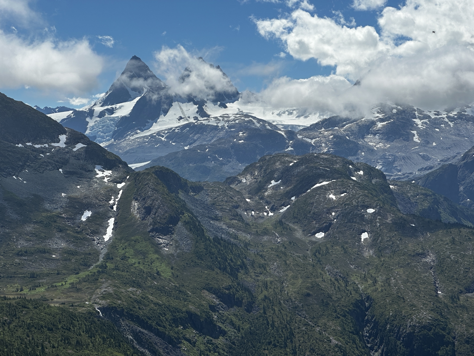
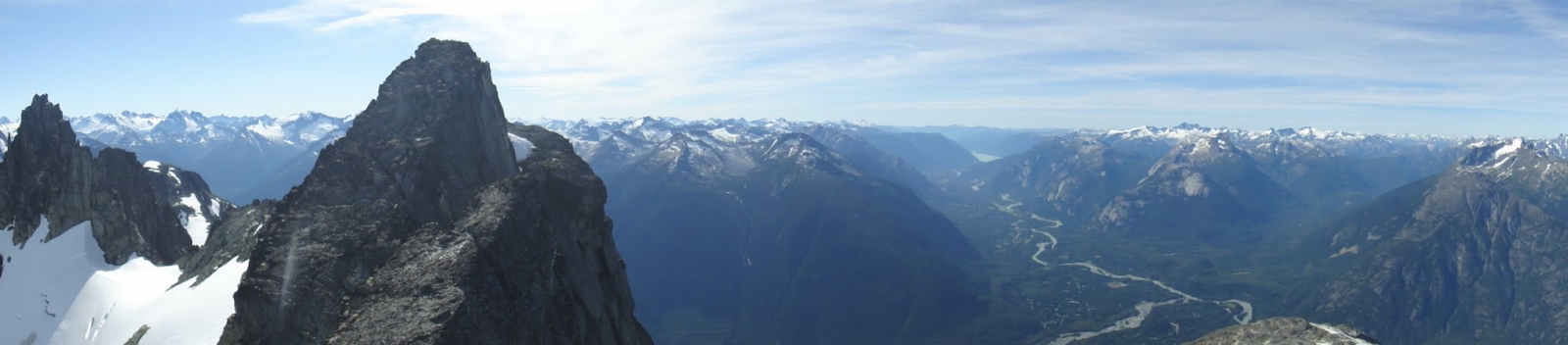
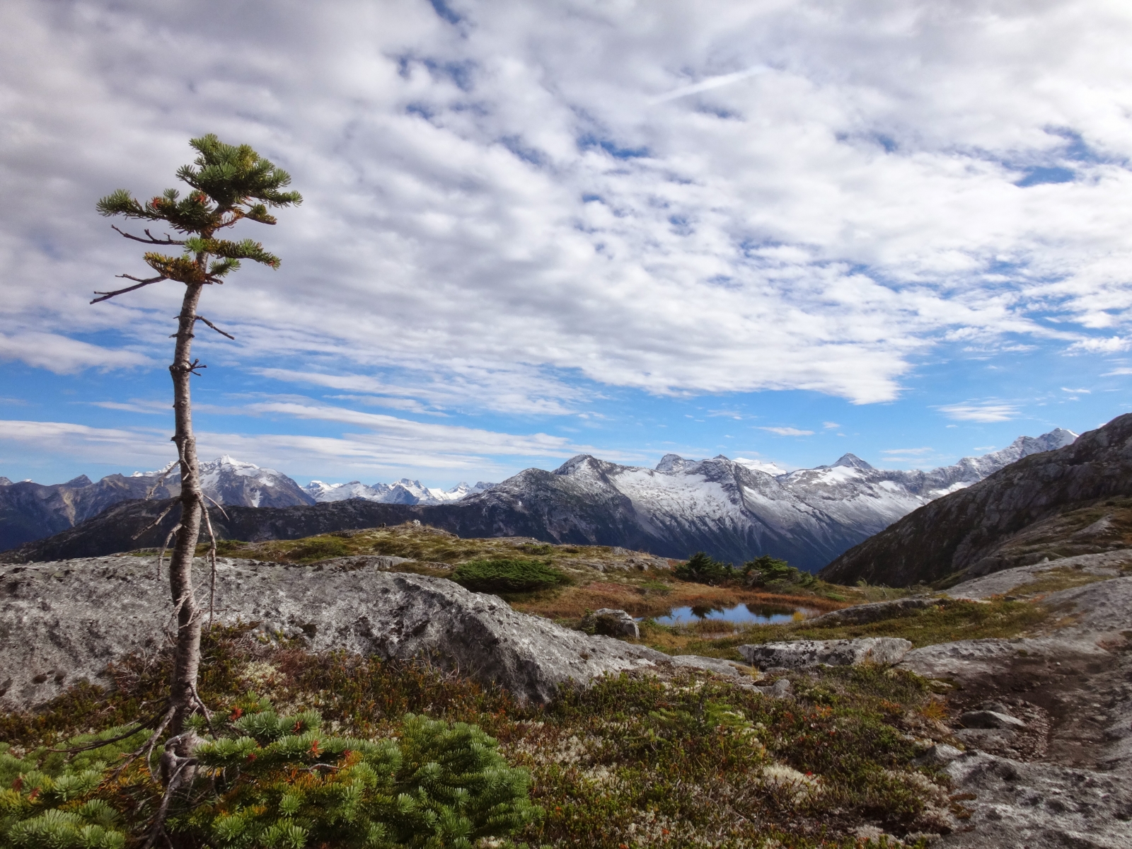
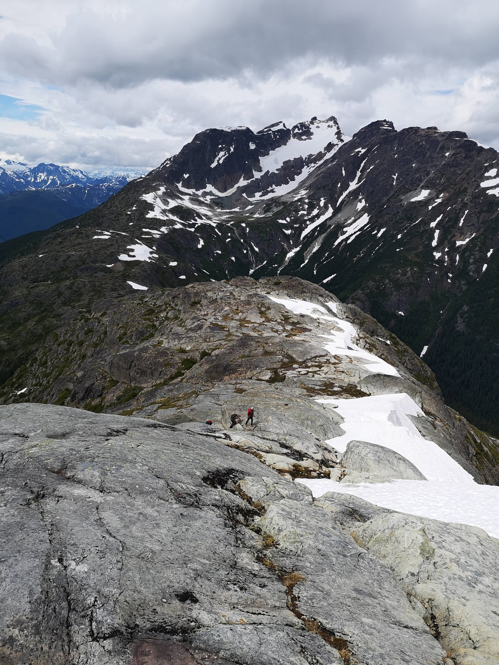
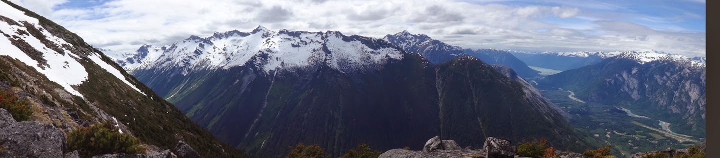
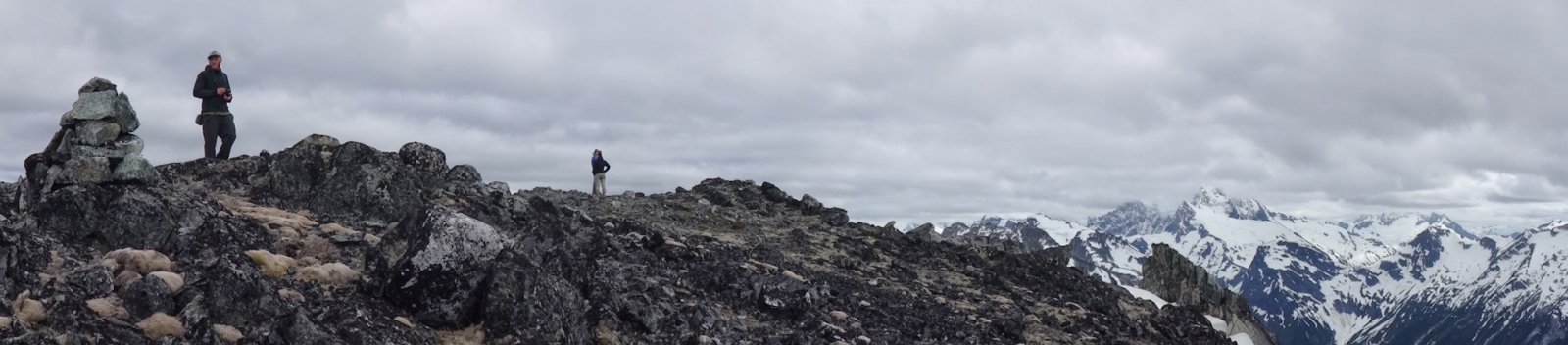
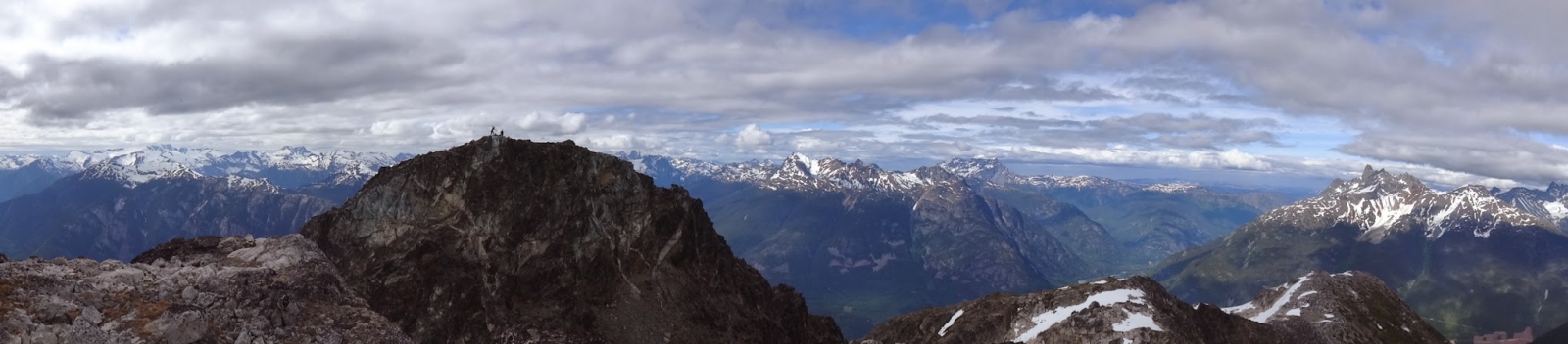
Observatory Ridge: Observatory Ridge stretches for 3km south from the top of the trail. This gentle ridge-line has one small steep part where care around rockfall should be taken. Follow the crest of the ridge despite its up's and downs. This generally windy and bug-free place has minimal to no water and though flat camp sites exist, early summer snow provides the only water source and disappears by late summer. Use this ridge to access Mad Dog and Space Point peaks or to get to the Dog valley. The views from this ridge are exceptional with views south to the Monarch Icefield. Highly recommended hike along with Space Point Lake if spending time camping in the area.

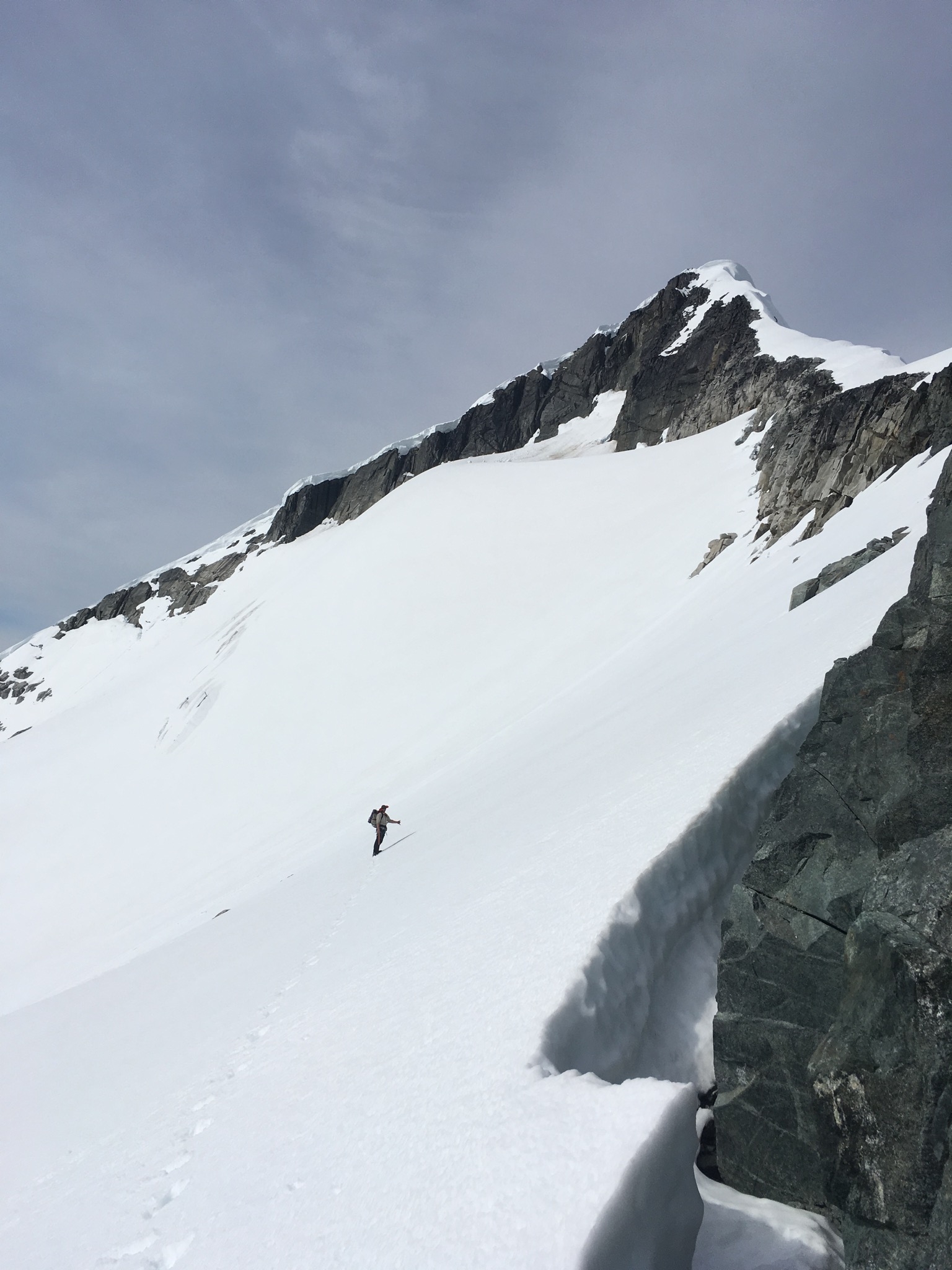
Monster Pass: For the adventurous, Monster Pass provides amazing vistas and continued exploration of the upper Noomst. Monster Peak is also a must do with mind boggling vistas. From Space point lake cross the creek from the lake outflow and follow it into meadows at the head of the Cacaotin Valley. Once the meadows end and become too wet, continue through the forest without climbing too much for 2km. Here ascend up and climbers left before reaching talus slope of an obvious avalanche path continue uphill climbing ~500m to reach the pass. Total distance is 3.6km and +500m from Space Point Lake

Nusatsum Shoulder: The Nusatsum shoulder is maybe not a first choice but a very worthwhile destination nonetheless due to the incredible views of Space Point Peak, Happy Dome, Mad Dog, Mt Saugstad and many more. From the trail summit, contour a bit before descending into the height of Mosquito Pass. Cross delicate wetlands gently before ascending through brushy forests for 300m meter to reach nice alpine walking. Use this approach to access climbs on Nusatsum Mountain. Total distance is 3.7km +400m

Maintenance Updates: As of summer 2023 this trail is clear of large majority of deadfall with good road access.

Tatsquan/Fougner - Clayton Approach (working title)

Approach of Tatsquan/Fougner mountain (not sure of Nuxalk name yet) from Clayton Creek FSR. The route follows a nice shoulder along a dry Douglas Fir timber type with great views of the North Bentinck through the trees almost the entire way. Currently the flagging stops at a very nice lookout over the North Bentinck arm at about 1050m elevation. As the mountain's profile suggests from the ground, this route is quite steep and the flagging is quite "efficient" (ie. very little switching back).

There is ample parking on a small landing just after the steep part at the beginning of Clayton FSR (near the BC Hydro penstock area) and the route has been flagged to avoid the private property to which it is adjacent.

The intent is to finish this route summer 2021 flagged/marked to the summit, and have it linked up the "Tatsquan West" trail to form an alpine loop easily doable in one day.

***Sorry, only one random pic, I will take more next time!***

Last updated: June 9, 2021

Snootli Peak via Snooka Lakes

An alpine ridge tour de force. All-day on a summit. Miles of ridge-walking, with some short technical sections and some sections of loose/rotten rock. Some parties may want to bring a rope and light rack for short sections.

Note: Exiting the Snooka Lakes bowl depends on snowpack levels; in low snow conditions, start from the upper of the three Snooka lakes (https://bellacoolatrails.ca/content/snooka-lakes), head to the south end of the lake, then up not-so-pleasant looking dirt and scree slopes until gaining a south-trending series of clean granite ramps. The dirt slopes are not as bad as they look, and the granite ramps are excellent and make for fast travel. Continue up the ramps until the ridge.

Continue on this ridge more or less the rest of the way, over several intermediate peaks, to Snootli peak itself.

A grand day out.

Tatsquan Ridge

A beautiful hike through steep timber from downtown up into the alpine. Either climb the '100 stairs' to the reservoir, immediately turn left towards the creek, and follow a well-tracked steep trail upwards to briefly join a logging road; OR follow same logging road up switchbacks right from the highway. Both starts will bring you to the beginning of the Tatsquan Ridge route, marked with flagging and a sign. Enter the forest following a well-flagged route. Continue steeply through timbered benches past a couple viewpoints (380m and 970m) and a seasonal water hole (750m), through open, old-growth timber, all the way into the alpine of Tatsquan ridge and beyond. A sustained and enjoyable hike with many points of interest.

Note: there is NO running water along the trail in dry conditions; bring enough water to enjoy the day! There is standing water in many alpine tarns throughout the summer.

The route is cut and flagged.

4 Mile Ridge via Saloompt Bluffs

An elegant and efficient route linking Saloompt Bluffs with the incredible alpine ridge of 4 Mile Mountain, via the Mills Creek basin. The trail is well marked and cut, with many points of interest along the way.

Follow the upper Saloompt Bluffs trail to the lookout, then continue West along the same timber bench, climbing through a short and memorable 'rock tunnel' feature to gain a connecting timber bench with excellent views of the Bella Coola Valley and Mills Creek basin. Continue along the bench past a couple seasonal creeks all the way to a beautiful pool and fjord at Mills Creek. Cross the creek and continue through open timber to gain the East shoulder of 4 Mile; follow the timbered ridge upwards to the base of a short headwall; traverse below the headwall to gain a steep timbered ravine directly left of the wall. Climb up the ravine feature into the bluffy alpine of 4 Mile Ridge. Continue as desired West along the ridge, past many views and interesting features.

Snooka Lakes

A complex approach up and through a series of timber ribs, slides and talus fields, leading to an incredible alpine bowl with 3 breathtaking turquoise lakes.

A great basecamp within striking distance of other objectives; ridge walking, alpine climbing, goat viewing... and just generally exploring!

Trail is currently in rough condition. Some flagging, better towards the bottom.

Mills Creek - Enso Pool

Follow Saloompt Bluffs trail to viewpoint, then continue West on ledges and through timber to Mills Creek, arriving at an enchanting pool.

Trail is well flagged and cut.

Mosquito Pass

Note: The new Nusatsum Meadows trail replaces this route
Gain the alpine south of Nusatsum Mtn via efficient route; an excellent basecamp for further adventures.

Goat Ridge via Saloompt Bluffs

Gain the striking alpine ridge leading to Goat Peak via Saloompt Bluffs.

Follow the fairly well established upper Saloompt Bluffs trail to the main lookout; continue west briefly then north and up past orange flagging through several tree terraces, into a distinct pinch point in a steep timbered slot; move upwards to easier ground and open granite slabs. Follow flagging up several slabs and timber ribbons to a small watercourse; follow the water to the base of more slabs and clear views of the alpine. Gain a blunt buttress feature and move upwards along the general prow of it, traversing off to the left or right as needed. After gaining the top of this granite slab/prow feature, alpine meadow strips open to your left below clean granite walls. Continue up through open ground, meadows giving way to rock slabs, to a final treed gully to the right of the attractive and massive summit block.

Goat ridge opens to the north-west.

Note - above 1000m there are several long granite slab sections that are easy to walk on in dry conditions, however parallel vegetated gullies offer an alternative in poor/wet conditions. The general route is the same.

Nuxalk Ridge via Crystal Creek

A steep and adventurous hiking route up to the alpine of Nuxalk ridge with many points of interest. Start from the ice rink, traverse below granite walls to the deep ravine of Crystal Creek. Crossing the creek, head up through the canyon before continuing steeply through burnt timber bands, weaving through small rock bluffs, gradually moving right towards the highest notable stand of timber. Follow ledge systems and gain the first summit from the West, traversing it Eastward before continuing up through steep old growth mountain hemlock to the alpine.

Goat Peak (Winter route)

Starting up the Saloompt Bluffs trail, continue north up the blunt ridge, through mixed slabs and tree islands until gaining the alpine.

Some short steep sections at beginning give way to gentle slopes.

Devon Girard's picture

Saloompt Bluffs

A steep start leads to moderate hiking through old growth, rising gently to a fork in the trail. The Upper Bluffs trail continues upwards past many waterfalls to a series of viewpoints overlooking Hagensborg and the surrounding mountains. The Lower Bluffs trail leads to the base of the climbing walls.

Trail is cut and well flagged; the Upper Bluffs trail gets more traffic, is quite tracked in and easy to follow. Water sources are plentiful for much of the year, yet tend to dry out in high summer.

Tatsquan Traverse

Incredible natural circuit following the ridgeline of the Tatsquan watershed. Start and finish from downtown Bella Coola.
+/- 3600m of elevation gain/loss and ~30km of distance. Recommended time is 3 days.

The circuit can be done clockwise (east to west) or counterclockwise (west to east). Which direction you take will dictate how you interact with the main crux of the route, which are a few exposed 4th and low-5th steps on a section of ridge about 7.5km in if starting from the east. Clockwise involves a down-climb or short rappel, where-as going counter clockwise would mean climbing the section.

A recommendation would be to bring a lightweight rope kit for this section and do a small lower or rappel. The rope can be used for glacier rescue if needed as there is one crossing on a mundanely flat glacier. If you plan to solo climb this section, going counterclockwise feels more comfortable than down-climbing it.

Overall the route has a lot of hiking and simple but fun scrambling through 3rd class terrain. Route finding skills are a must for navigating the scrambling and rock steps but overall navigation is simple as you just follow the ridge for the near entirety of the route.

Devon Girard's picture

Nuxalk Mountain Circuit

Alpine tour de force, an incredible circuit linking Nuxalk ridge and the Snootli descent trail with the Snooka lakes.

Nuxalk Mtn is more technical from the North, so climbing up from Nuxalk Ridge and descending via Snooka lakes is recommended. Technical difficulty will vary with conditions, there are a couple brief sections of 4th class scrambling between the North and South Nuxalk summits, where some parties may wish to use a rope. The descent via Snooka lakes trail involves some route-finding and can be a bit rough/bushy in places. Allow 16 hours for the complete circuit.

Odegaard Meadows Route

Easy route finding, follow the approximately 2km flagged route to the meadow and lakes above Odegaard Falls. The route heads up onto the ridge and into the alpine via the Odegaard Falls Recreation trail. Watch for the pink flagging on your right (East)

Hammer Lake, Ape Lake

This trail route leads into the heart of the Coast Mountain wilderness through dense high elevation forest to more open sub-alpine parkland and then onto lushly flowered alpine meadows that lead to imposing jagged peaks. The trail starts off through a subalpine forest of Engelmann Spruce, Mountain Hemlock and Subalpine Fir where huckleberries are plentiful in season. The trail can be quite wet at certain times of the year or during/after prolonged wet weather. There is a large section of boardwalk closer to the lakes where the trail opens up into subalpine meadows. The views of the surrounding mountains are impressive. Pearl Peak with its glacier plastered on the side can be seen beyond the meadows and lakes.

An alpine viewpoint is the final destination with amazing views of Iroquos Ridge and its glacier ice fall over the Noeick River. South-east is the route to Ape Lake and the peaks of the Monarch Icefield\, including the looming pyramid of Mt. Jacobsen. Beyond the viewpoint the route to Ape Lake requires a map and compass and should only be attempted by experienced\, well prepared hikers. There is no flagged trail yet.

Grey Jay / Blue Jay North Bentinck Lookout

This trail and boardwalk wind through alpine forest along Grey Jay Lake and then wanders through open meadows and wetlands to end at a viewpoint overlooking North and South Bentinck Arms. It offers a nice afternoon stroll and on return there is the option for a refreshing swim in Blue Jay Lake. Views of the Coast Mountains are spectacular, although somewhat limited compared to the ridge above M Gurr Lake. Alpine flowers are abundant in the summer. Blue Jay Lake is much warmer than M Gurr Lake and, uniquely, this high elevation lake contains trout.

Purgatory Lookout

This route offers spectacular alpine views as it winds between meadows, ponds, talus boulder slopes and snow avalanche brush tracts and is an ideal mountain bike excursion. Originally part of a road that connected all the way to South Bentinck Arm, it can still be driven in a 4X4 to the lookout, depending on the level of debris from the previous winter’s snow avalanches and roadside brush encroachment. The lookout is spectacular with a fabulous view of the Noeick River valley, Styx Mountain and Purgatory Glacier directly across the valley. It is possible to continue walking the old forest service road downhill for more views; however, the road is brushing in quickly. If you do make it downhill to the river, just remember it’s a long way back up to the vehicle. The Noeick River valley was washed out a few times by a jokulhlaup (a glacial phenomenon where the rising waters of Ape Lake broke through the receding Fyles Glacier ice dam, dumping a wall of water down the Noeick River valley and wiping forests and roads all the way to South Bentinck Arm).

Odegaard Falls

The Odegaard Falls area in the Nusatsum valley is a must see attraction as it is in the heart of the Coast Mountain wilderness with its spectacular peaks and glaciers. The falls are very impressive, especially in early summer when it swells with snow melt. The trail to the falls passes through an old mossy forest of western hemlock, Sitka spruce and amabilis fir. You get the first view of the falls from the foot bridge crossing the Nusatsum River. There is a great viewpoint at the base of the falls that have a vertical drop of ~175m.

Should re-route trail to stay on west side of creek, enhance trail to top meadow.

Clayton Falls Rec Site

With a great shoreline picnic site and a viewing platform of the falls cascading through a canyon of cliffs scoured smooth by water and glacial action, the Clayton Falls Recreation Site is one of the most popular sights in the valley. Depending on the season or the current weather, the falls can be a full apron or narrow streamlets flowing through ancient grooves. Pink salmon spawn at the bottom of the falls between late July and September. Look for them attempting to jump up the falls. Salmon also use the spawning grounds created by B.C. Hydro below the outflow from the generating station. The park has picnic tables and outhouses. At low tide there is even a small stretch of sandy beach. Watch the boats coming and going and maybe even a sailboarder, yacht or ferry. Note the old cannery across North Bentinck Arm. Seals hang out at the mouth of the creek and from the bridge over the creek you can sometimes see seals chasing down salmon at high tide.

ATV parking at water tower and BC Hydro may put in off-loading ramp

M Gurr Lake

This is an easy access trail that winds through stunted sub-alpine forest to a crystal clear\, emerald jewel alpine lake. You may want to go for a quick swim, although the neighbouring pond east of the lake is warmer. Wildflowers are abundant and provide a colourful bloom in July and August. Beyond the lake the trail is not as distinct\, but still easy to follow. Once on the rocky part of the ridge\, pick your own way to the highest point. The viewpoint above the lake) provides awesome views of the coast mountain peaks rimming North and South Bentinck Arms, Burke Channel and the upper Clayton Falls Valley.

Nusatsum

Amazing ridge walk in the sky, to the iconic peak of Nusatsum.

Snootli Descent Trail

Breathtaking views up an improbable line, crisscrossing the open north-west butress of Nuxalk Mountain, up narrow ledges with a few fixed lines.

Saloompt Peak

Elegant natural line up a timbered West rib of the Saloompt massif, gaining the alpine ridge just before the summit ridge steeply rises up to the south.

Park where space allows by the junction at the top of the Lost Lake road hill; follow the right fork (towards Lost Lake) on foot for about 500m to an overgrown logging road on the left; push through the alder-overwhelmed road for another few hundred meters to a small scree slope; avoid this to the left, enter the old-growth timber and follow a flagged route up through mossy douglas fir, hemlock and cedar forest. Gain a broad bench after several hundred vertical meters, with large talus fields coming into view above. Avoid the talus fields to the left, following steep game trails to easier ground. Continue through open forest up a gentle hogs-back feature all the way to the subalpine. Pick your way through the scrub forest until breaking through into open heather strips. Follow the open meadows left towards a small boulder field, then up and right to the base of a scree slope. Edge around the right side of the scree slope, overcome a small thicket of stunted balsam firs, to gain the final rock and moss rib leading up to the saddle of the main ridge, and views to the east.

For Saloompt peak, head south up green gullies splitting the steep granite slab for about 100 vertical meters, to easier ground and a gorgeous swimming hole. Continue south along the easy granite summit ridge, enjoying tremendous views and many points of interest.

For Hagens peak and related objectives, head north along the friendly ridge, past several small tarns, a beautiful large flat 'delta' area riddled with flowers, creeks and aquamarine stones.

Schoolhouse Peak

An alpine walk thru the sky; beautiful terrain and great views of the Bella Coola valley.

Gain the Northwest ridge via the Hagensborg Loop Trail; leave the loop trail east of the quarry, up the right side of a creek and into timber, avoiding a cutblock to the right. Traverse gradually rightwards to the true ridge line, and then up a sometimes-faint but friendly trail up through interesting features, various stands of timber and broad ledges. Forage your way through the subalpine to a magnificent broad ledge at about 1600m. Continue slightly right of the north ridgeline through alpine boulder fields and bands of meadow. Depending on the snowpack, move upwards as seems reasonable through snowfields, ledges and gullies to the broad summit.

Subscribe to RSS - Alpine