Main menu
You are here
Nusatsum Meadows (Mosquito Pass)
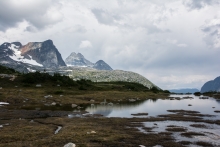
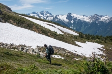
This new hiking route replaces the old 'Frank Cook Route' to the Mosquito Pass area for accessing the amazing meadows overlooking Nusatsum Peak. Lots of exploration opportunities exist from this area including hiking up the ridge below Space Point Peak to overlook Mt Saugstad and the mountains lining the Nusatsum River, travelling to Monster Pass and the upper Noomst Valley, or traversing under Space Point into the Dog Valley. Mountaineering objectives abound this area including Space Point Peak, the many summits of Nusatsum Mountain, Mad Dog, and from Monster Pass, Defiance and Happy Dome. Lots of ski touring opportunities exist up here for the winter adventurers also
Time: 4-5 hours 1-way
Distance: 6km
Elevation Gain: 1200m
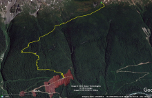
Trailhead Access: Drive the 2WD Nusatsum East FSR staying right at the Medby Rock fork early on and look for an obvious left fork leading uphill at ~3km. Some vehicle clearance recommended, most SUV's will be fine. Follow this switchbacking road as it ascends for 1.4km and its end. Near the end an obvious cairn marks the trailhead. Drive past the cairn for a turnaround spot and extra parking towards the end of the road. Room exists for 6-8 vehicles and more parking exists at the last switchback, with only a short walk to trailhead.
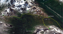
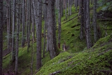
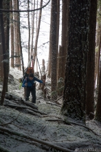
Trail Description: Follow the well flagged and fully cut (2021) trail through ascending switchbacks. A nice lookout over a talus field exists at 950m 1.6km in. The next 1.2km of trail continues to ascend through the forest but involves sections of steep side hilling. Sturdy boots and hiking pole recommended until the trail receives more work. Caution: If the ground is frozen in late fall or winter this section can be dangerous. The mountain slope eventually eases and you will continue traversing towards the creek and descend a short distance to reach a prominent avalanche path. Cross this avalanche path and look for where the trail re-enters the woods. Follow this to a beautiful cascade and onward to a log crossing of Mosquito Creek. The log crossing is easy over little water. The trail then ascends for 350m distance through shrubby forests before opening into beautiful heather meadows. Follow the flagged route through the gentle meadows for another 1.5km, eventually reaching a prominent creek, follow that creek up to the full alpine!
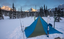
Camping: the flagged route leads to a beautiful flat ridgetop with amazing vistas and nice tent spots near the creek. The windy ridge keeps any bugs at bay. Please practice Leave No Trace camping and dig poop cat-holes to the north of the ridge (facing Mosquito Pass's wetlands) and away from the water source to the south.
Wildlife: The Mosquito Pass area is a prominent corridor for wildlife including black bear, grizzly, mule deer, wolverine and more. A resident herd of mountain goats occupy the area also. Please be bear aware and respectful of wildlife.
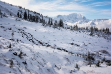
Ski Touring : For ski touring access, upon reaching the avalanche path at km 3.6 climb to the top of the path before crossing the creek in a spot similar to summer travel. Then continue upstream and east into the Mosquito Pass proper. Running water usually exists in the pass if you search for it.
Space Point Lake: Space Point Lake is a gorgeous overnight camping destination or easy jaunt from the trail summit camp. From the camp spot at the height of the flagged trail route (1650m) traverse along beautiful meadow benches heading east along the headwaters of the Cacaotin valley for 3km before reaching the obvious lake with floating glacier. Total distance is 3km +150m -200m from trail summit.
Observatory Ridge: Observatory Ridge stretches for 3km south from the top of the trail. This gentle ridge-line has one small steep part where care around rockfall should be taken. Follow the crest of the ridge despite its up's and downs. This generally windy and bug-free place has minimal to no water and though flat camp sites exist, early summer snow provides the only water source and disappears by late summer. Use this ridge to access Mad Dog and Space Point peaks or to get to the Dog valley. The views from this ridge are exceptional with views south to the Monarch Icefield. Highly recommended hike along with Space Point Lake if spending time camping in the area.
Monster Pass: For the adventurous, Monster Pass provides amazing vistas and continued exploration of the upper Noomst. Monster Peak is also a must do with mind boggling vistas. From Space point lake cross the creek from the lake outflow and follow it into meadows at the head of the Cacaotin Valley. Once the meadows end and become too wet, continue through the forest without climbing too much for 2km. Here ascend up and climbers left before reaching talus slope of an obvious avalanche path continue uphill climbing ~500m to reach the pass. Total distance is 3.6km and +500m from Space Point Lake
Nusatsum Shoulder: The Nusatsum shoulder is maybe not a first choice but a very worthwhile destination nonetheless due to the incredible views of Space Point Peak, Happy Dome, Mad Dog, Mt Saugstad and many more. From the trail summit, contour a bit before descending into the height of Mosquito Pass. Cross delicate wetlands gently before ascending through brushy forests for 300m meter to reach nice alpine walking. Use this approach to access climbs on Nusatsum Mountain. Total distance is 3.7km +400m
Maintenance Updates: As of summer 2023 this trail is clear of large majority of deadfall with good road access.

