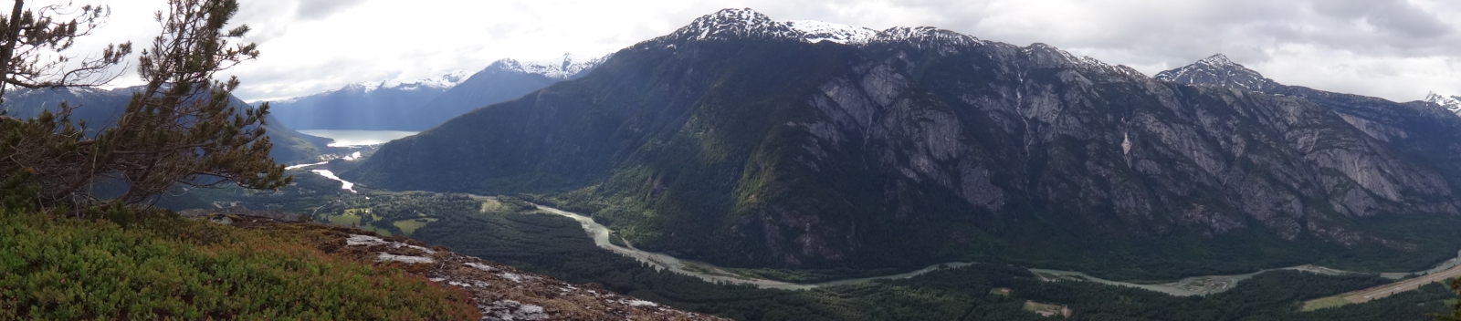
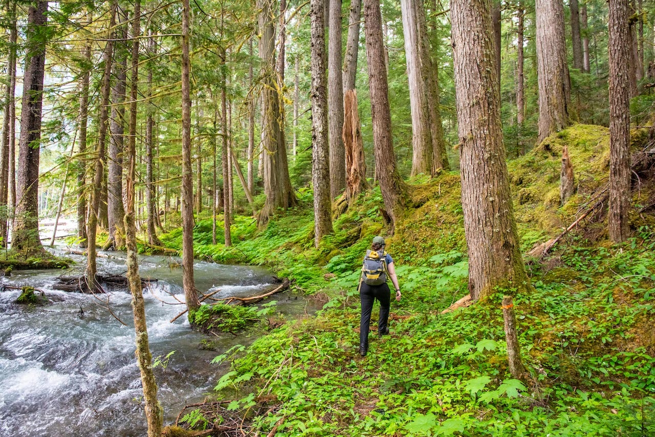
Experience the Bella Coola 'Himalaya' with this incredible hike through old growth forest and along the Nusatsum River (west branch) to reach the Saugstad NE Glacier. Surrounded by massive rock walls, cascading waterfalls, hanging glaciers, a rock shedding glacier tongue and the 2900m Mount Saugstad this trail provides an incredible end point. This trail can flood in high water levels and is best hiked from Late June to Late September. The intrepid hiker can hike in high water times by bushwacking around flooded areas. Water sources are abundant along the whole trail.
Time: 3-4 hours 1-way
Distance: 7.5km
Elevation Gain: +750m -100m
Trailhead Access: Drive the 2WD Nusatsum West FSR as for Odegaard Falls until KM 13. This trail shares the same small parking pullout as for Nusatsum Boulders. If you reach a bridge crossing the Nusatsum River at KM 13 you've gone a few hundred meters too far. If you haven't visited the Nusatsum Boulders, take this time (5-10min) to check out these spectacular towering boulders tucked in the forest. To find them follow the trail from the parking lot. The Saugstad Glacier Trail starts on an old lush logging road and is a different trailhead from the Nusatsum Boulders. The trailhead is marked by a small cairn and is only a few meters from the parking lot up the Nusatsum logging road. If you're the first hikers of the season, lush ferns, elderberry, etc. may have overgrown and hide the trailhead.
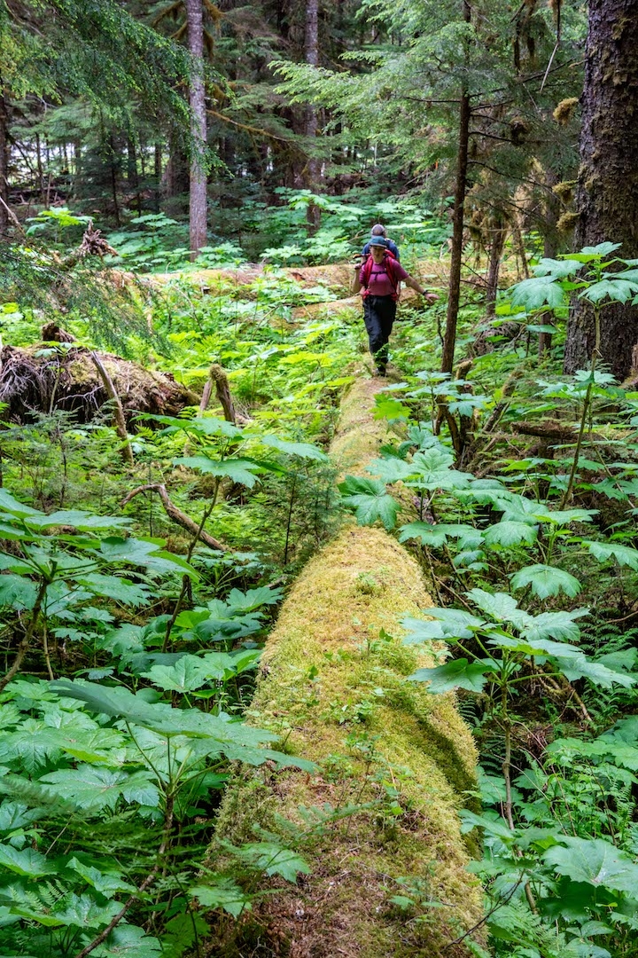
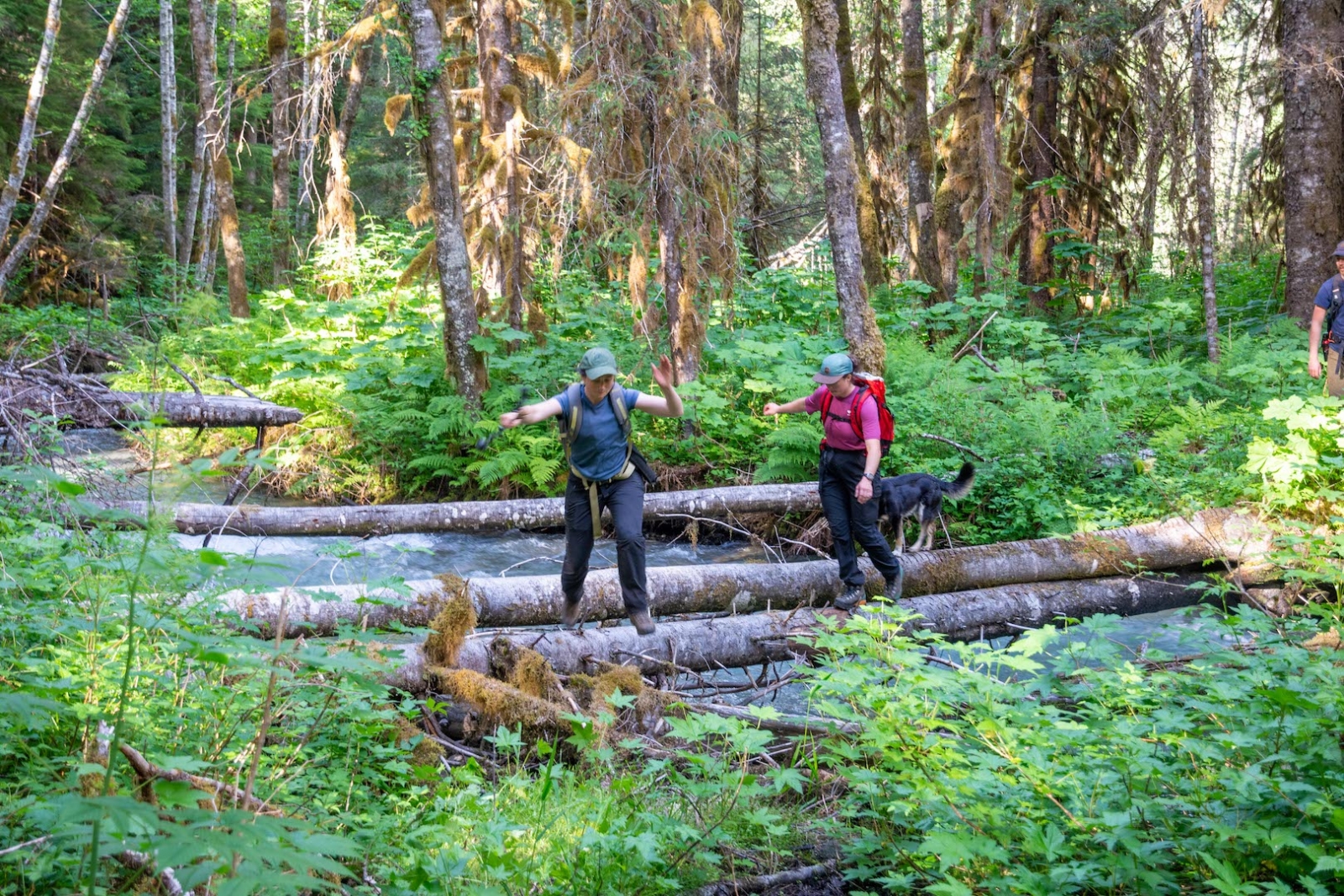
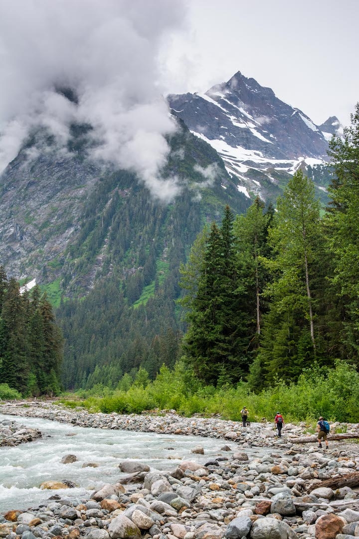
Trail Description: The trail starts on an old overgrown logging road. The 700m of logging road is lush with fast growing soft herbaceous plants, knock back these plants with your hiking pole. You'll descend through an old cutblock to reach old growth forest following the river. Continue along until a log crossing crosses a small newly formed water channel. Follow the trail to reach a slightly flooded area where some hopping might be required to keep boots dry before crossing another log back to the dry side. The trail continues through the forest for another 700m before climbing and side-hilling for a few hundred meters to pass through a ravine. The trail then gently descends back to the river leading to a log crossing (pictured below), follow along the forest again until a short section of river bank walking leads to a final log crossing. The next section is a mix of river bank walking and forest sections continuing for the next few kilometers. Keep an eye out for cairns and flagging that lead back into the forest and for where the trail turns towards the river out from the forest. The last section of river bank walking lasts almost a kilometer. Though footing can be tricky along the river rock, be sure to look up at the incredibly prominent peaks jutting above you.
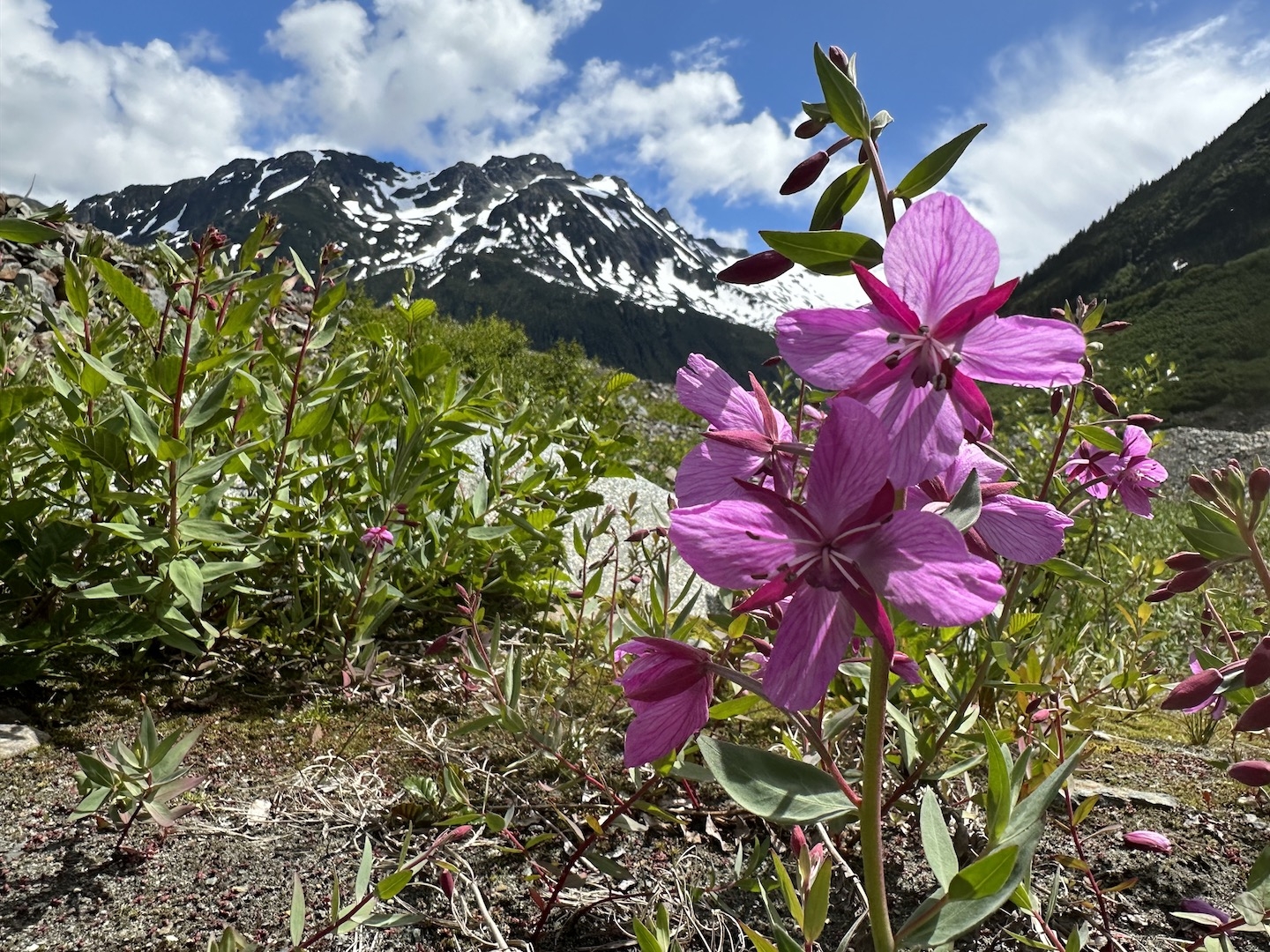
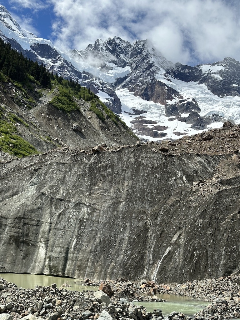
The trail then leads along a gangway of fallen massive trees before climbing the steep hillside in short switchbacks. This is the main elevation gain of the trail and continues up for 1.3km. An incredible giant cedar and big burled spruces dot this section. Finally, the trail exits the forest into the alder covered basin extending from the retreating glacier. Follow the cut section through the alder and along scenic rock slabs. A cairn at the top of the rock slab marks an incredible viewpoint. You're almost there, continue through the alder and talus to reach the glacier toe.
To download the route KML file for loading into your phone or GPS, look for the download button at the top right of the description.
CAUTION: The glacier presents a hazard. Rocks shedding off the ice are a constant risk so keep your distance from the ice if swimming or walking up to the glacier. If you continue uphill along the glacier edge following the moraine, you can eventually gain the ice easily. The lower glacier ice is blanketed by rock and is easy walking for the most part. If snow is present, it may hide crevasses and is incredibly dangerous. Also, solid gravel, sand and rock may slide easily on the ice. Extra care should be taken on the glacier surface. Avoid holes, snow and any steep areas.
Camping: Follow the glacier toe upstream and to the right a bit to a big flat area. Water is abundant. The sound of rockfall, calving ice and splashes are ever present.
Wildlife: Grizzlies and blackbears frequent the area and bearspray is recommended. Please be bear aware and respectful of wildlife.
Maintenance Updates: Cleared and flagged as of summer 2023.